Sam and I finally had a chance to watch the video from the on board camera Mark was using that day. We also inspected the glider to be sure there wasn't a problem with it. Joining us was also an investigator from the NTSB who was a friend of Mark's wife Peggy. His experience with these types of events was instrumental and we thank him.
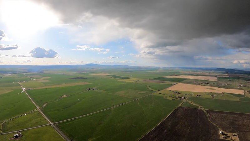
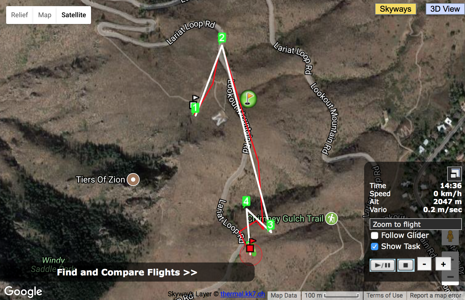
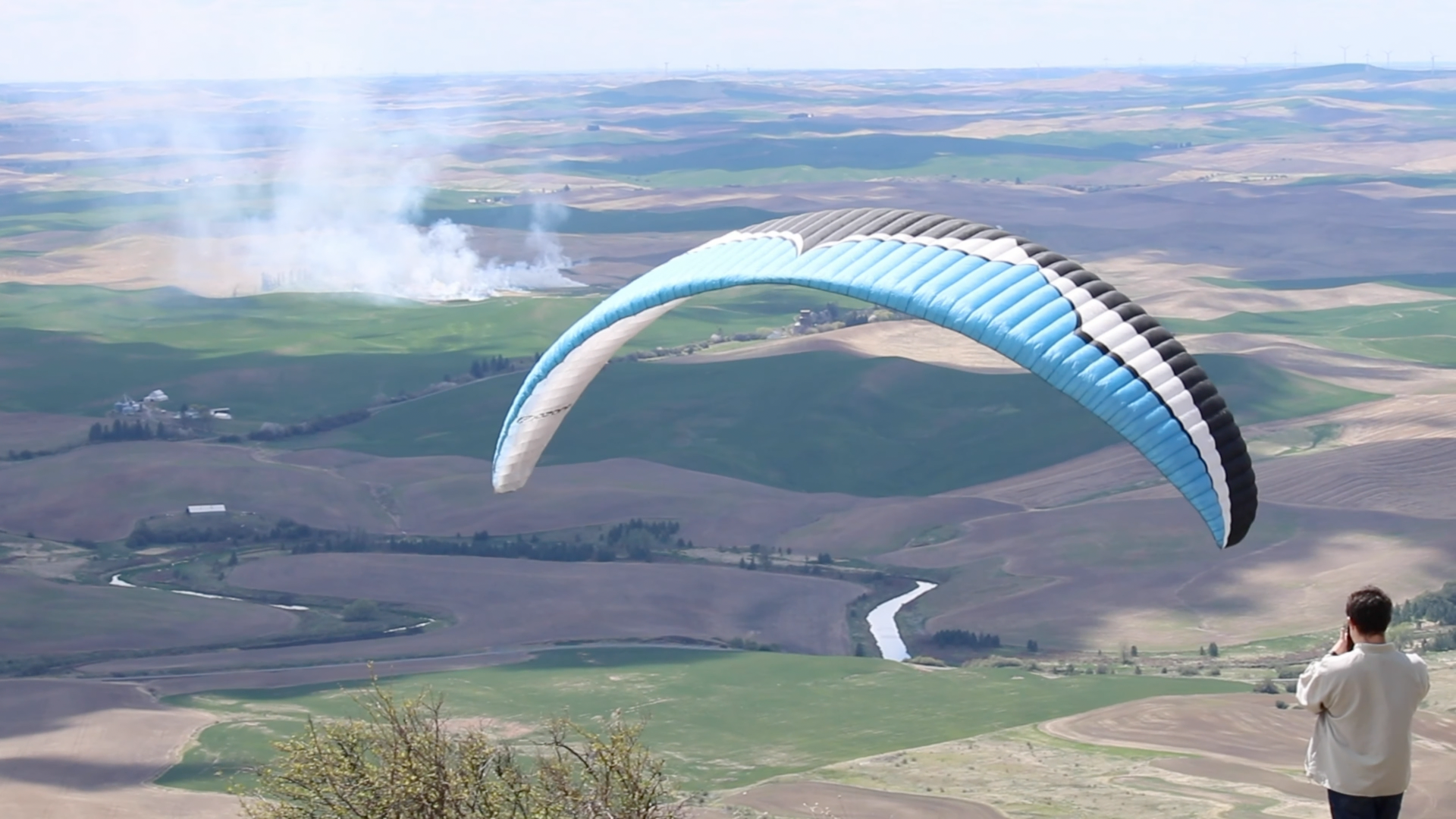
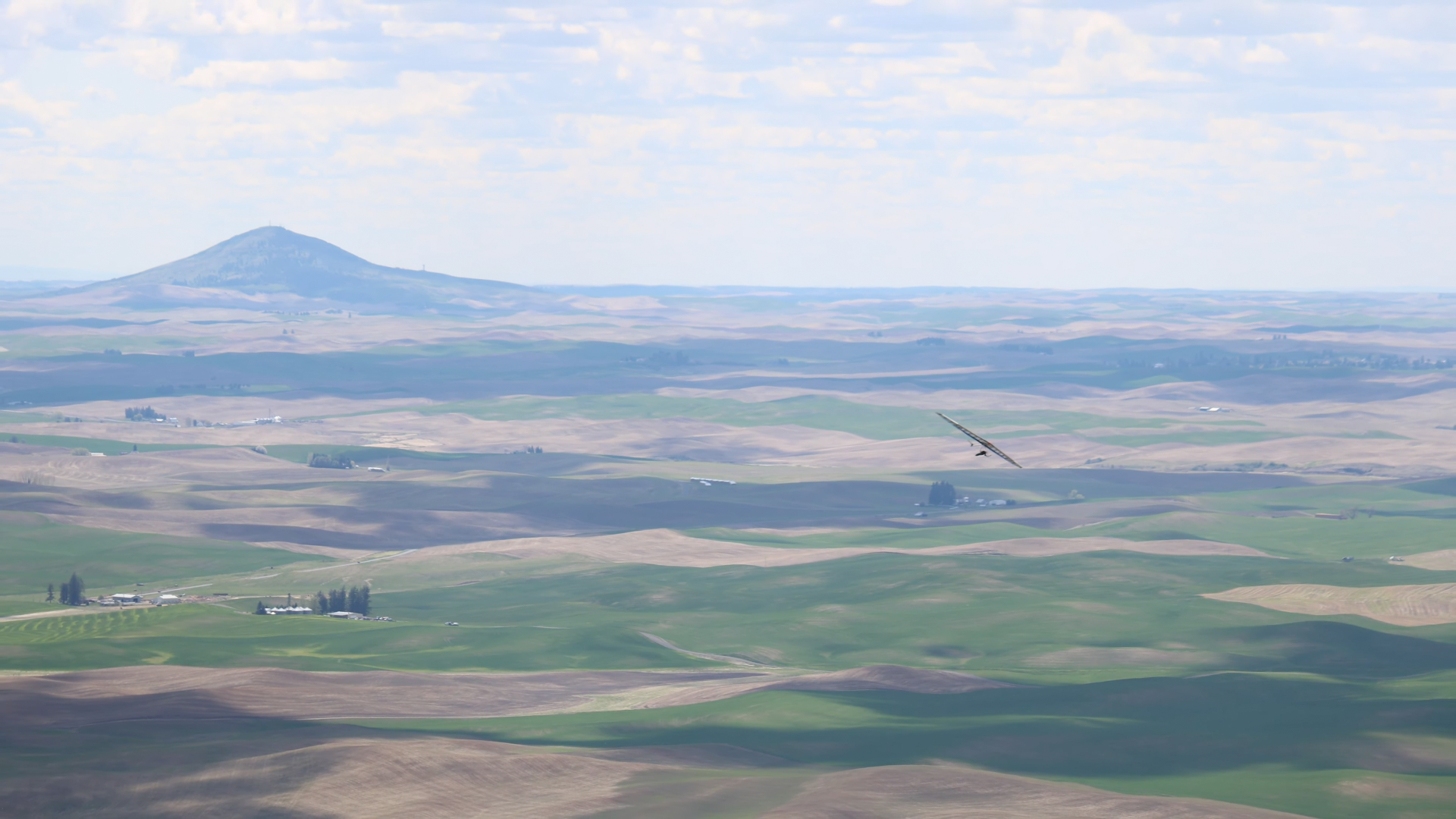
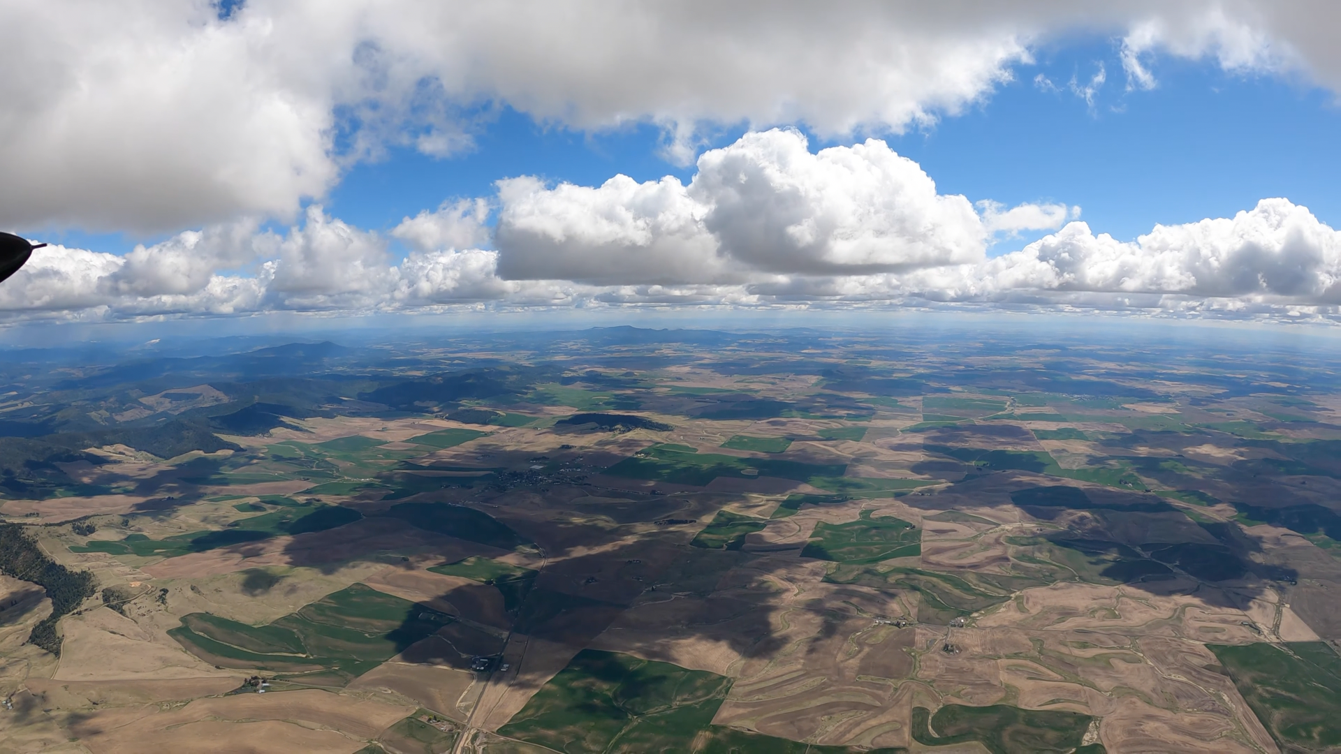
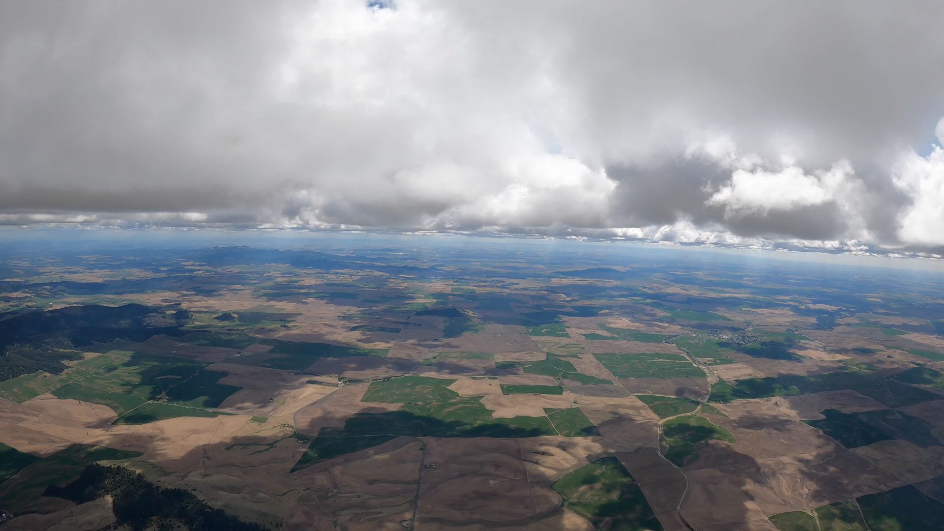
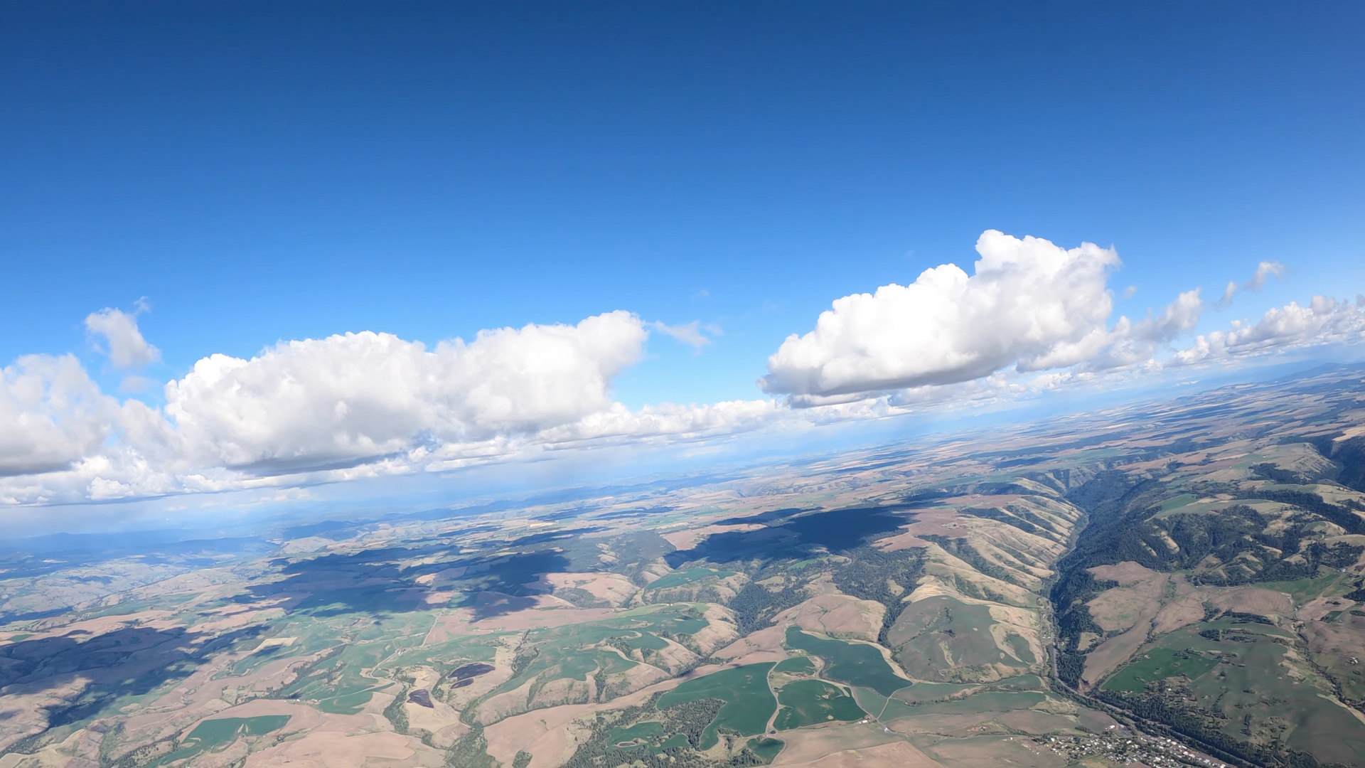
The initial push from the front hit with a lot of energy. Gust to 44 according to the wind talker. As per a normal cold push we like to let them settle before launching. Once the upstream weather stations started reporting NNE in the 15 range we prepared for launching. I was first off climbing slowly in the strong smooth lift until I was 1000 over then headed for the towers. Kim followed soon after. Mark was next up, I didn't see it so I will describe the video.
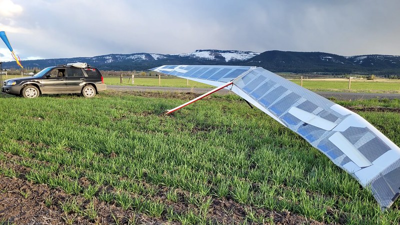
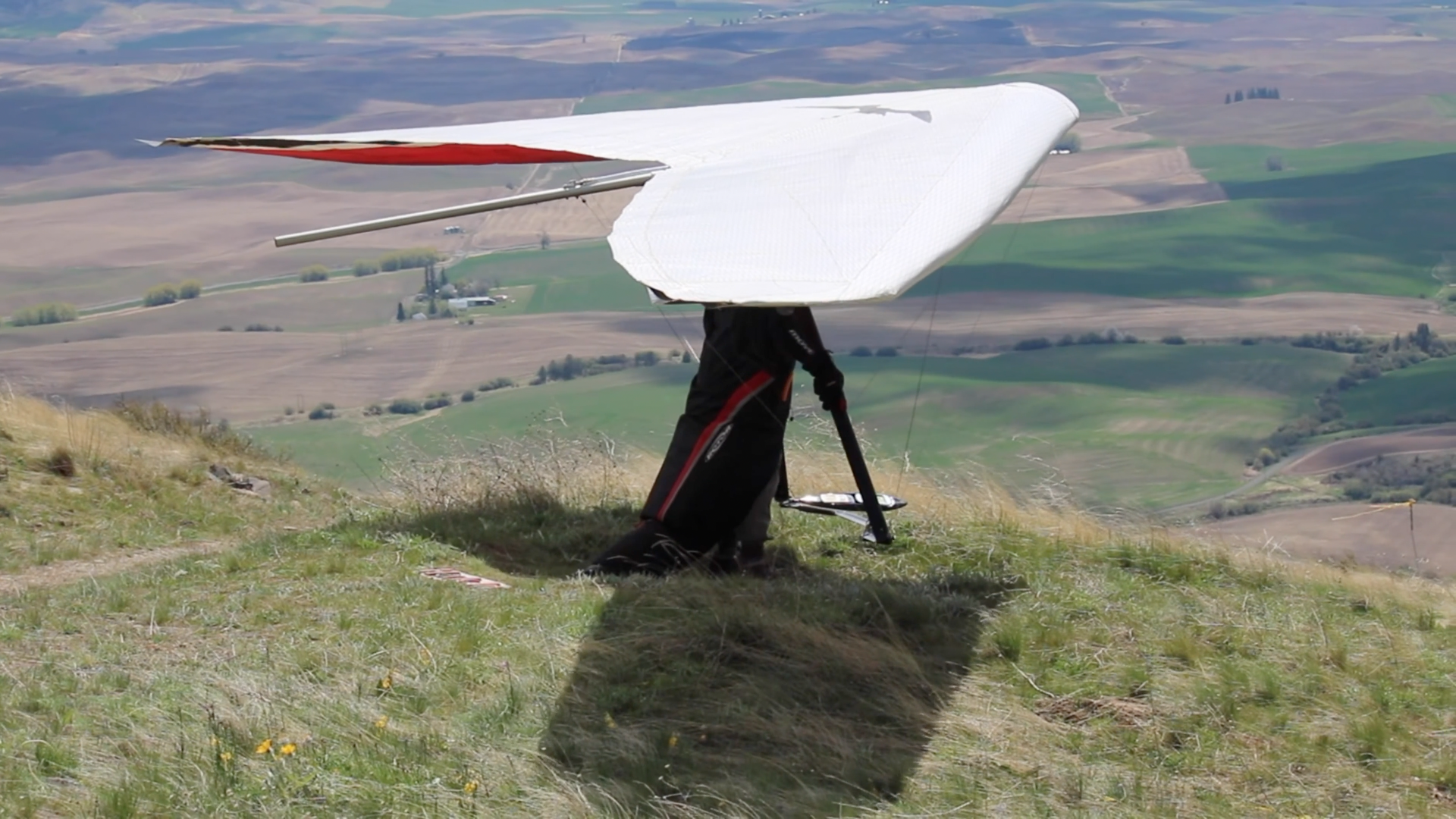
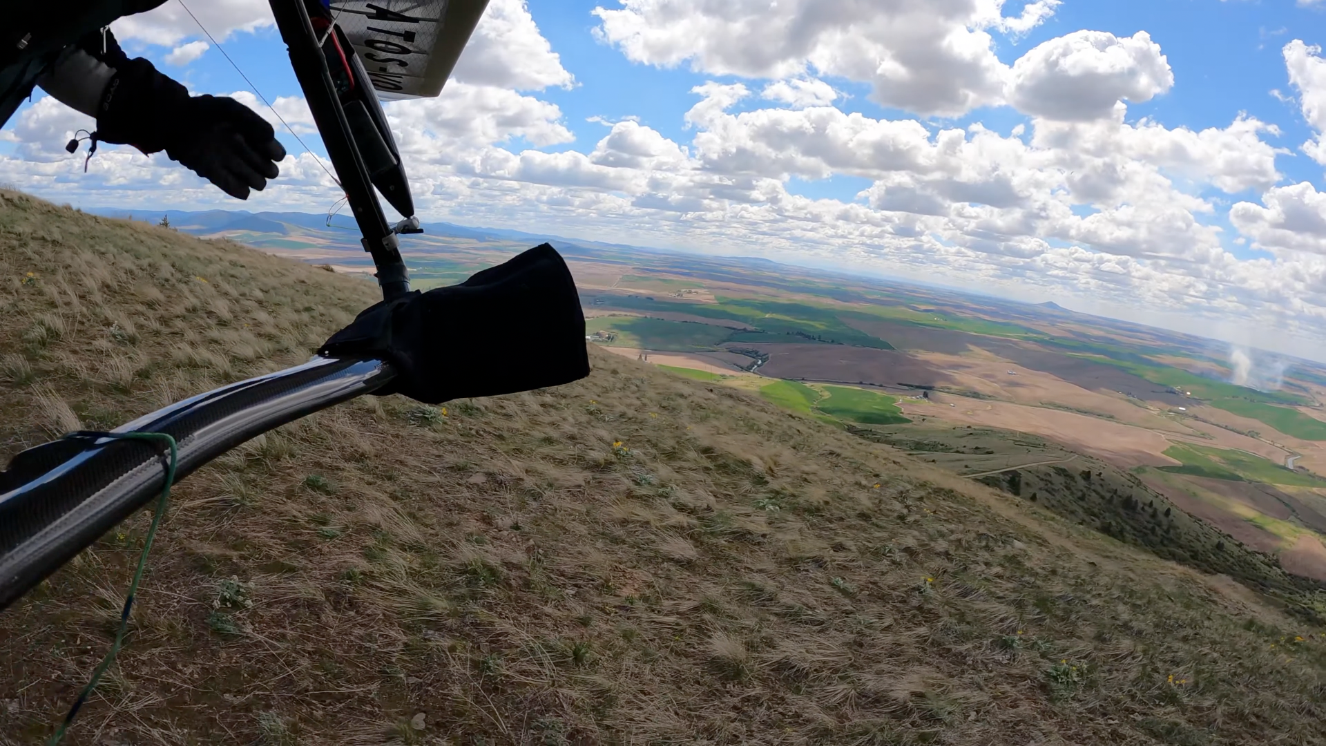
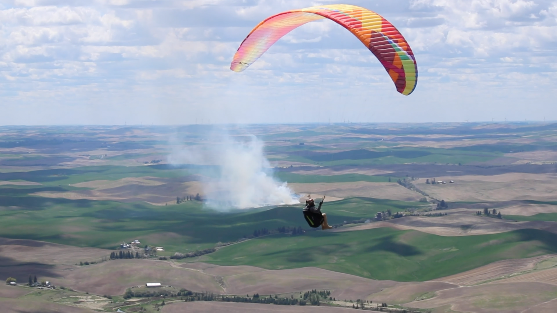
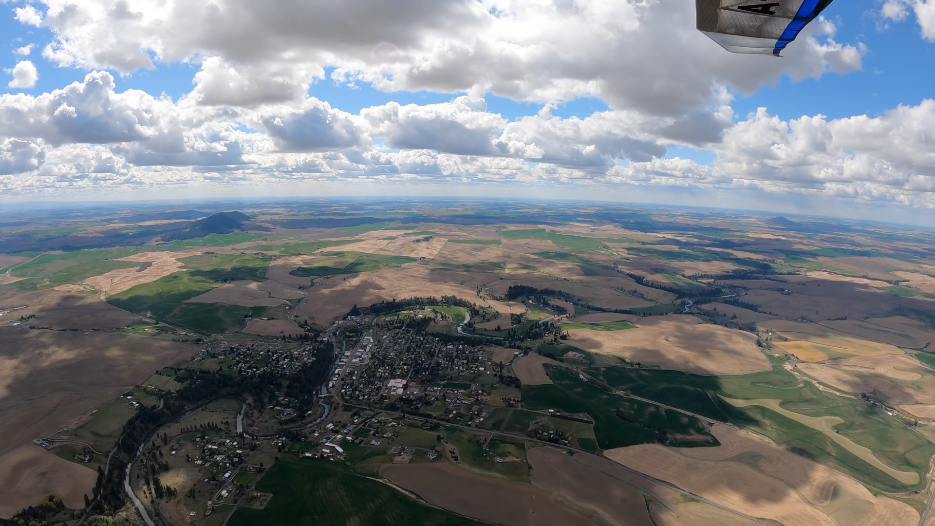
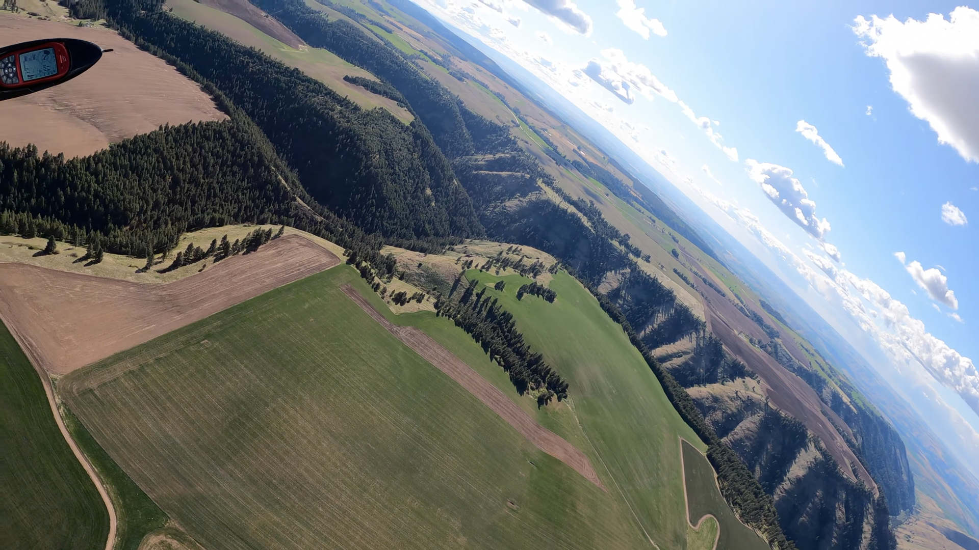
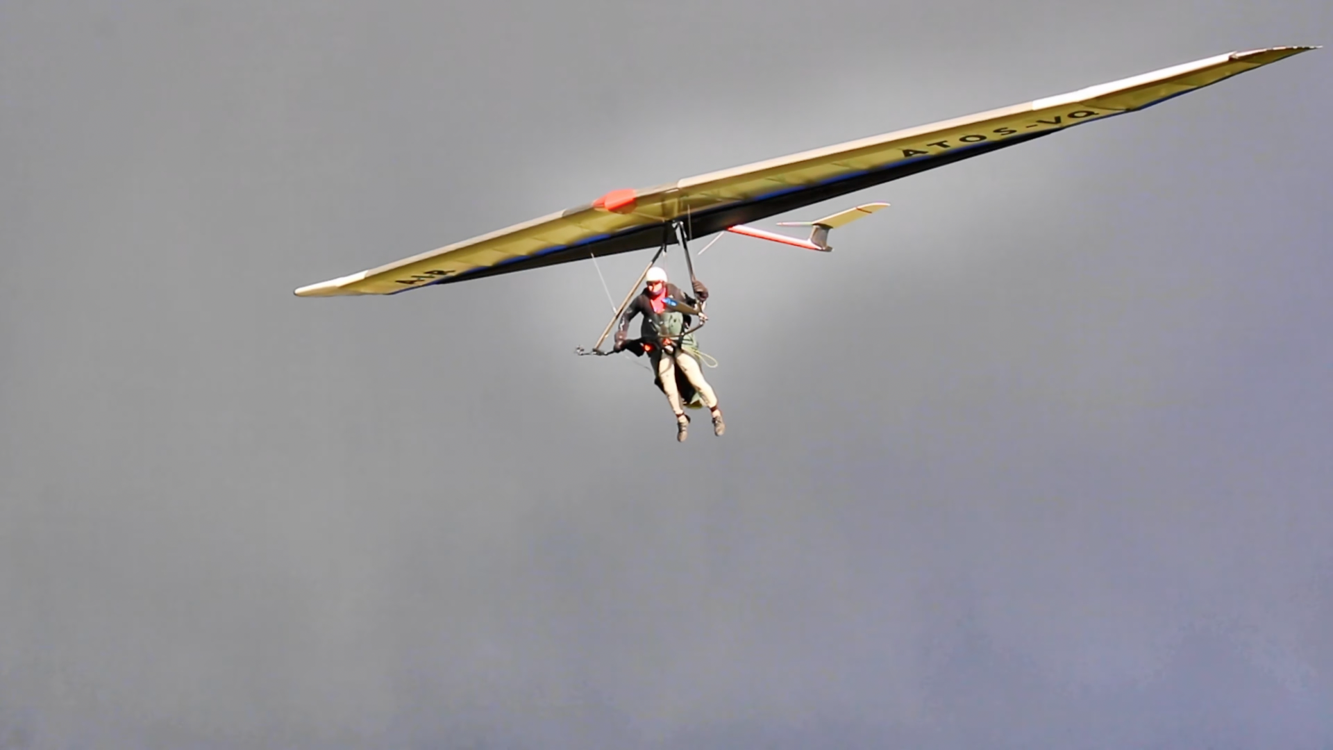
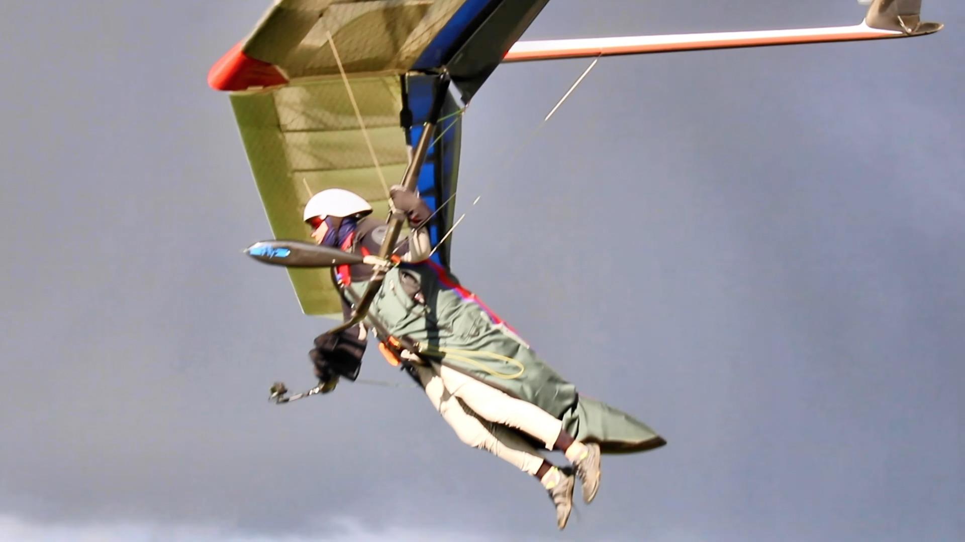
He launched from the crows nest above the PG launch area as this takes a north wind nicely. As he hike his glider up Sam offered help and he refused it. His ground handling skills were fine for those conditions. He flew slowly to the north point climbing the whole time. During this time he zipped up his harness and pulled a little VG. As he reached the north point he banked an easy right turn and headed south. At this time he is about the height of the top of the hill. There is a slight east arc to his flight path, but once he gets to the south launch parking area he banks a left turn and heads back north as if to get back to the windward side of the hill. He pulls the rest of the VG cord and heads a course a little NNW putting him even closer to the hill. Up until now he has put very few control inputs in indicating smooth air which is congruent with what Kim and I have been experiencing. But as his course is a little closer to the hill he gets his first pop of turbulence. This forces him into an uncontrolled descending left turn just north of the south launch parking area. He gives an input to counter the turn but given the full VG, steepness of the turn, and the turbulent air he was in it did no good. It seems he realizes this and commits to the turn. 3/4 The way around his turn now facing NE he makes a hard counter to the turn even swinging his feet to the outside of the control frame to no avail. At this point he looks at and grabs his VG line releasing about half of it before getting both hands on the base tube. Now at 75 feet facing SW he looks south between the cars and hill for an out, but cannot get the wing out of the steep bank. At this point the left wing tip about 3 feet from the end strikes the Jefferson County rangers truck breaking the leading edge and starts the inevitable rotation into the ground.
Given the information we have I think it is safe to assume that rotor was the cause of Marks accident. Once Mark turned south and past the south point he put himself in the lee side of the hill and south point. Susceptible to both rotor and wrap. Keep in mind as the wind speed doubles it's force quadruples. At 15-20 that rotor had lots of energy and was going to disturb a lot of air for a good ways behind the hill.
Mark was a kind and generous person. He would want us to learn and grow from this. Please do so
Rest in Peace Mark we will miss you
Sam and I finally had a chance to watch the video from the on board camera Mark was using that day.
Well, it was obviously a dirty job with which nobody else in the sport would've wanted to burden himself. Thanks bigtime for getting it covered.
We also inspected the glider to be sure there wasn't a problem with it.
Did you check to see if it had any VG pulled on? My understanding is that VG tends to inhibit roll control responsiveness.
Joining us was also an investigator from the NTSB who was a friend of Mark's wife Peggy. His experience with these types of events was instrumental and we thank him.
- This sorta thing happen a lot in your neck of the woods?
- Guess he found the Zack Marzec inconvenience tumble and fatality as much of a total mystery as the AT pros at Quest did, huh?
Once the upstream weather stations started reporting NNE in the 15 range we prepared for launching.
Yeah, but ya gotta be sure to watch out for rotors when the wind's in the fifteen range and the direction is parallel to the slope.
Mark was next up, I didn't see it so I will describe the video.
'Cause it would be UNTHINKABLE to allow anyone else to view the video and draw his own conclusions.
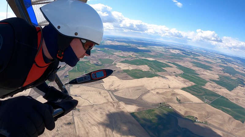
He flew slowly to the north point climbing the whole time. During this time he zipped up his harness and pulled a little VG.
A little VG.
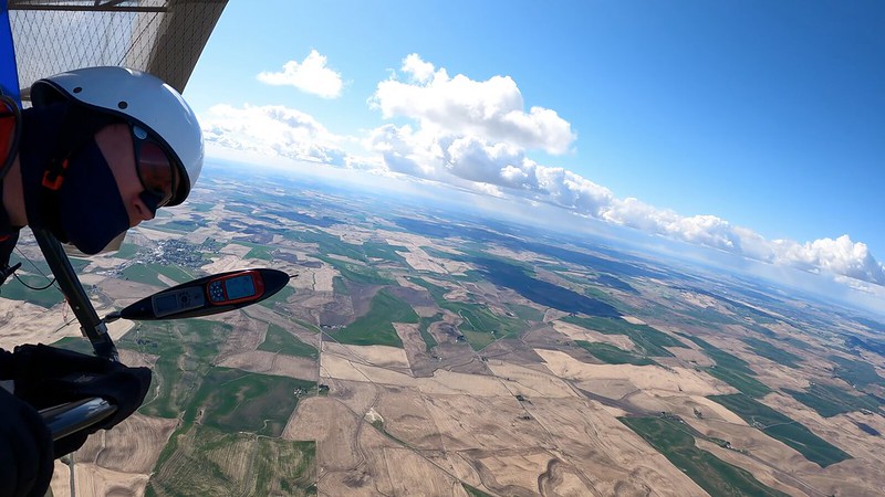
As he reached the north point he banked an easy right turn and headed south. At this time he is about the height of the top of the hill. There is a slight east arc to his flight path, but once he gets to the south launch parking area he banks a left turn and heads back north as if to get back to the windward side of the hill.
Once he gets to the south launch parking area a left turn would head him out from the slope / east if he were still on a south heading or south if he were heading into the slope / west. That statement makes no sense whatsoever.
Looking at the crappy track log and trying to make sense if this my guess is that he turns RIGHT onto a NNW heading.
He pulls the rest of the VG cord...
Full VG.
...and heads a course a little NNW putting him even closer to the hill. Up until now he has put very few control inputs in indicating smooth air which is congruent with what Kim and I have been experiencing. But as his course is a little closer to the hill he gets his first pop of turbulence. This forces him into an uncontrolled descending left turn just north of the south launch parking area.
Oh. A pop of turbulence FORCES him into an uncontrolled descending left turn just north of the south launch parking area.
He gives an input to counter the turn but given the full VG, steepness of the turn, and the turbulent air he was in it did no good.
P.S. And it obviously goes without saying that he had tons of airspeed to burn. So I won't bother saying it.
It seems he realizes this and commits to the turn.
Not that he has a CHOICE.
3/4 The way around his turn now facing NE he makes a hard counter to the turn even swinging his feet to the outside of the control frame to no avail.
Yeah - no airspeed / no avail.
At this point he looks at and grabs his VG line releasing about half of it before getting both hands on the base tube.
- Well written dude. He's flying along in a critical situation with no hands on the basetube, notices his VG setting, considers the implications with respect to roll control authority, slackens off a fair bit, then commits both hands to the basetube.
- What an asshole! Everybody knows that in a situation like that you need to unzip your pod, rotate to upright, grip the downtubes up high for better roll control and flare authority, kick out of the pod and get ready to run in case you're late on your flare timing.
Now at 75 feet facing SW he looks south between the cars and hill for an out, but cannot get the wing out of the steep bank.
He was above 75 feet with zilch roll control knowing that the situation was heading critically south and was able to take his right hand off the control bar, uncleat the VG cord, ease it from full to half, recleat the VG cord, return to what he had left of flying mode.
At this point the left wing tip about 3 feet from the end strikes the Jefferson County rangers truck breaking the leading edge and starts the inevitable rotation into the ground.
Well, he did as best he could with what he had to work with.
Given the information we have I think it is safe to assume that rotor was the cause of Marks accident.
Well duh! It's an ASSUMPTION isn't it? Whoever heard of an assumption that WASN'T safe?
Once Mark turned south and past the south point he put himself in the lee side of the hill and south point.
Yeah. And as every hang glider pilot knows only too well whenever you're on the lee side of ANYTHING in ANY strength of wind there's ALWAYS a near or totally lethal ROTOR.
Susceptible to both rotor and wrap.
What the fuck is "WRAP" supposed to be? If it means what I think it does wrap would PRECLUDE any possibility of rotor. Kinda like saying that just when we thought our lives couldn't be any more threatened by the racing wildfire we were beset by a blizzard which in five minutes rendered the roads totally impassible and reduced visibility to inches.
Keep in mind as the wind speed doubles it's force quadruples.
Also bear in mind that whenever you get on the lee side of anything the wind speed triples 'cause it knows it's gotta prepare itself to generate a deadly rotor.
At 15-20...
Where did we get twenty? We heard "Once the upstream weather stations started reporting NNE in the 15 range..." and nothing higher than that about launch. And "the 15 range" doesn't mean fifteen is the MINIMUM. It means fifteen is the AVERAGE. And if it had been twenty my guess is that everybody would've been quickly elevatored up in front of the slope and pretty much parked. And this wind was PARALLEL to the relevant stretch of the mountain and their would've been a gradient approaching the surface. And when you're flying downwind through a gradient your airspeed goes UP with decreasing altitude.
...that rotor...
The one we've all just agreed actually existed.
...had lots of energy and was going to disturb a lot of air for a good ways behind the hill.
Yeah, once those rotors get footholds they just play total havoc for miles downwind of obstructions.
Total bullshit. This one had ABSOLUTELY NOTHING to do with ROTOR. He was flying too slow, downwind, close to the surface, full VG. He was close to stall when he got his butt kicked a little and it put him out of control.
He's at TRIM when he responds by ADJUSTING HIS VG - instead of stuffing the fucking bar to start giving himself some actual options.
Mark was a kind and generous person.
And ALWAYS kindly and generously pushing for open quality incident reporting and better procedures and equipment standards and implementation.
He would want us to learn and grow from this.
To the extent we could without any video from any part of the flight. He certainly wouldn't want us to go totally nuts with this learning and growing inclination. Everything in respectable levels of moderation.
Please do so
Nah, we're good now. Don't fly into rotors. And tell your friends.
Rest in Peace Mark we will miss you
And Mark also wouldn't want us to go totally nuts on grammar, punctuation issues either.
flytm - 2017/10/08 16:12 UTC
Thanks Guys,
This kind of review is invaluable to learning and progressing.
I sure know I'm a much better person and pilot for having read it.
Thanks for stepping up and addressing what I know to be a painful and challenging task.
- Also big thanks for preventing everybody else from stepping up and addressing anything.
- Goddam right painful and challenging. HUGELY challenging.
A lot to learn here.
I don't even know where to begin. I'm still years away from getting my flare timing perfected. All this top landing with the hazards of rotors and parked rangers trucks is daunting beyond all imagination.
Respectfully,
With the DEEPEST respect!
Tim
Rick Maddy - 2017/10/08 21:17 UTC
Thanks for the writeup. I know that couldn't have been easy reviewing the video.
Let's get him an Exceptional Service Award.
Let's be safe out there.
Yeah, but first we gotta understand all that stuff about rotors. And even after we get down somebody else is gonna get killed by something else nobody ever thought of before and somebody else will hafta watch the video and write a report we all can learn from. "We all", of course, not including that next guy who gets killed.
Mike Benzie - 2017/10/10 15:01 UTC
Thank you Dean for that write
EXCELLENT work. First class, through and through.
I'm sure it wasn't easy watching the video.
Nah, it was an absolutely HORRENDOUS job. Better those two guys than me - and/or anybody else on the planet. Even saved us the agony of having to look at any key stills.
Definitely something we all can learn from.
Definitely. All of us. The stuff that we never learn from any of our instructors before we get our tickets to fly places like that. And ya know what they say about one word. Worth a thousand pictures.
So...
2017/09/04 - Mark Henline
Mark Henline (57), an Intermediate (H3) pilot and USHPA member since 2013, suffered fatal injuries during a flight near Golden, CO. The circumstances of the accident are under investigation.
Do we get to hear which one of you total fucking assholes signed him off, qualified him for flying that environment in those conditions, has just learned something new and valuable he'll start teaching his current and future students?
What the hell. u$hPa's told us flat out that they're not and can't be in the safety business. So they remain where they've been since the beginning of time - in the spot landing business - and we just wait for the fatality reports we always all can learn from.
Steve Corbin (Lazypilot) - 2018/02/01 20:59:38 UTC
i just read the posts about the pilot who crashed in Colorado. The report tells us that he made a wrong move that placed him in an area of turbulence.
- And because it was such a great report none of us needs to see the video.
- The report doesn't tell us that he got into "an area of turbulence". It tells us that he got into a ROTOR. But good job seeing through the bullshit and recognizing that he got into an area of turbulence.
It tells of him trying to correct, or reverse a turn he was in, but as many have experienced he needed both hands to muscle the glider and at the same time he needed to release the VG.
No. It's just like towing. You can use one hand to release the VG or your glider and the glider will wait patiently while you complete the task.
It's hard to do, although he desperately needed more control authority he also likely felt the need for as much performance as he could get.
Bullshit. He needlessly got himself into a crappy area and situation and stalled in turbulence. End of story.
I've felt for a long time that HG's really oughta have a foot-actuated VG, one that wouldn't require the pilot taking hands off the control bar to operate it.
But you've always felt for a long time that all our tow configurations are just fine.
Just bend your knees and go loose, straighten out your legs to tighten.
That's a really stellar idea. Engineer it and get back to us. But make sure that you don't use more than three components 'cause anything over that would be ridiculously Rube Goldberg complex and guaranteed to fail.
Go loose to wrestle your wing into a thermal, get it centered and then tighten up so your anhedral can assist you in staying in...
There's no such thing as ANhedral on a plane. There's positive and negative DIhedral. And I don't care how many fuckin' moronic air jocks call the force transmitted by the towline "pressure".
...if she overbanks ease off the VG and let dihedral help you level off. Once banked up, you could quite literally core that baby without having to shift your weight at all, just vary the dihedral and let that ever-present adverse yaw no longer be considered "adverse", it would be your friend.
Adverse yaw isn't "ever present" on a swept wing hang glider. It's virtually immediately overcome and irrelevant.
The Sport 2 155 that I flew was very responsive to the VG in the area of roll stability. If a glider were to be designed with this goal in mind, right from the git-go, it could make for much easier handling.
But back to the ranch. I have to say again that the necessity of a VG is an indictment of our decision to use weight-shift and weight-shift only as our sole means of roll control. I do believe that weight-shift is a good idea for some aspects of pitch control...
Up and Down. For what aspects WOULDN'T it be a good idea?
...but the industries failure to recognize that it is an inadequate way of steering anything other than a single-surfaced billow cruiser is borderline criminal.
Rubbish. The gliders are HGMA/DHV certified and we all know what they and we can and can't do.
We've been told over the years that competition wins drive glider sales, and since the competition ruling bodies decided back in the 1970's that we would fly in Class 1, where weight-shift with no help from any kind of extra device would be the only way to turn the glider, the 99% of Hg pilots that don't fly in contests have been bearing the burden of that decision ever since.
So how do explain Sports and Falcons then? Or hell, the new Wills Wing Easy Flyer that throws away the second half of the speed range?
How many unexplained deaths can be directly attributed to a roll responsiveness that is at best pitiful, and totally unacceptable to any sane person.
- Most of the time when a death is unexplained it's 'cause a corrupt criminally negligent commercial interest (read: all commercial interests) has done as much as possible to unexplain things. But we can generally figure out what we need to anyway.
- Cite one example of an unexplained death.
- Deaths - even when we're going through a 2015-2016 Bloodbath Period - are rare as hens' teeth. They're almost always just perfect storm examples of shit for which we have hundreds of minor and no consequences videos. So show me a video example of something that could translate to an unexplained death.
I've had the holy shit scared out of me many times since the Comet came on the scene in 1980 or whenever it was.
1979.
Those scares needn't have been, and I must shamefacedly admit right now in front of God and everybody that I, and I alone, are responsible for who knows how many scary moments that pilots the world over have had to endure, and God only knows how many serious crashes and injuries and yes, fatalities, all because I just went along to get along.
Like you're doing now in tolerating the total shit practices of Jack in order to be permitted to carry on discussions in his Living Room?
No posts or links about Bob K, Scott C Wise, Tad Eareckson and related people, or their material. ALL SUCH POSTS WILL BE IMMEDIATELY DELETED. These people are poison to this sport and are permanently banned from this site in every possible way imaginable.
By remaining silent instead of rallying the troops...
The fuckin' total wastes of space that infest The Jack Show and have been instrumental in helping u$hPa and the Flight Park Mafia gut every reform effort that's reared its ugly head to date.
...I've been complicit, when maybe, just maybe, I could have been instrumental in making our form of aeronautical recreation better.
Nothing was stopping you from at least doing the engineering and challenging conventions as an individual before.
We call it a "sport", and athletes like sport, and I've noticed that they like to work out and sweat a lot. Fine for them, they can make their entire 10 hour XC with full VG all the way, and get their workout and sweat a gallon in the process.
On the other hand there are pilots like me who want complete control of their glider at all times, and don't want to have to fight for it.
And folk in Hell want ice water.
Bullshit. There's no such thing as an aircraft that delivers complete control at all - or ANY - times. Birds wish they had complete control at all times. Anything that goes into the air is an exercise in tradeoffs.
Let me encourage those satisfied with the status quo to notice that it's me authoring a post to this fine site...
Fuck you. The FIRST thing one must do if one has any delusions of being able to reform anything in this sport is denounce all mainstream sites as totally VILE.
...and take the appropriate action of skipping my comments.
No problem there. You're totally harmless so people will be skipping your comments in droves.
I'm not interested in offending anyone...
See above. Step One is to offend the fuck out of Jack and Davis and get permanently banned in every possible way imaginable.
I only want to voice an opinion...
No worries then. You're in a flavor of aviation that gets airborne ONLY on the voices of opinion. Just stay the hell away from aeronautical theory and you'll be fine.
...an opinion I realize not everyone shares.
It's hang gliding. Any opinion you hold is as good as anyone else's opinion. 'Cept of course for those of Jim Keen-Intellect Rooney - and nobody can remember what any of those were now.
I speak up to encourage others that do see it like I do to voice their feelings also.
Feelings are OK too.
The worst case scenario for me would be to find that I'm the only one who feels the way I do, in which case I'll quietly fold my tent like an Arab and silently sneak away.
I honestly don't know what the answer is, but I'm hoping that discussion of this matter will eventually reveal the answer.
Or hundreds of them. All equally valuable.
This is bullshit.
- As long as we've got Grebloville victims flying on the control tubes from the Kagel launch till stopped on the old Frisbee in the middle of the LZ we've obviously got control authority to burn.
- Yeah, hang gliders are a bit of a bitch to turn at lower speeds and higher performance configurations. But we can get anything to turn really well - often TOO well (see: PIO) - at higher speeds. And we don't need to put ourselves into situations in which we really need maneuvering speed but can't get it.
- You want conventional aircraft control authority... Get a sailplane and a trailer on which to haul it around. A hang glider is something that doesn't cost much, packs up quickly and easily into a tube (plus a backpack for the harness and gear), can be thrown onto the roof racks or one's shoulder, hiked in short distances to slope, cliff, ramp launches that sailplanes can't exploit.
There are ZILLIONS of zero to low cost fixes we can effect to increase hang glider control authority, performance, safety. Hell, there's even negative cost shit. Get rid of the idiot fucking backup loop.
But go ahead and have fun reinventing the sailplane. In the near dozen year history of The worlds largest hang gliding community there's never been a single goddam positive contribution to make it out and into the air.
P.S. Note the conspicuous absence of any discussion about the LeverLink - Jeff Roberson / Ridgerunner / ridgerunner. Last signs of pulses on the Davis and Jack Shows - 2016/04/08 14:07:56 UTC and 2016/05/29 12:44:11 UTC respectively.
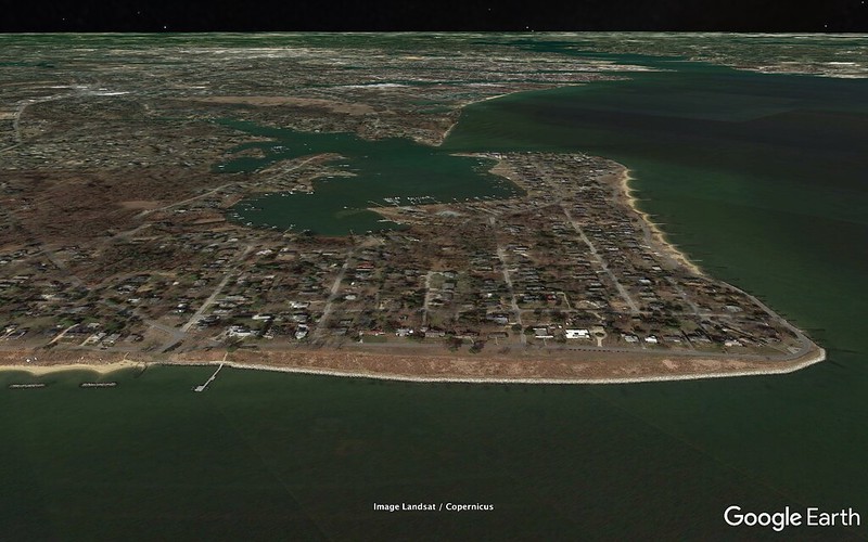
You're looking NW from the Chesapeake Bay at the bluff at Bay Ridge - a wee bit shy of forty feet. The mouth of the Severn River is on the right, the white heavily developed area in the distance is Annapolis proper, the Naval Academy juts out to constrict the river.
The smaller body of water at center was Cathole Creek, later gentrified to "Lake Ogleton" (it's not a lake), my old family home is on the near side of the far constricted area.
1982/11/04 I'd shortly before finished up the season at Kitty Hawk Kites and was out for an afternoon spin on my bike. Sky was overcast, wind was coming straight into the bluff, gulls were parking above. Hmmm...
Came back with the '79 diesel Rabbit and Comet 165 on the racks. Set up quickly and out of sight as much as possible 'cause I figured that while there was no law prohibiting what I was about to do there would be an hour or two afterwards. Got into my stirrup harness, got somebody to take a sidewire, ran it off into the smooth 20-25.
Total blast.
Slightly south cross, my runs were about four hundred yards. At the NE end I'd lose on my turn and come back skimming out ground level. The foremost tree - I think the same one visible in the middle - was a Black Locust, then small and scraggly. I'd aim for it, climb just enough to clear it, need to bend at my knees to finish clearing it. At the SW end I'd make my money backing up to the cluster of trees to milk a little more lift. There was a traffic jam of spectator cars on the road. (And you can go into Street View mode for a pretty good perspective of what they and I were seeing.
The wind gradually increased towards the upper end of the aforementioned range and clocked to more south cross. And maybe I got a little sloppy on a turn at the downwind end and was unable to maintain. Hugged the slope for a final SW run, made it to just beyond the end of the bluff, turned into the wind, landed uneventfully in shallow water close to the beach. One and three quarters hours for the log book. And how I wish I'd quit while I was ahead.
Wind kept strengthening and clocking cross. I switched to my new Robertson cocoon and ballasted with sand to help with the upwind penetration. This one would last fifteen minutes.
Another downwind end turn that might not have been all it could, hugged the bluff but couldn't maintain, had to turn out and go down in chest deep water with swells coming in. Didn't have any really great plans for this situation.
Got unclipped with some difficulty. Let the nose come up. This puts the tips underwater and ensures a turtle of the glider. The water's edge is and was riprap. A small flock of young teenage kids had rushed down to help save my sorry ass. We got the glider out but it was rather badly beaten up in the process.
Looking at my log... Got the glider repaired and got off seven test flight at a forty foot bump at the community college 1983/01/27. Then some High Rock flights - two apiece for 1983/02/05 and 1983/02/26, one for 1983/03/13.
Then I was down with the cancer, chemo, surgery drill. It was brutal and they hadn't expected me to survive. (I did, but my endurance never came back.)
Then, damn, I was back in the air at High Rock 1983/12/17, Wilbur and Orville Eightieth, an hour ten, twelve hundred gain. I'd been thinking I'd been out until Jockey's Ridge 1984/02/11. Can't believe that period went by so quickly.
---
P.S. - 2019/04/05 13:20:00 UTC
Subsequent to that second disasterous Bay Ridge flight I concluded that the only safe/sane way to exploit that bluff would be with floats on the glider and a boat standing by for retrieval. Not terribly practical.
Pretty cool. Somewhere in the vicinity of:
Galdhøpiggen Summer Ski Centre
61°39'55.19" N 008°21'46.65" E
If I understand "speed gliding" then this isn't an example - fortunately. I think of speed gliding as hugging the slope and seeing how fast you can rocket down to the LZ. Never had the slightest appeal to me. Ditto for the people who engage in it - as far as I can tell so far.
He's flying fast but efficiently in ground effect and SOARING - should be able to stay up all day with those runs.
Criticism... He has a beautiful clean topless and ditto pod harness but has a full twist in his suspension (port side of the carabiner). Undoubtedly a consequence of a rotation of a tang around the bolt. Trashes his performance a bit and significantly mars his otherwise beautiful video.
Also... We're not seeing a hook-in check. Sorta looks like he's doing lift and tug but the suspension never goes tight until he's fully airborne. He's just adjusting his grip, support of the glider. Shallow slope but things would still be pretty ugly with that surface.
Real good bet based on what we're seeing that there was no stomp test on the preflight.
Yeah, he's probably one of the cool guys
I do like his flying style, coming in low and fast for the landings. Not afraid of trees.
Did you check out some of his other videos?
Here is more speed gliding: http://vimeo.com/231280882
And a compilation, also with some crashes http://vimeo.com/391534744
As long as you have a fair bit of airspeed you don't need to be too afraid of trees. (But the situation in which he didn't and was too low could've ended very badly.)
Usually not much interested in sleds but in 1984 at the head of Sognefjord - overcast, dead air - it looked like one could have a lot of fun.
Beautiful flights, terrain, approaches; fun to watch.
Note that over here in the Land of the Free and the Home of the Brave you're not allowed to turn a glider below two hundred feet and no later than that point are required to be upright for better crash survivability and have both hands on the downtubes at shoulder or ear height for better roll control and flare authority
More bitching though...
- When we see a spreader he has it way low to keep the top of his carabiner from being crushed.
- Has the (locking) carabiner turned around backwards. Probably doesn't have the chute anchored on it so it probably doesn't matter but if you have any aerodynamic common sense you put the thick end upwind.
Thanks for those gems. Enjoy your glaciers and tundra as much as possible while you still have them.
And any tips on resisting and overthrowing fascist government and occupation will be greatly appreciated.
---
Tad Eareckson - 2020/07/17 17:00:00 UTC
In the early Seventies - starting 1971/12 - I made a dozen parachute jumps. Locations:
42°24'44.32" N 083°34'33.79" W
42°08'49.59" N 083°47'25.44" W
36°46'49.29" N 076°26'55.58" W
The first two - Michigan (near the University), Salem and Saline - no longer exist. The third (near home at the time) is still going strong.
I'd wanted to get airborne in the driver's seat and hang gliding hadn't quite started breaking out. First five jumps were static line - from 2800 feet. The first one I did textbook. Nothing seemed real and I wasn't scared. But the winter weather in Michigan sucked and it tended to be a long time between doable weekend days. (And I remember one hop in which my gloved hand was so cold that I failed to hold onto the ripcord assembly and watched it spiral down below me.)
I might have been OK if my schedule had been packed but as things were fear started creeping in and taking over. I was fine with an open canopy (Para-Commander for all but the one standard in Virginia). I couldn't pull the ripcord fast enough and was doing zilch to get myself stabilized. On one pull I bent at the waist and looked "down" at my feet. I saw:
- my feet surrounded by nothing but blue
- the pilot chute, deployment sleeve, suspension shoot by my feet
- the canopy rapidly blossom
This is gonna hurt. (Harness bruises on my shoulders for the next week.) Flipped through the rises and for a while thought that that meant that I was facing backwards with respect to the canopy but quickly enough got sorted out and realized I'd be flying and landing normally.
Made one hop at Suffolk and brought it in to the edge of the pea gravel target circle. Left foot made it in, right foot stopped on hard turf. Right ankle got badly sprained and I had to hop around on a cast for several weeks. I'd underestimated my descent rate on the low performance chute. And, it has only now occurred to me...
Nothing creates carnage like declaring a spot landing contest.
Went for another hop at the same when I'd recovered adequately. Climbed out on the strut, instructor gave me the nod, couldn't do it - chickened. Back into the cabin, landed with the plane.
Back in Michigan I made two more hops but they were just exercises in controlling fear - I wasn't having fun.
Shortly thereafter hang gliding started getting in gear, I watched Bob Wills in "To Fly" at the Smithsonian National Air and Space Museum's IMAX theater... And on 1980/04/02 I did my first hang gliding flight at Jockey's Ridge on an Eaglet 191 trainer.
But it had always bothered me that I'd been unable get my fear under control enough to function competently in that flavor of aviation.
There's one in White Marsh just off of I-95 just outside the far side (for me) of the Baltimore Beltway. I'd stopped there on the way back from New England a few Thanksgivings ago and checked things out pretty thoroughly. Had been really impressed by the control booth with all its displays showing what was going on in the column.
On Monday (2022/07/04) health and other considerations were lining up well enough to commit for a full monty reservation for noon two days later.
Arrived plenty early. I've ALWAYS heard - and just confirmed - that terminal is around 120 mph but they were running the fans for 80. And down to 50 - if I was reading the gauge right - for little kids.
Instructor Corey had the twelve o'clock group - eight of us - suit up and watch the video and then briefed us. I'd bought five minutes which he wanted to do as three 1:40s. OK. I got to the back of the line so's I could watch and maybe learn a bit more prior to my slots.
I was in a jump suit with a visored helmet. (Also ear plugs which I'm sure weren't shielding me from anything but was wearing them 'cause they were making them available.) When my first turn came up I wasn't the least bit apprehensive about anything beyond following instructions and performing adequately. You just lean through the entrance, fall forward, go into freefall configuration.
Was frequently instructed (hand signals) to straighten my legs more. The visual image I have of freefall configuration is body arched and knees bent.
A bit into things the fan driver started signaling me and I was able to pick up on what they wanted me to do a lot faster and better. As we'd rotate around the cylinder I'd have my head turned towards his position to get any updates as quickly as possible.
I was pretty fried after two of my 1:40s and DID NOT want to take my third without a half hour of recovery time. But that's not how their assembly line normally works so...
Got out of that one very tired, stiff, sore. They wanted my head tilted way up/back and my neck was not happy about the deal. Corey said that consequence was pretty standard for guys around my age.
I liked Corey personally and we talked sky diving, hang gliding, astronomy afterwards before he had to start mobilizing for his next class. But...
I'm sure I could've learned, progressed a lot better, faster and just as safely if they'd just:
- turned me loose in the tube
- let me experiment, make and correct minor mistakes
- coached me from the control booth
For my first hang glider flight I launched, flew, landed solo just fine. And, having worked for Kitty Hawk for a long 1982 season, I knew what a ride factory was and how they work.
Our jump suits have grips at several points and their ride guys use them to keep things moving the way THEY want them to. I was frequently getting horsed around and I wouldn't know if Corey was compensating for something I was doing wrongish or setting me up for the next exercise.
I think the corporate strategy is to retard the progress of the "student" through a couple of these sessions before really handing him the steering wheel and letting him gain the competence and confidence needed to do things right departing from the plane.
Still... I'm thinking at this point that I COULD bail from the plane, stabilize, hit terminal, pull the cord. The thought of having to do the drill remains well south of pleasant though.
New and improved version of Final Cut Pro - 10.6.4. Now I don't have to listen to the audio when I'm going frame by frame - only an option when I'm viewing at normal play speed. Thanks bigtime Apple, keep up the great work. It was such a royal pain to turn the volume down or hit the mute key when I didn't wanna hear sound when I was working in something outside of normal play speed. (It was extremely useful to hear what was going on frame by frame to determine the instant a Standard Aerotow Weak Link had increased the safety of the towing operation - for example.)
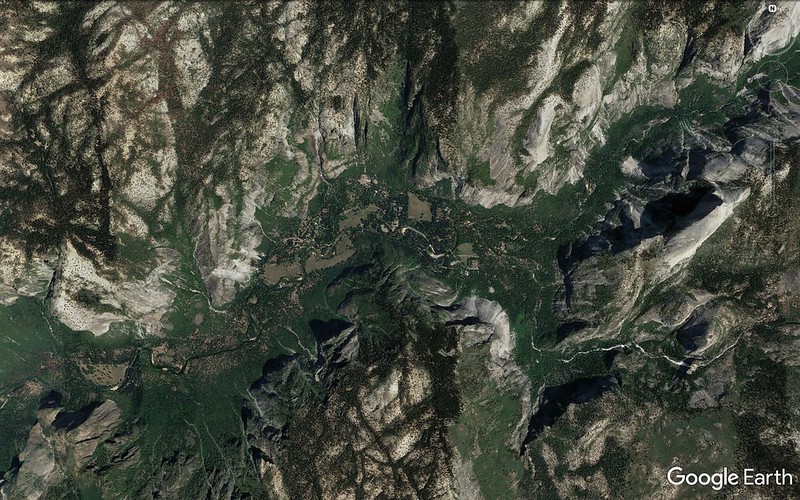
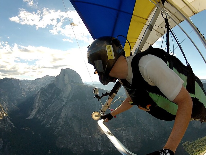
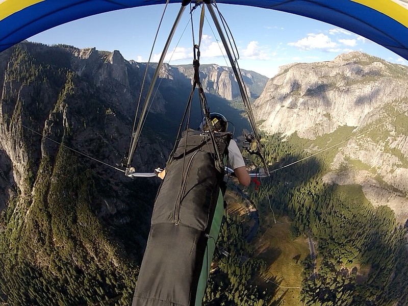
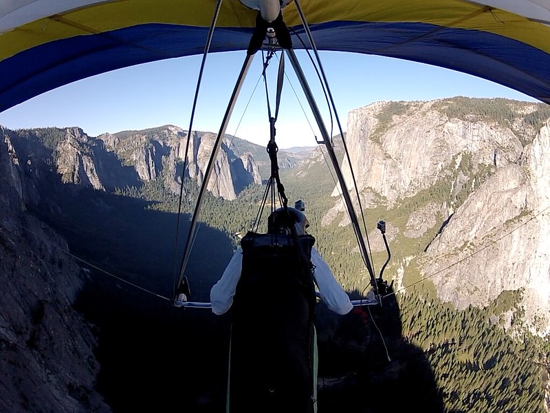
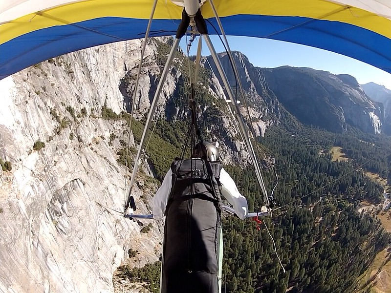
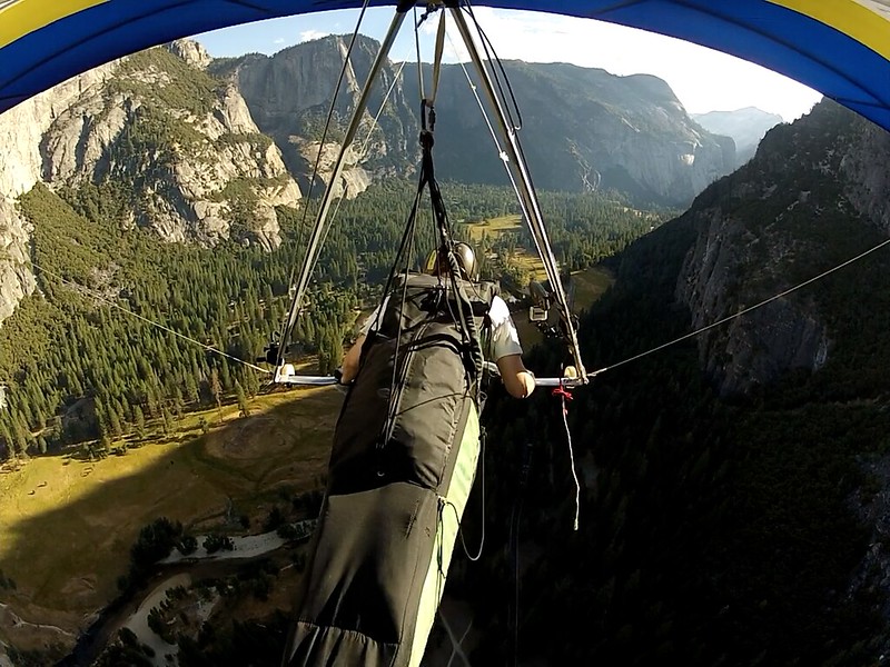
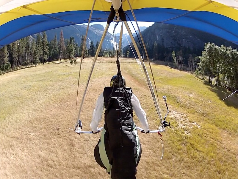
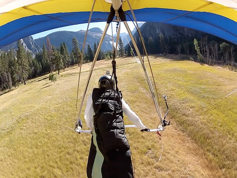
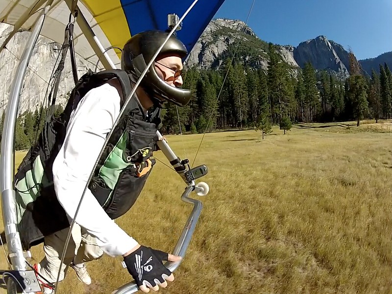
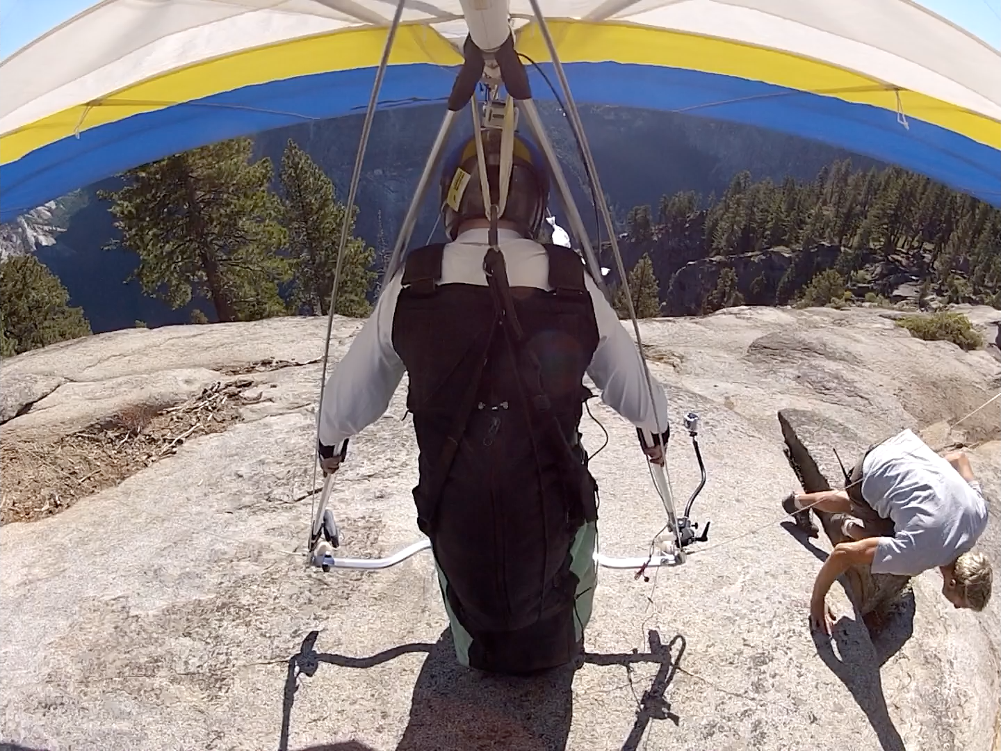
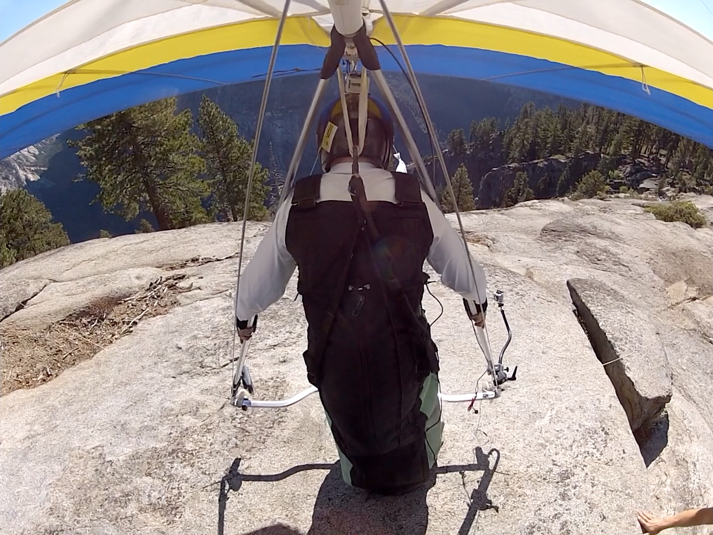
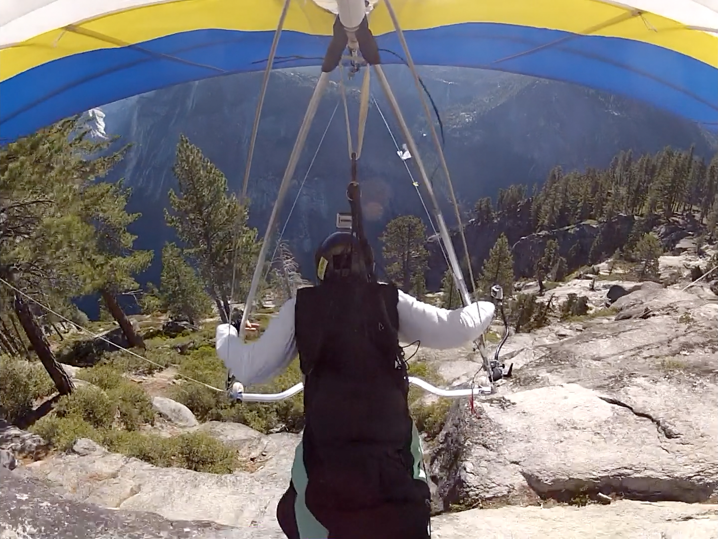
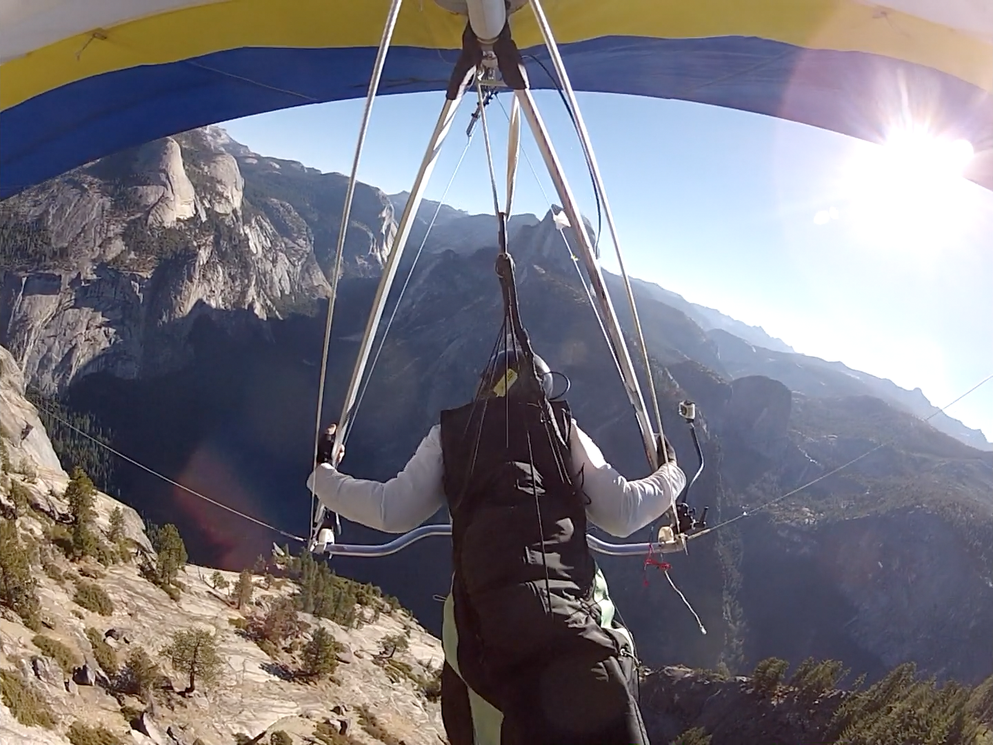
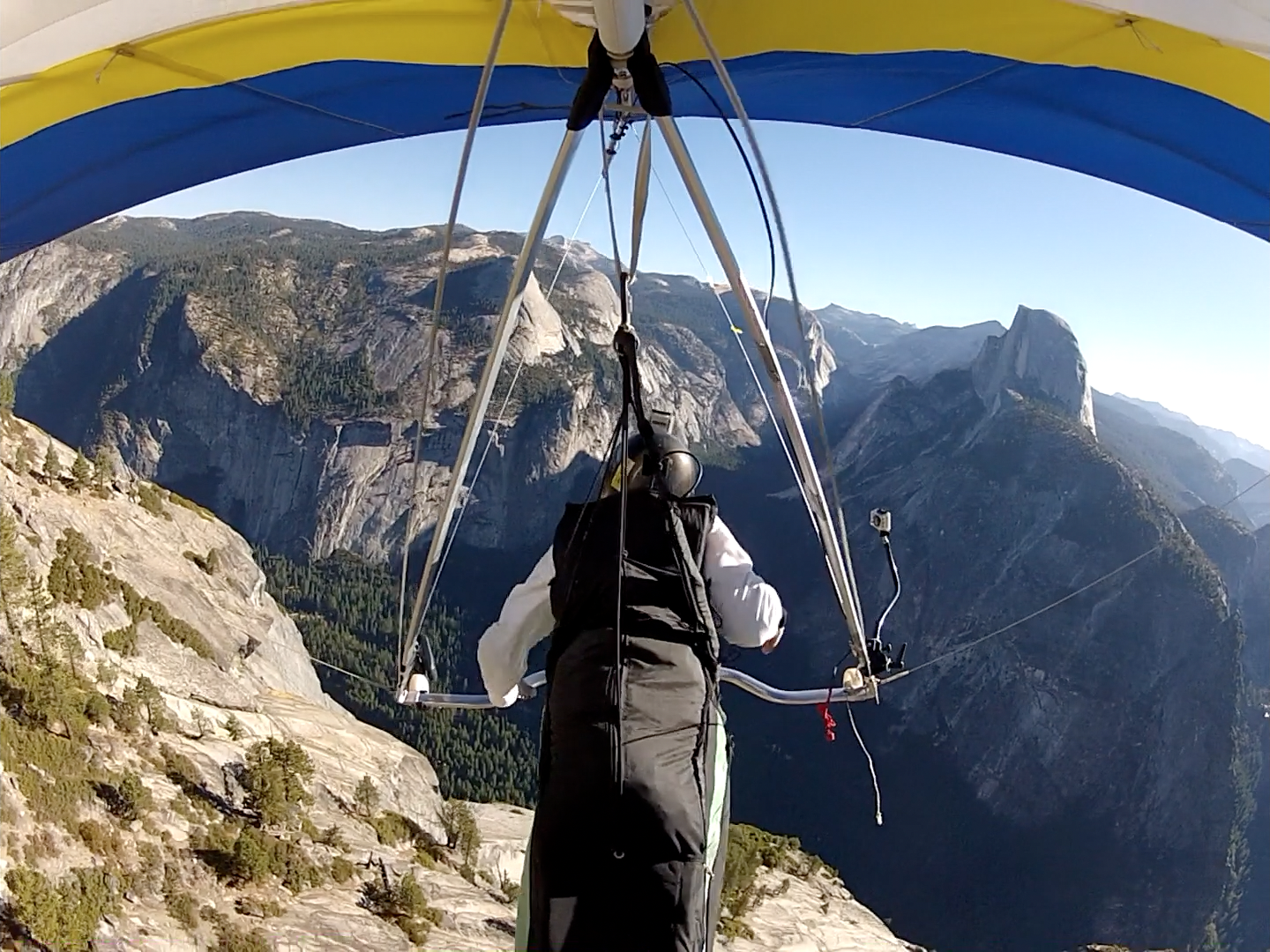
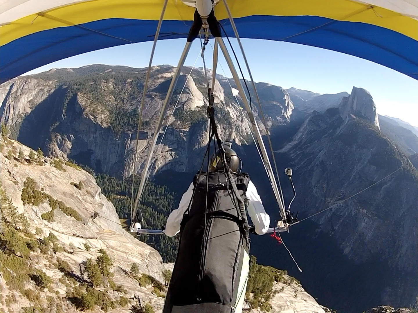
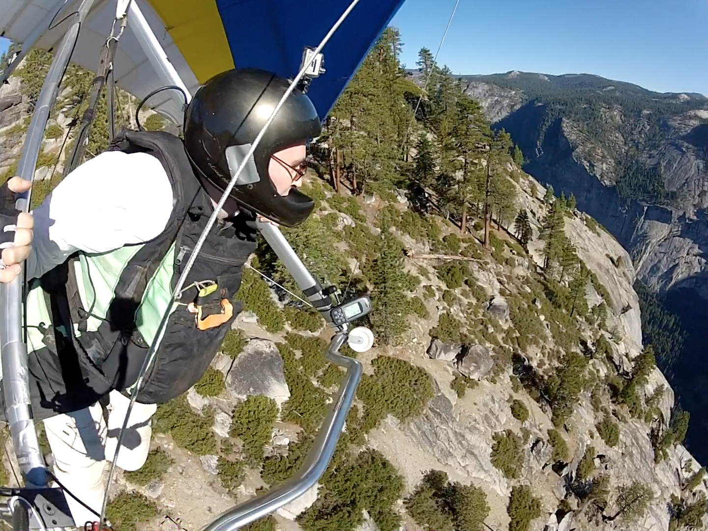
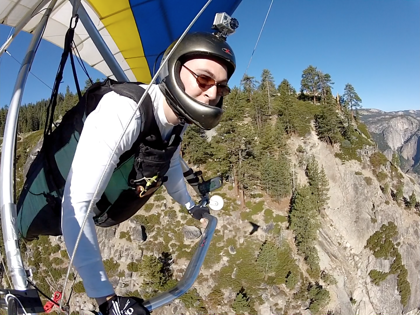
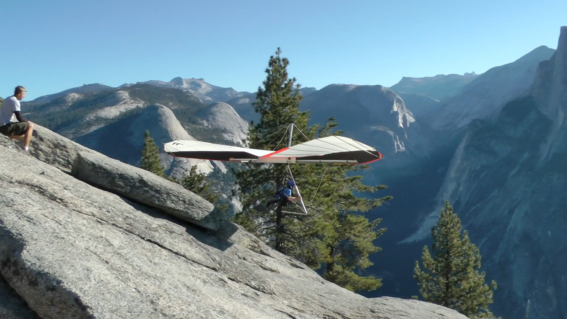
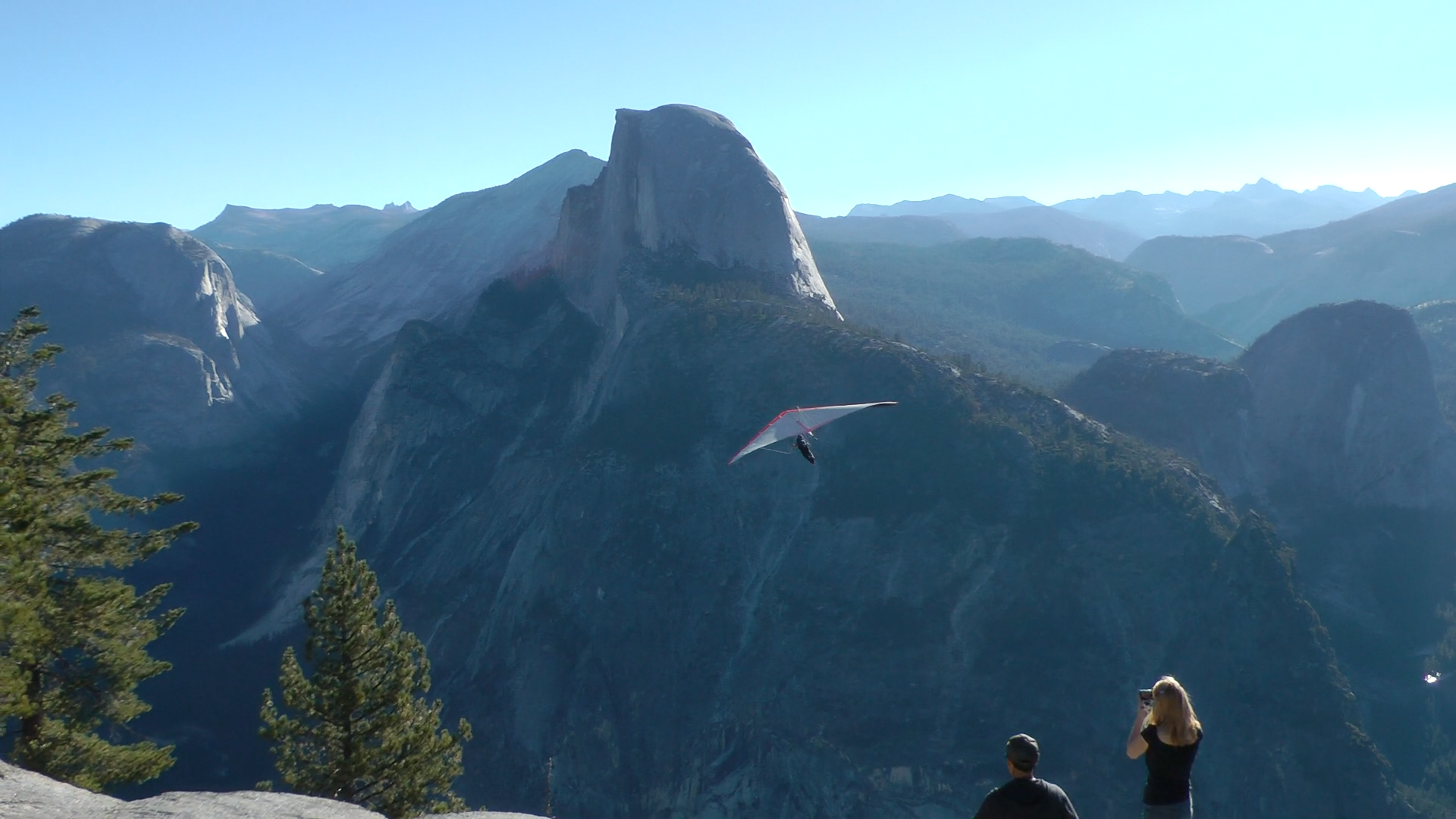
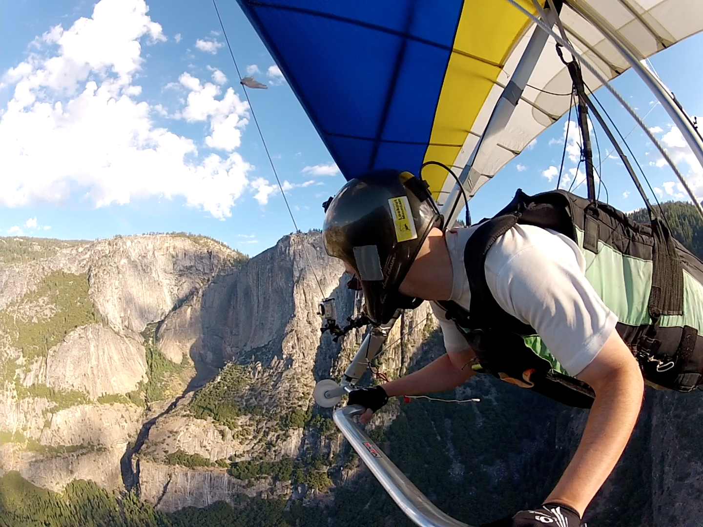
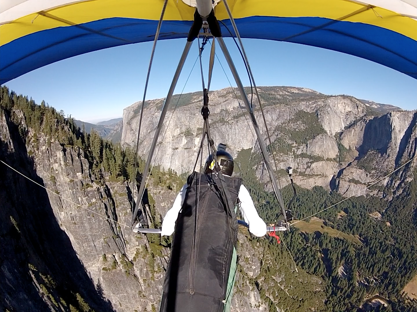
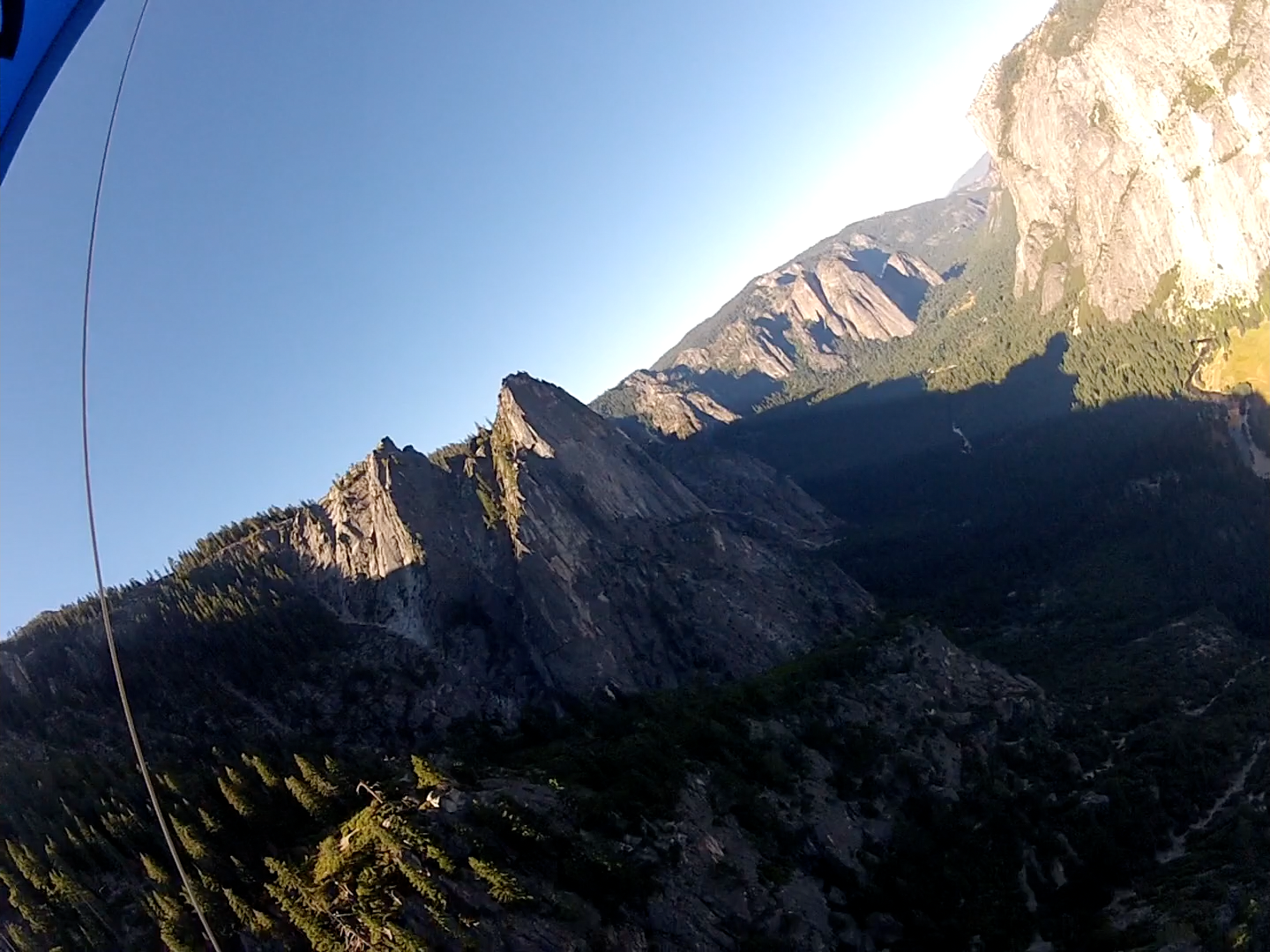
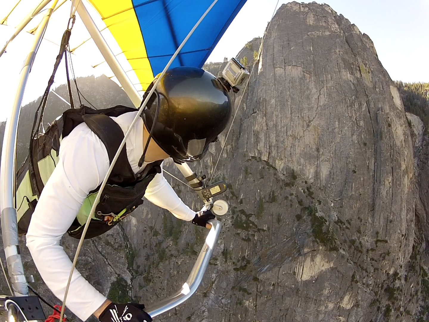
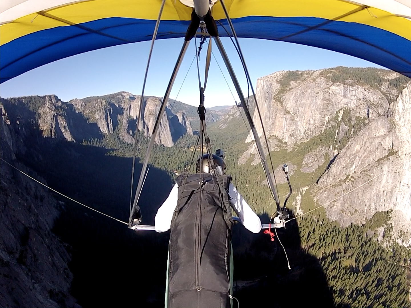
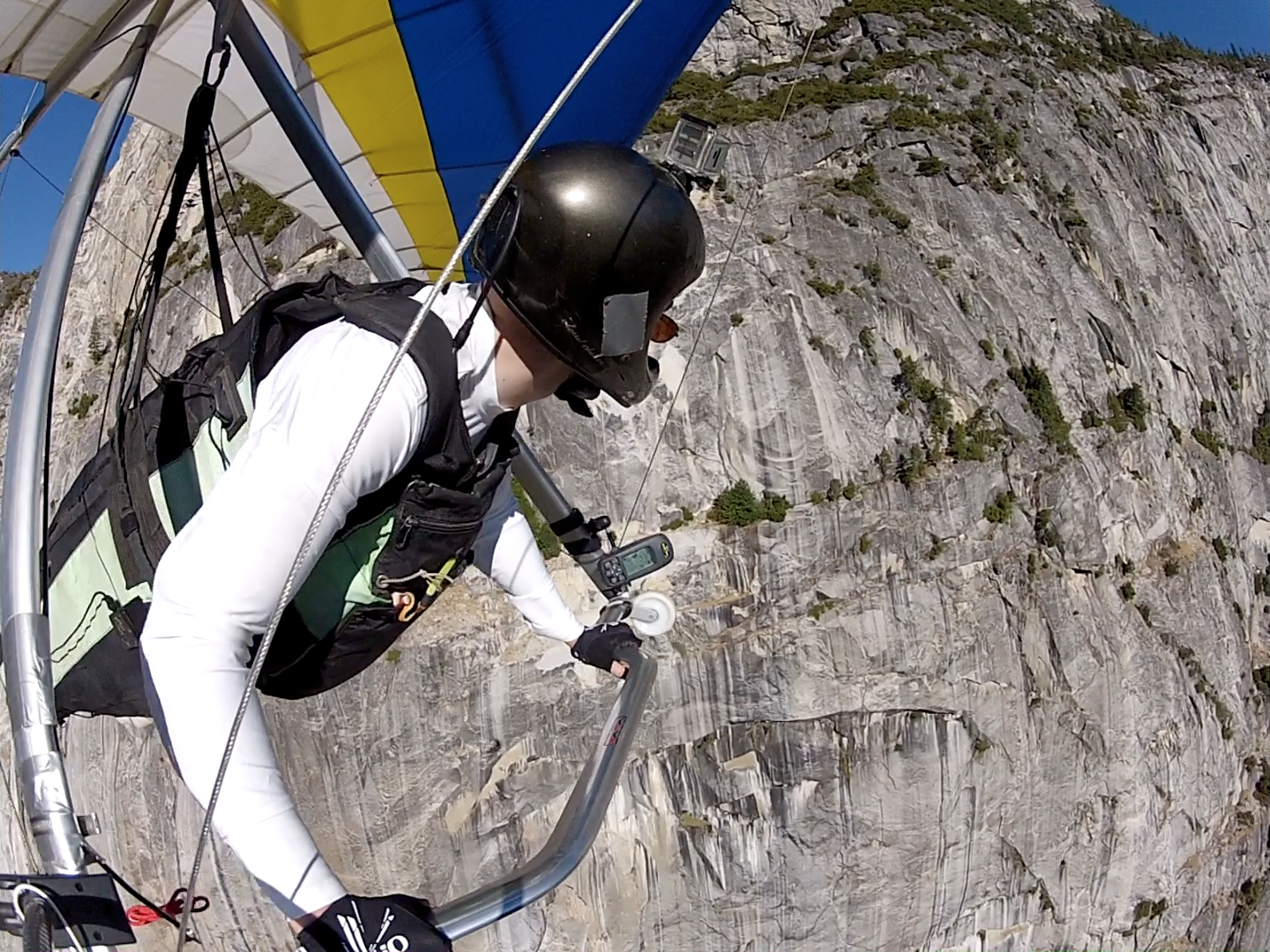
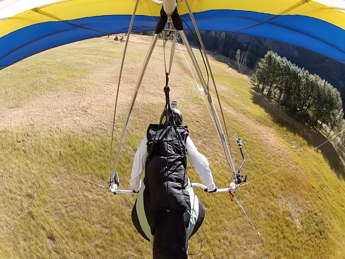
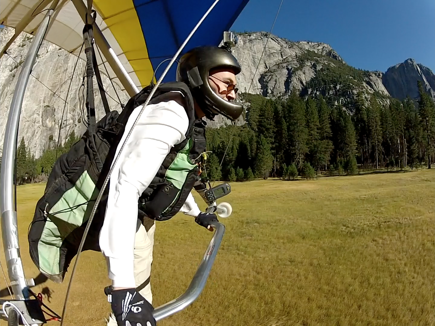
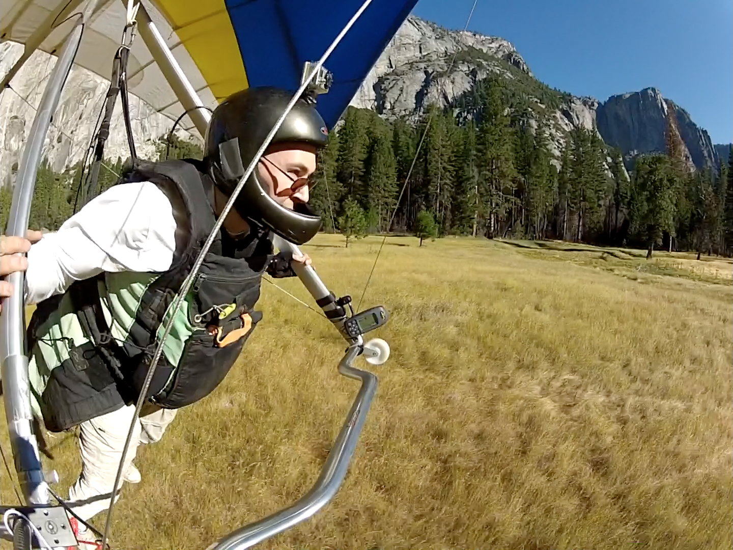
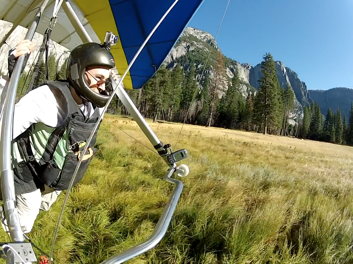
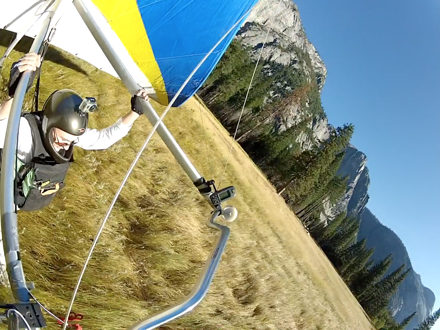
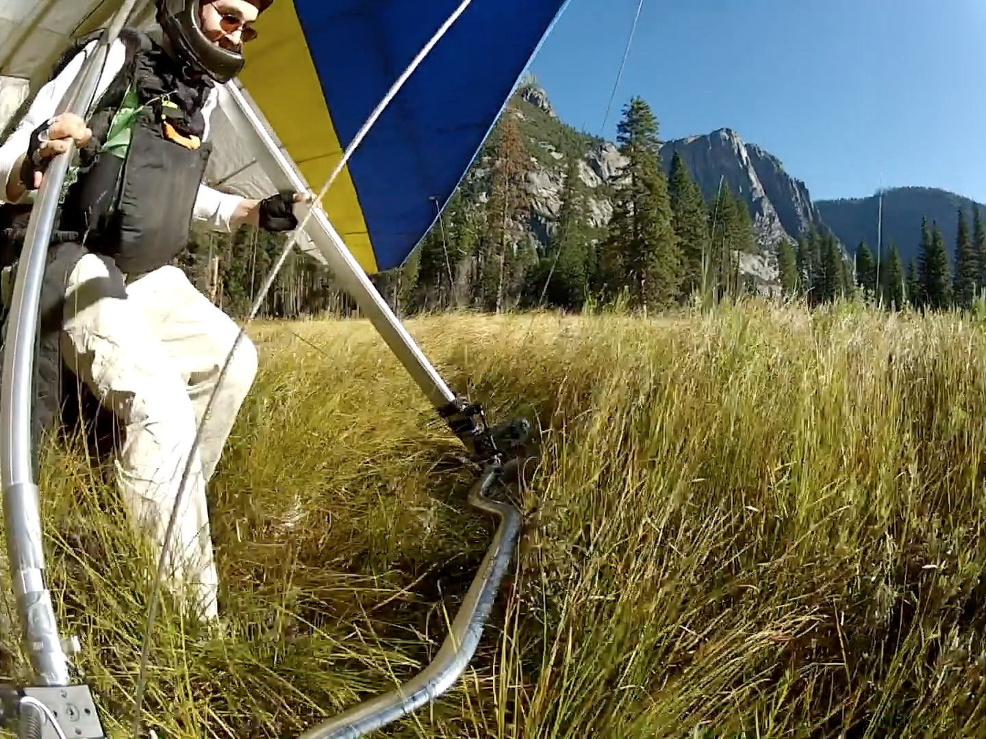
My take on one of the most videoed sites in all of hang gliding. Yosemite Falls is unfortunately dry, but hopefully the large quantity of in-flight camera angles is consolation.
The park requires us to launch before 9:00 AM. Since this is too early for thermal activity, flights here are all straight glides down (generally lasting around 15 minutes).
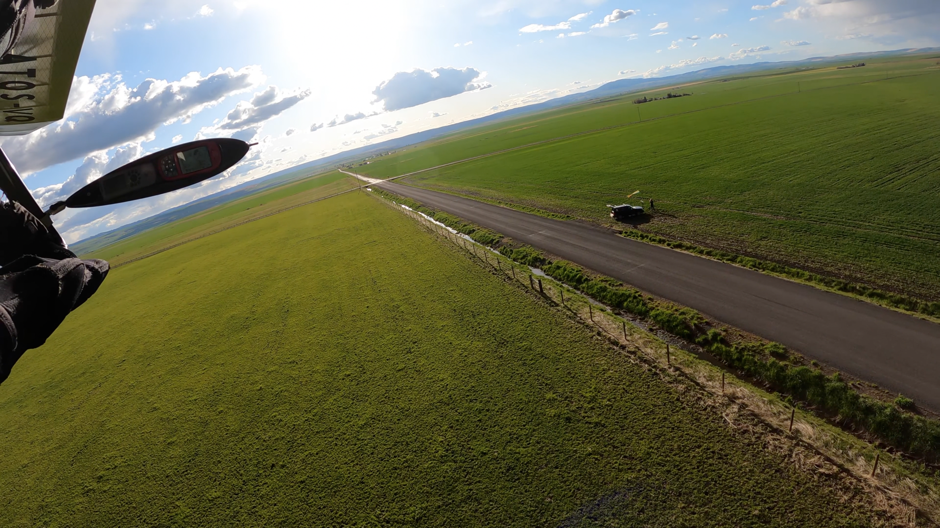
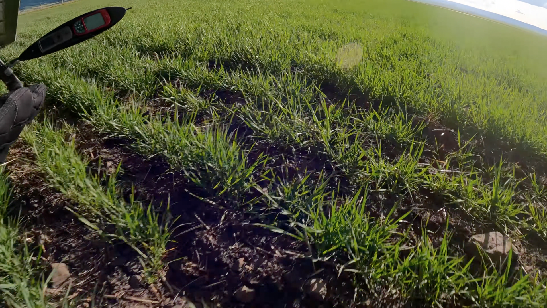
I intentionally flared a little late on the landing as I didn't want to put it down in the ditch.
The in-flight footage was taken over three flights (three consecutive days of flying) with three cameras running each day.
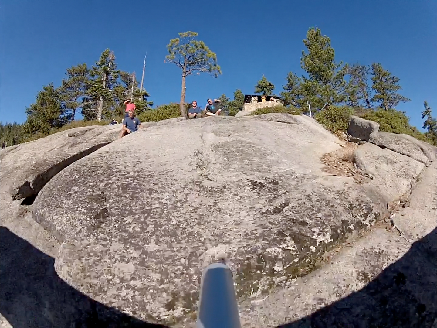
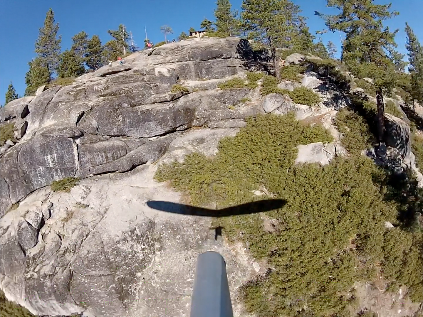
The scenes of the park taken from the ground are leftover shots that didn't make my general park footage (vimeo.com/54364168).
So obviously one flight per morning 'cause according to the Yosemite Hang Gliding Association the park also requires you to launch after 8:00 AM and getting off twice within an hour would be a massive logistical impossibility.
The YHGA has established a group of volunteer "Site Monitors" who are authorized to oversee recreational hang gliding activities within Yosemite National Park. It is the responsibility of the Site Monitor to check the qualifications of each pilot seeking to fly within the Park and ensure that each pilot is familiar with the site rules and regulations.
The Site Monitor is responsible for ensuring that the safety of the site is not compromised by hazardous conditions or failure of equipment utilized at the site. The Site Monitor is responsible for communicating with the Yosemite National Park Service Emergency Communication Center (ECC), also known as Yosemite Dispatch, to ensure that the air space within Yosemite Valley is clear of other flight activity before allowing any hang glider pilot to launch. The Site Monitors conduct routine inspections of the site and notify the Park and the YHGA Board of Directors of any concerns. The Site Monitors also complete accident and incident reports, and submit recommendations for improvements, if applicable. Copies of all accident and incident reports are forwarded to the YHGA Board of Directors and the Park's representative within 3-7 days. All Site Monitors are required to be first-aid and CPR certified.
...I don't know what good checking the qualifications of each pilot is supposed to accomplish since u$hPa openly stated almost exactly eleven years ago that they weren't and couldn't be in the safety business - which is another way of saying that they weren't and couldn't be in the pilot competence business. So the only businesses they're really in are information suppression and damage control.
If you don't believe me just ask Chris Valley - who somehow managed to scribble his signature on the form.
Launch:
37°43'44.91" N 119°34'22.22" W
Aligned to the east, a bit to the right of Half Dome. So we launch towards that rock then turn downstream to sled to the LZ.
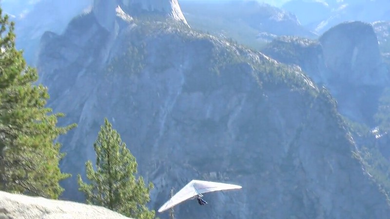
Alright Zack... You're clipped in, you look good...
OK, nose now...
Alright. CLEAR.
Your glider on clear.
Run run run run run run run run RUN!
No lift and tug but Zack can't on his Sport 2. Also... This is Glacier... Where it's a violation of site rules - not to mention common sense - to approach launch hooked in. Ditto for Makapu‘u - for analogous safety considerations. So neither of these launches has ever had an unhooked launch incident.
We're about to clear the Dan Veneman snag. Holy shit, that was 2012/08/03 - only 25 mornings before Zack's first launch. The tree is at:
37°43'45.26" N 119°34'20.62" W.
A ground squirrel that has probably never been noticed by anyone before emerges onto the sunlit face of the nearest rock between these two frames. Probably looking for a trail mix donation.
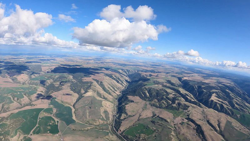
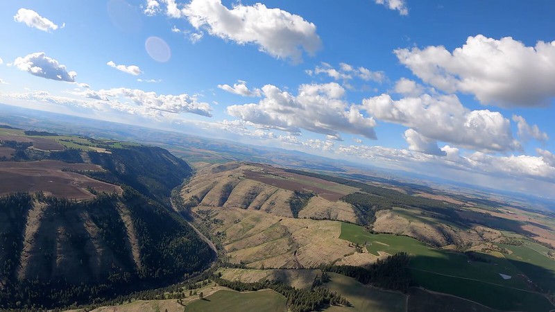
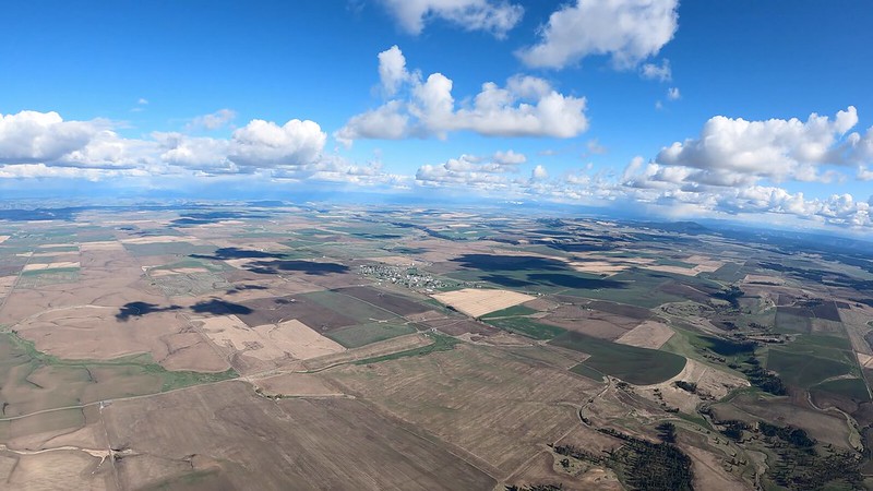
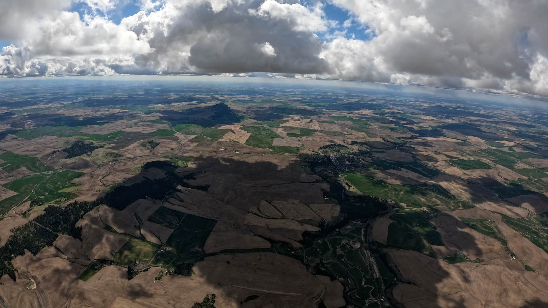
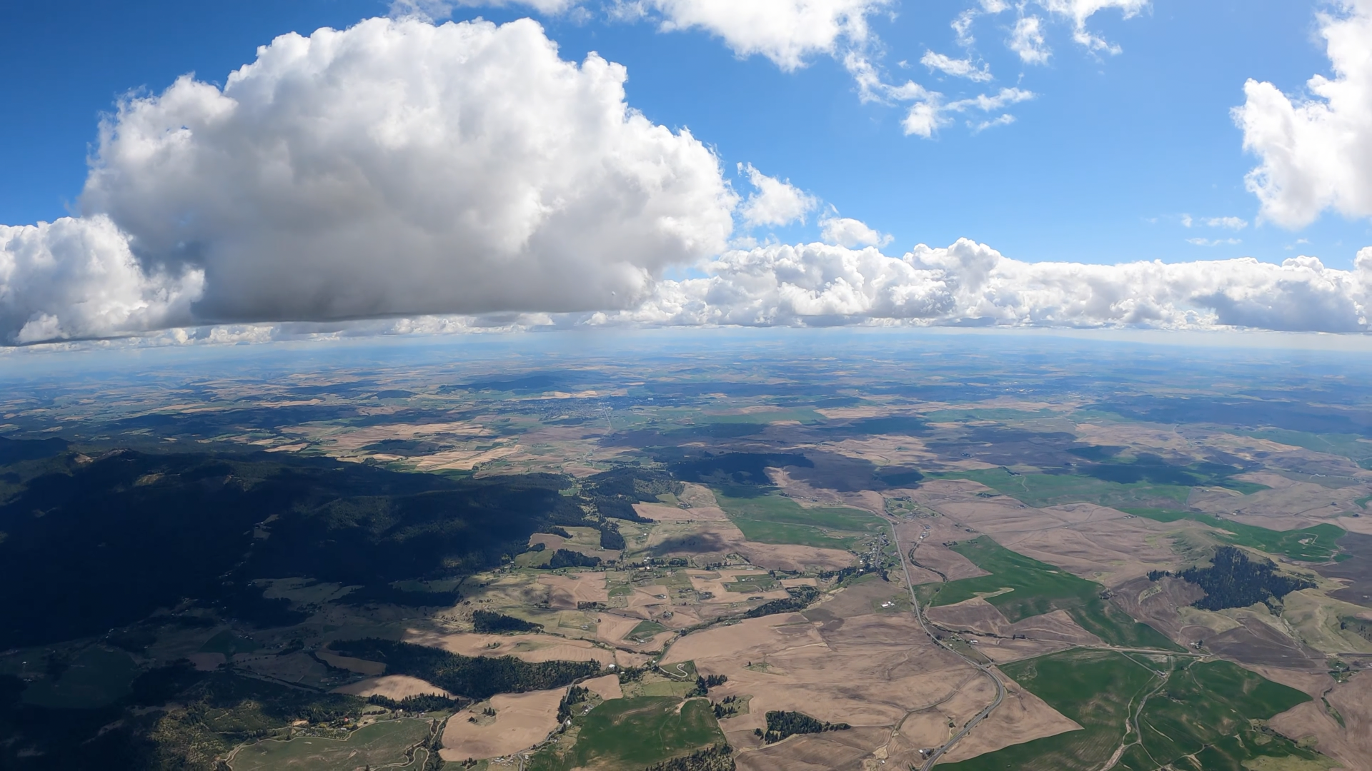
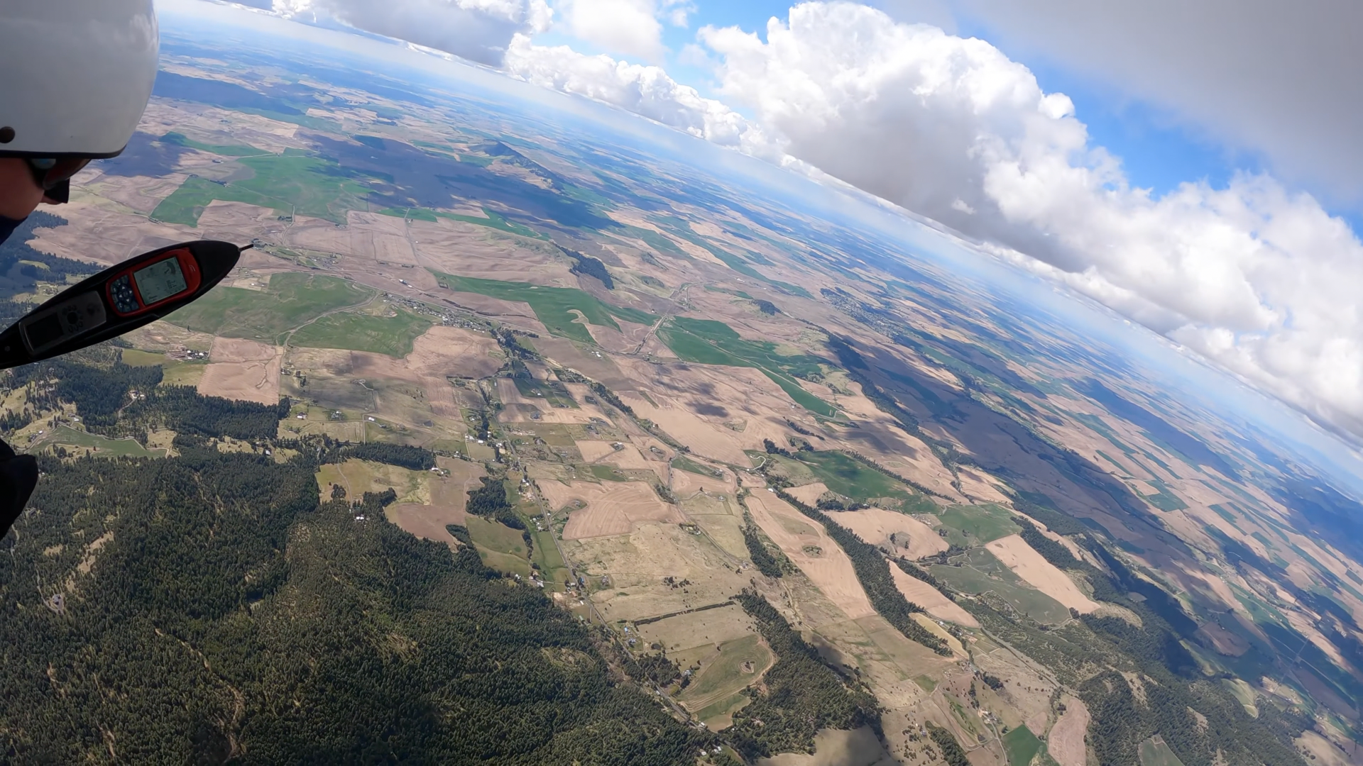
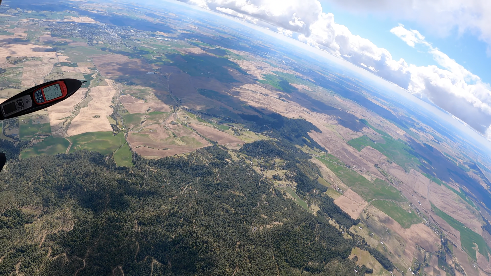
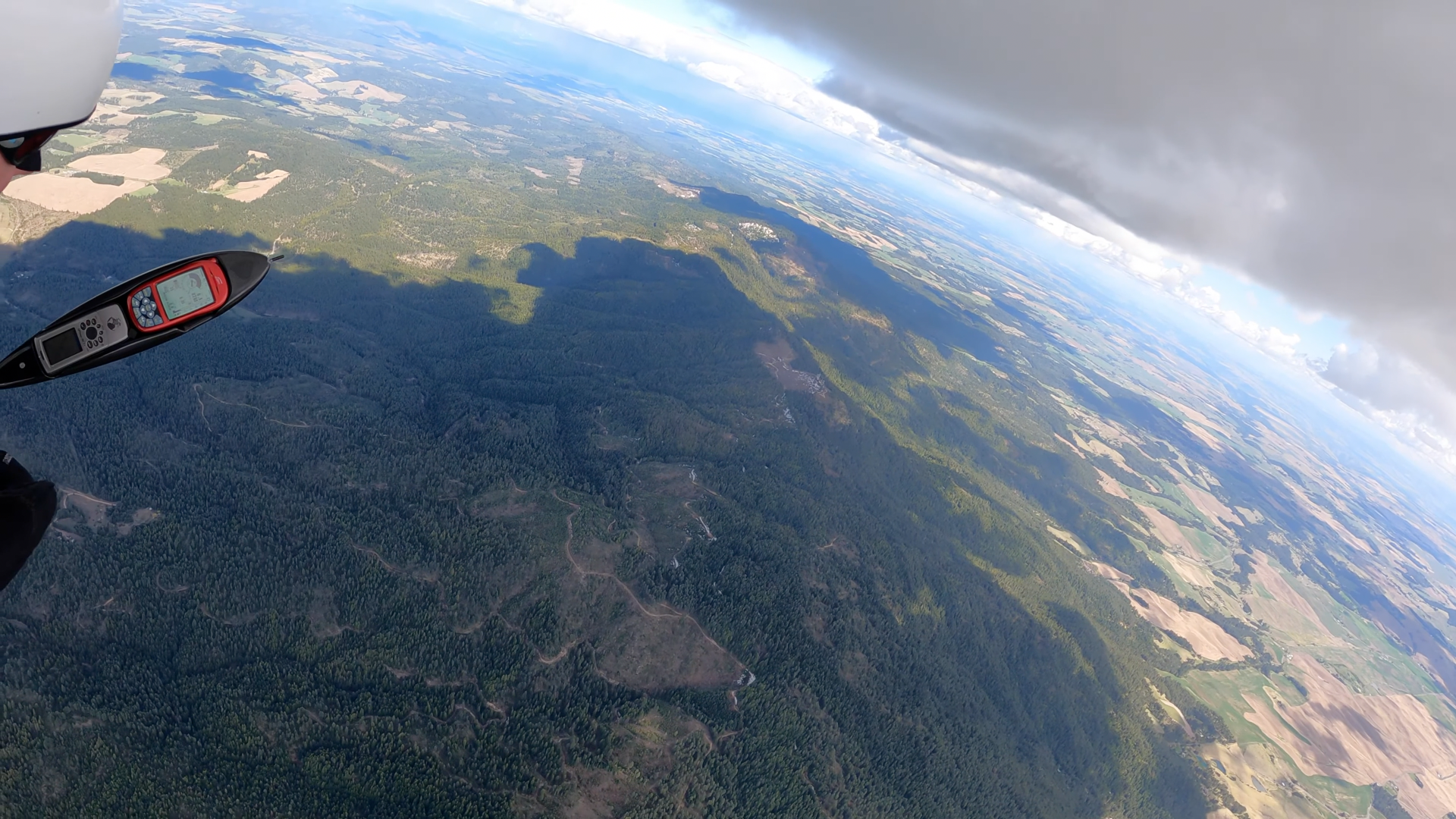
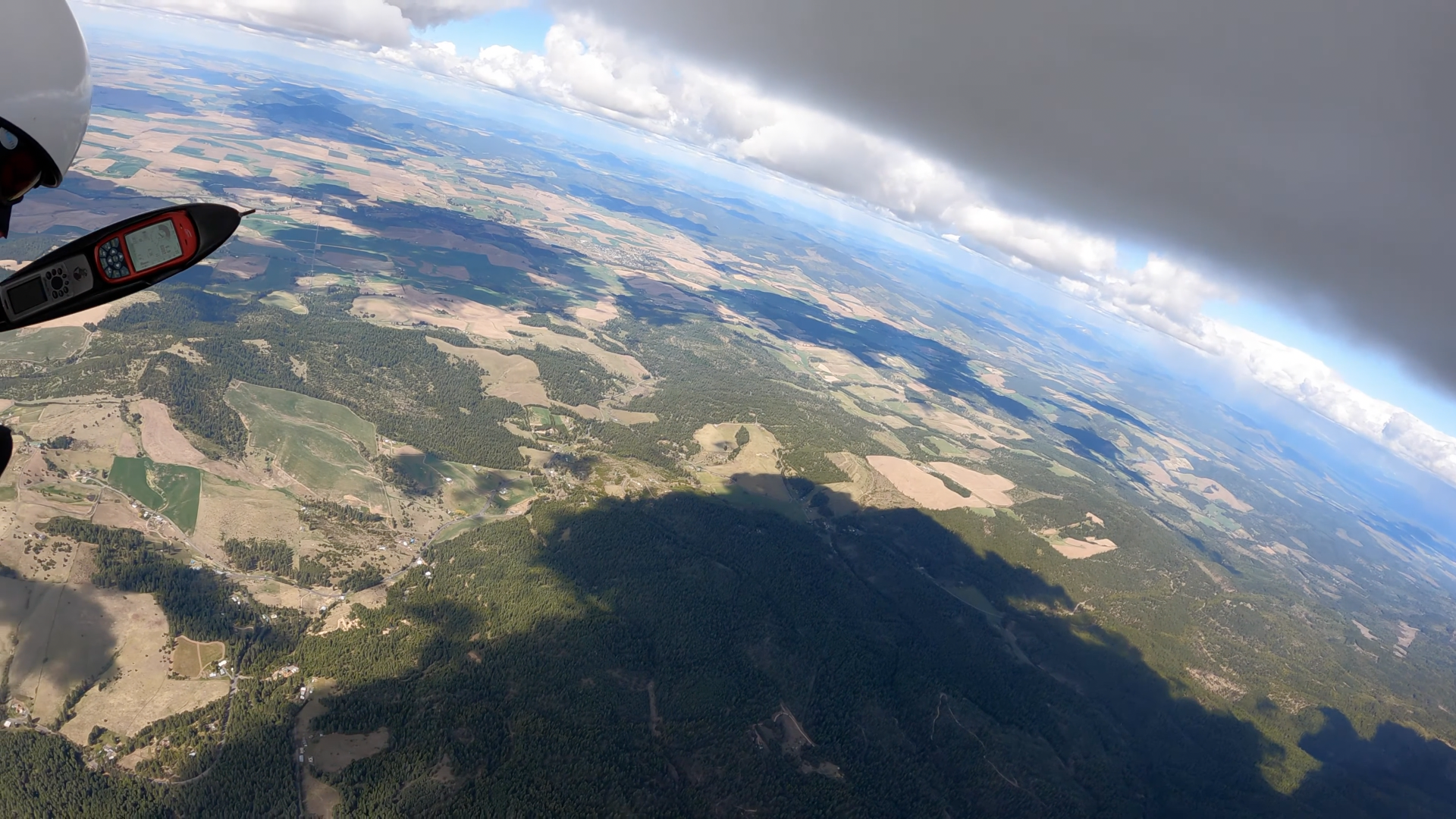
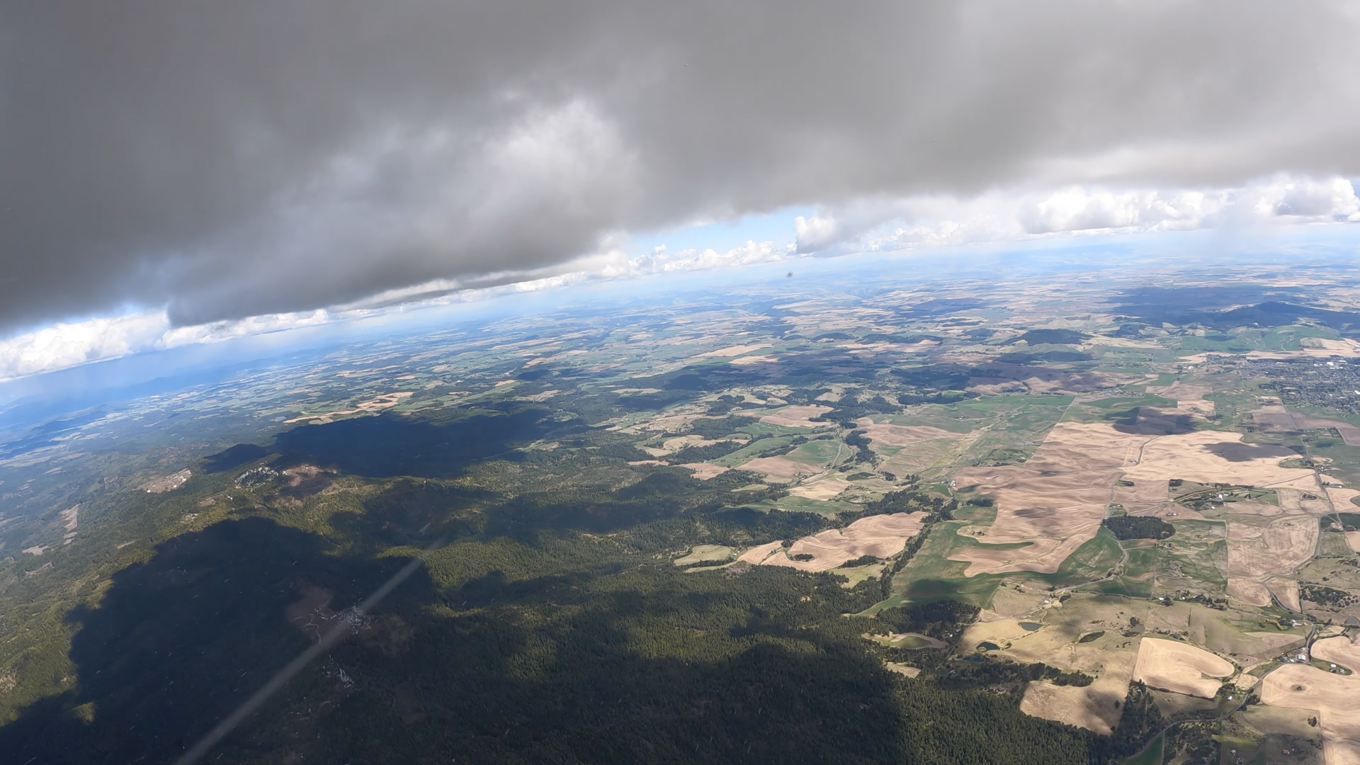
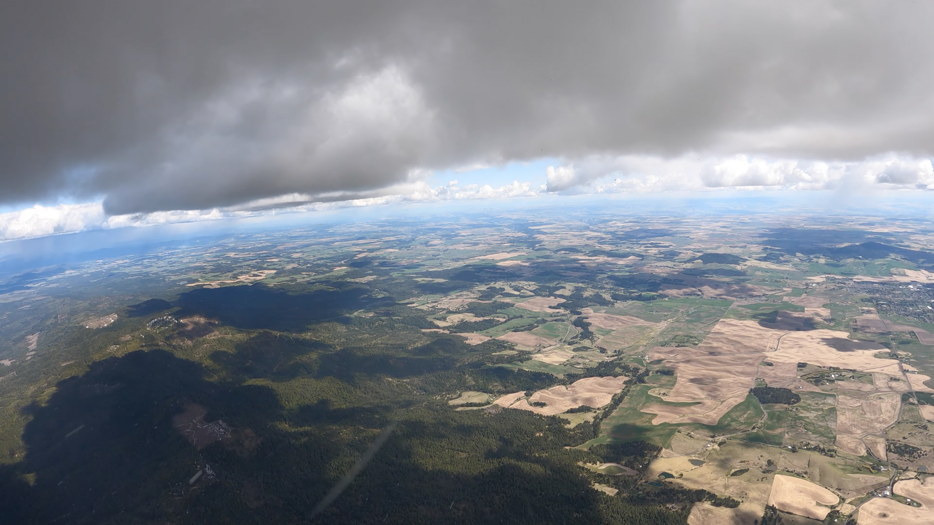
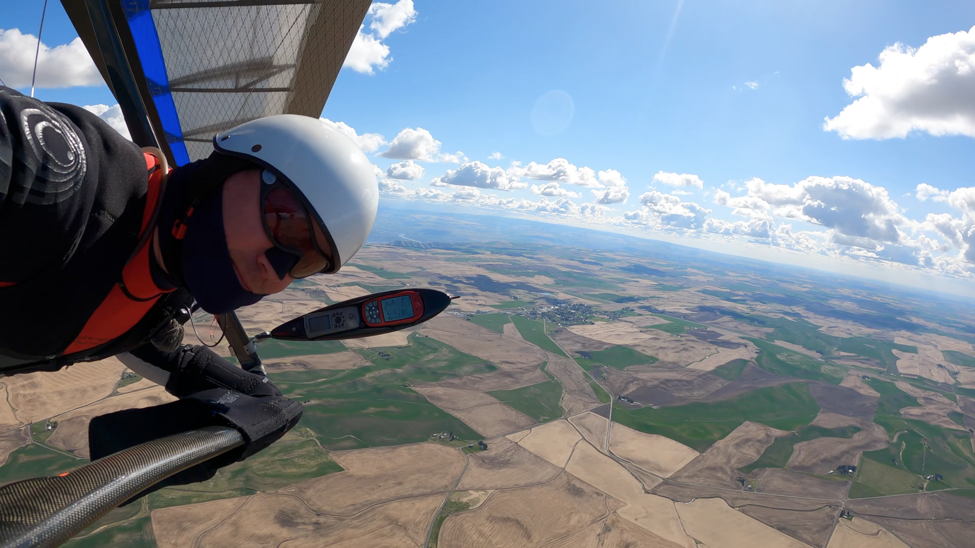
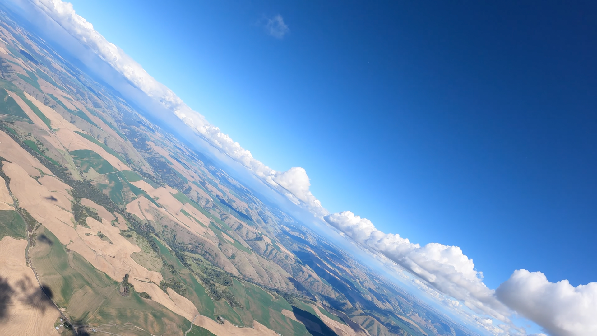
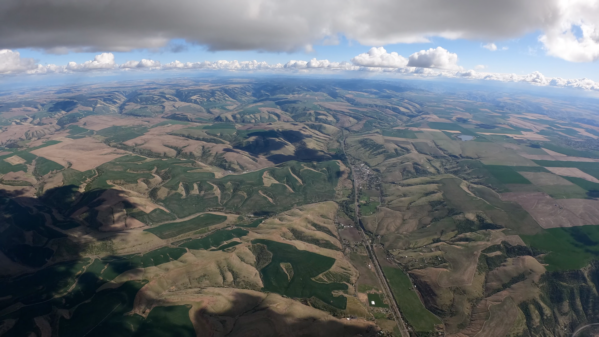
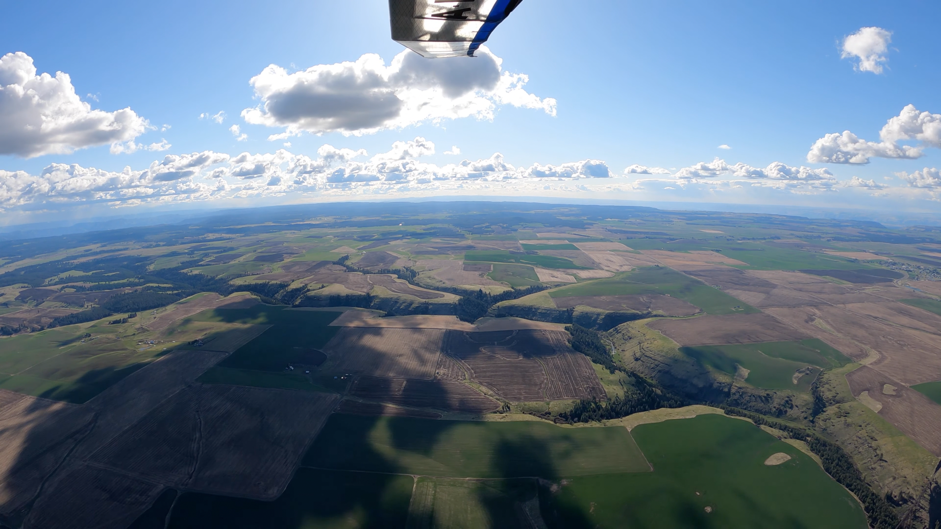
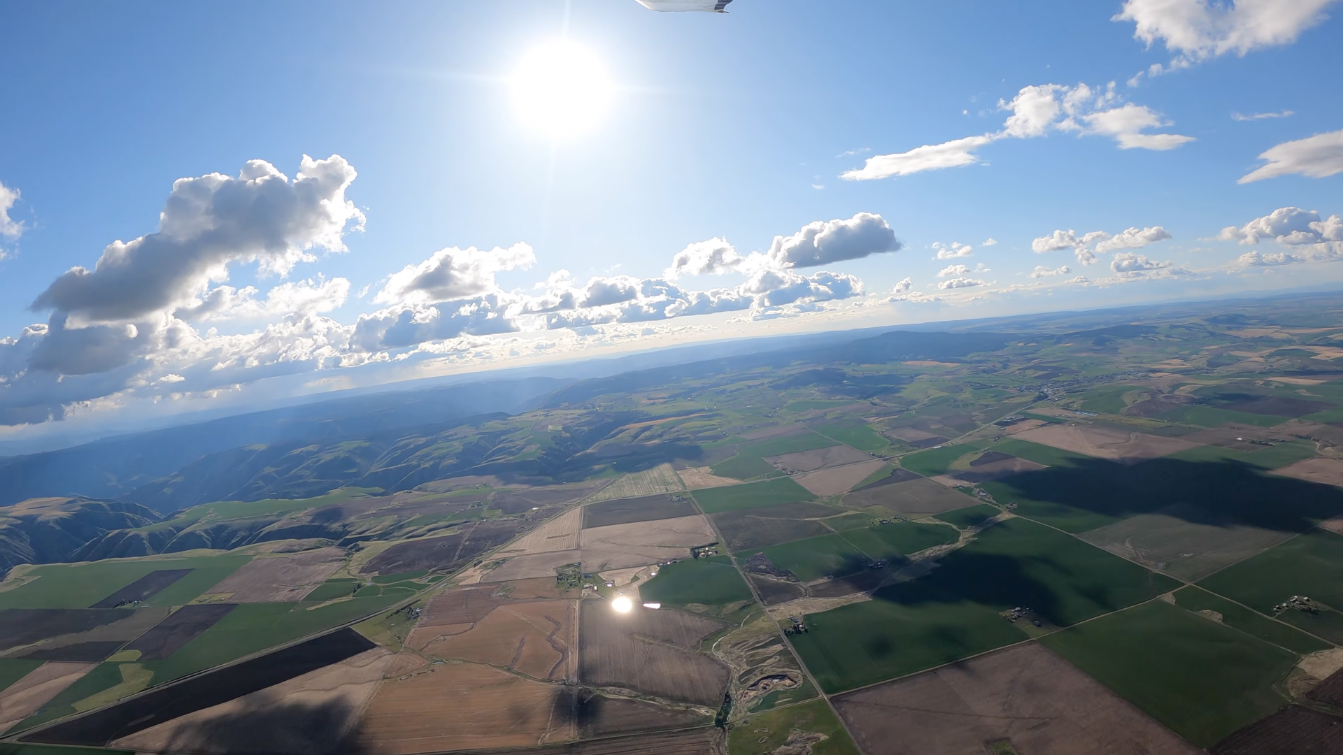
Maybe the most spectacular hang gliding XC video ever made. Classic conditions and spectacular terrain, very competently recorded. I may be a bit prejudiced though 'cause I've spent a lot of time on most of this turf. My sister lives in Viola and has been a teacher at Moscow High School for decades and I was out there a lot while the niece and nephew were growing up. (The family's house, barn, and pond appear in 093-081649 on Four Mile Creek at the base of Moscow Mountain.)
The effort I've poured into this project is multiples of any other such post on this forum - or anywhere else. But... Pretty substantial learning experience though (I try to tell myself anyway).
My harvest of the Google Earth imagery of the relevant area - rotated clockwise ninety degrees for a better screen fit:
BomstadGrangevilleGE2021/05/02 http://live.staticflickr.com/65535/52455848571_cd3c1ea4f0_o.png
2016/07/30 - 46°36'24.07" N 116°25'08.25" W
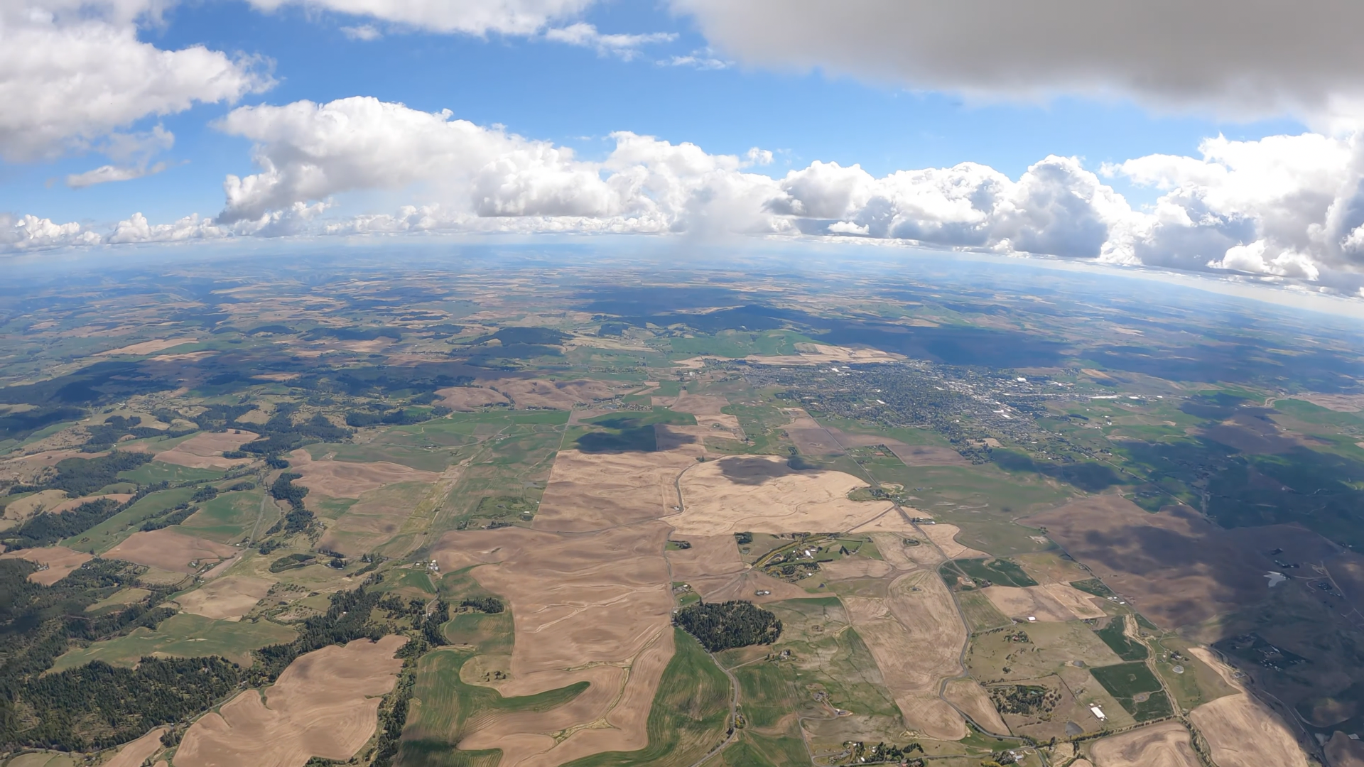
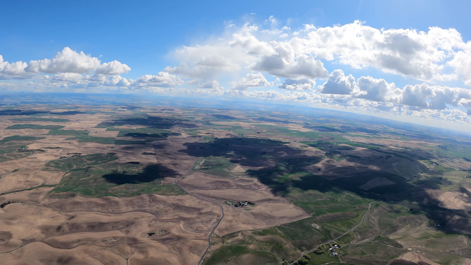
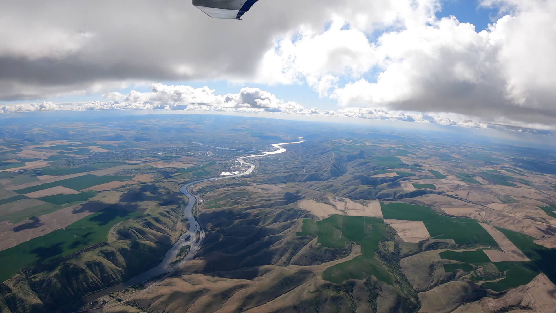
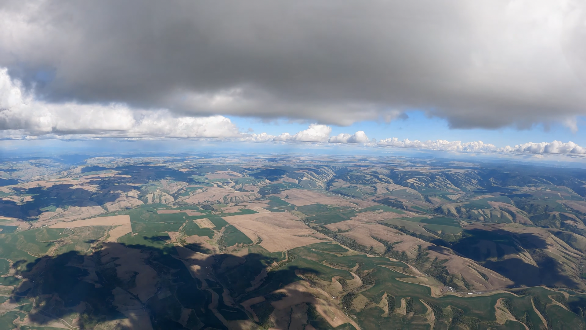
(And go to the URL for full rez.) Note that even from an altitude of about 97 miles we can fairly easily see the white smudges of Moscow/Pullman, Lewiston/Clarkston, Kamia, Grangeville. And it's a pretty good illustration of the drainage patterns of the region. Obvious waterways... Palouse, Potlatch, Clearwater, Lawyer Creek, Salmon, Snake...
Flight starts in middle latitude Washington two and a third miles from the Idaho line, crosses into Idaho where the Palouse River exits it after close to two dozen crow flight miles to the south, stays in Idaho, we get to see the northwest corner of Oregon around the crossing of the Clearwater just before it dumps into the Snake (which began trickling downhill from the Continental Divide in Yellowstone). Flight's a real good aerial match for US 95 for virtually the entire route. Undoubtedly made things as easy as possible for the chase driver. (This area is a huge total Interstate highway desert.)
95 seems to start life way the hell up in Golden, British Columbia at 51°18'18.47" N 116°58'13.00" W, crosses into Idaho, skirts Idaho's western line many times (just a hundred yards a long walk north of the Snake/Clearwater convergence, finally leaves Idaho for Oregon way the hell south at 43°15'02.69" N 117°01'35.94" W.
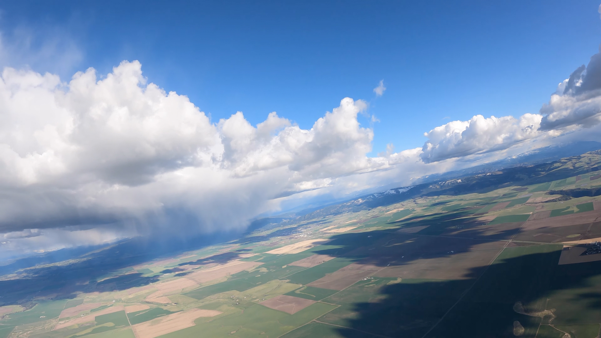
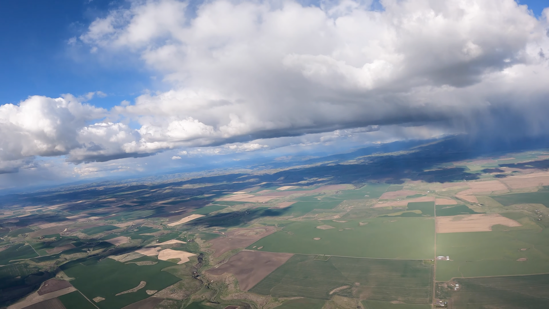
I wanted to understand what I was seeing / where we were at any given point in the flight so nearly went blind matching reference points visible on the video to coordinates from Google Earth. And I've tried to use the exact same coordinates for the same reference points in different frames to facilitate matches. And those beautiful cumulus clouds which made the flight possible cast some high contrast dark shadows which sure didn't help much in that exercise.
Note the drainage patterns. Everything ends up in the Columbia. And the overwhelming volume of everything first by way of the Snake. Subtracted from everything is what's sucked up for agriculture - which, it appears in the cases of many of these creeks, is literally everything. A fair bit depressing to see that damn near every square inch of farmable land in this basin has been.
Some substantial drainages as best as I've been able to organize them:
Snake:
- | Hangman || Spokane ||
- | Palouse |
- | Graves || Rock || Salmon ||
Clearwater:
- | Boulder | Rock | Cedar | Pine | Little Bear | Middle Potlatch | Cottonwood | Little Potlatch || Potlatch ||
- | Butcher | Sally Ann | Threemile | Rabbit || Clearwater South Fork ||
- | Sevenmile || Lawyer ||
- | Orofino |
- | Little Canyon || Big Canyon ||
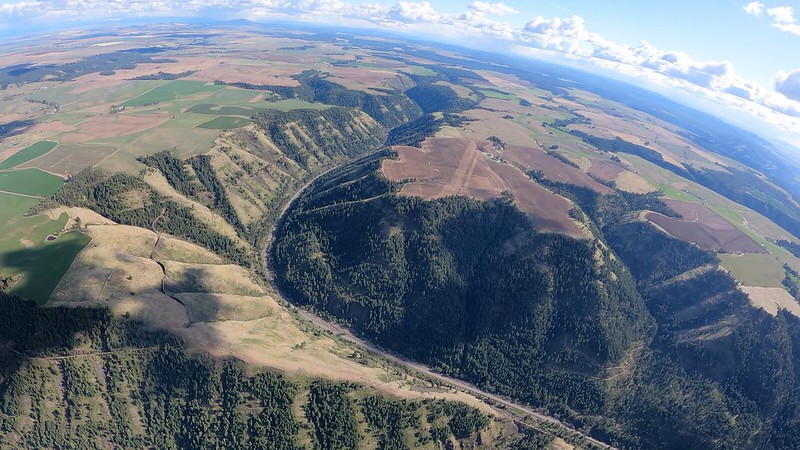
Launch area:
47°15'05.45" N 117°05'28.29" W - 3822 feet
High ground for that stretch of road, parking pull-off, gotta be a windsock planted on the top of that little pine. (Everything up there is a pine.)
LZ is around 47°14'05.42" N 117°06'03.42" W - 2591 feet
Mike Bomstad - 2021/10/18
A flight I have been wanting to do for a while now. It's not often conditions cooperate to head to the S from Tekoa. No one has done this route before. (Well, I made it to Lewiston last year I was on my way to sinking out after launching. Had a low(ish) save to keep the flight going. (so glad I did!)
Got low a few other times. The sky was falling near Grangeville ID. It was an interesting sky.
Botched the landing as it had been NNW setting up to land. I didn't notice it was switching N then as I was landing it went due E. No harm done and a good lesson to always be ready and to pay attention!
beautiful as always. I wander.. you fly a lot above light brown fields and dark (wet)green fields. Which are better for generating thermals?
Mike Bomstad
Thank you. Green fields are not as good, nor are fields with tall-er(ish) crop. Shades the ground from getting the direct sun
tom thompson
It just gets better ..
Mike Bomstad
Thanks
manometre
Toujours une belle aventure à te suivre sur Youtube
Mike Bomstad
Glad you enjoyed the adventure, thanks for watching
Mike Bomstad
Yes, very lucky. It's too bad the best part of the season we get shut out due to fire danger and then we have so much smoke. The clouds are pretty amazing around here.
Navigator777777
And the award for the best songs in a video go to....Mike Bomstad!
Mike Bomstad
Thanks! I try. sometimes they work, sometimes I get it wrong
trnbrn21
What a story! Suh-weet! Nicely done Double-oh-Bomb.
Mike Bomstad
Thanks man!
Watch it on the big screen 4K.
Jon Mcg
you know Mike , you succeed where so many others fail . Its an honour to watch the pro's doing what the rest of us can only dream about . On behalf of All of us , thanks for showing the landing , the lesson learnt is simple , even thevery best can hash the landing , except I think we would of used stronger words . Congrats on the flight , Nailed it !
Mike Bomstad
I appreciate that! I have my bad days just like anyone else. All we can do is try, learn from the past and try not to repeat it. If others can take heart from it that's great. No one is perfect, we all have bad days. Glad you enjoyed the flight. It was a fun one.
Jeff Johnson
Now that is a cool flight ,way to fly
Mike Bomstad
Thanks. It was a really fun flight. An amazing area to the south. Thanks for watching.
Jutte777
Wow that was epic ! Hearing that vario start to sing when you think you're going to land is just magic !
Mike Bomstad
Glad you enjoyed it. Oh yeah, that sound cant get loud or fast enough when you are low.
Bernie Massey
You are so lucky to have such a fantastic soaring location. Clouds to die for.......
Mike Bomstad
Yes, very lucky. It's too bad the best part of the season we get shut out due to fire danger and then we have so much smoke. The clouds are pretty amazing around here.
H5-Phil
Thanks for sharing!! That a fun ride watching from my recliner - beautiful scenery and glider!
Mike Bomstad
You are welcome. Glad you enjoyed the flight. Thanks it flies so very well. The scenery, now matter how many times flying, you always see something new. It never gets old. Cheers.
NoTengoIlusiones
Magic day. Funny in the 1st takeoffs with gliders and paragliders the fire in front was showing wind from right to left. When you takeoff no wind. Thanks for sharing . Cheers
Mike Bomstad
It was a really good day.
It was one of those days the wind was being difficult. Right to left can be tuff if too strong the trees to the right can make it trashy. You're welcome, thanks for watching and commenting.
Carlos León
That's definitely an epic flight. Great choice of music as well. Bummer about the landing but as someone else already said, thank you for sharing so that we can all learn from it.
Mike Bomstad
Glad you enjoyed it. It was a bummer, really glad it was gentle. (I've had worse You are welcome. Best of air to you.
Mike Swift
Very nicely done! Great video and even nicer flight with some special views along the way. Defiantly miss that area of the country.
Mike Bomstad
Glad you enjoyed it. It will be fun to fly with you again
The world of hang gliding
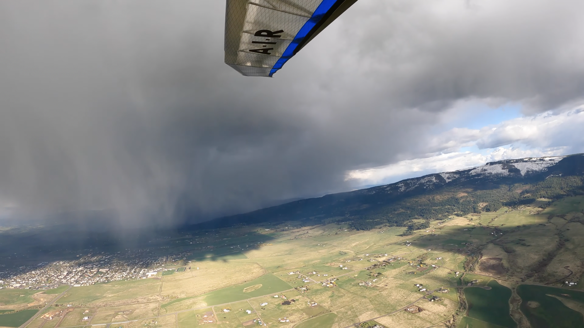
Incredible - those clouds made a promise that they didn't entirely keep, clearly... Great flight. Looking at the sky, one would think it's a simple matter of making it to base, then flaps to race position and off to Grangeville you go Not so.
Mike Bomstad
Agreed! it sure was more work then it looked like it should have been. Makes the flights even better when its not that easy.Thanks for watching, best of air to you!
windn1nja
Good grovel to get up, great sky!, great flight, good pics and outstanding retrieve!
Mike Bomstad
It was a really fun day. Driver waiting at the LZ, awesome!
Thanks for watching, glad you enjoyed it
Ecoturismo Valle
Nice video as usual Mike. How do you decide when to take the Atos vs the T3 for a spin?? .....decisions....decisions....
Mike Bomstad
Thanks! Depends on the forecast. If its looking like an epic day and I want to maximize the miles, ATOS. If Im in a hurry after work, or the day looks iffy or its going to be dumb windy and it just a ridge soar, I'll take the flex. And occasionally fly the bag. I'm fortunate to have options.
Ecoturismo Valle
you BET you are mate! I will keep on praying for a flex wing hoping God looks down my way!!
David Williams
Great video and I love that it's in 4K, the quality is amazing and it's like I was really there on board with you!
Mike Bomstad
Great to hear! The cameras have come along way. Its great to be better able to share the experience.
Steve Baran
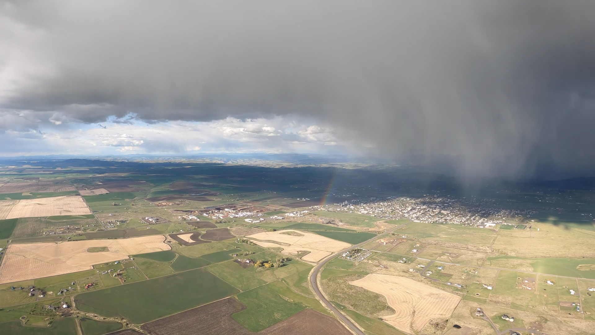
Nice! Glad you got up at Tekoa! I know you've had Grangeville as a goal for some time. That was scenic! Complete with a rainbow @ Grangeville and then Theresa in the LZ, windsock out and all. Hard to get better than that. Glad the turtle was in a nice soft field. I'll definitely watch it again in 4K when the new Mac comes.
Mike Bomstad
Somedays things just work out. I really wasn't sure this was the day until I got up near the Clearwater, then I had hope Really like the are to the S, so much texture.
Glad it was a soft field. It literally switched after passing the car, you can see the dust go to my left when I landed.
Haven't had that happen before, going to keep that in mind going forward... you never know!
Steve Baran
Yep, when precip starts dragging air down with it - hard to predict what will happen. I may be off on my direction reckoning but you looked to be landing SW-ish and it switched NW (???). The sky from the NW to NE of your LZ looked like it was spilling air. I’ll have to watch you vid again
Mike Bomstad
My approach was NNW, wind switched from the E
Bari FPV
Mate, show many wings do to have? And how does an ATos compare to T2C, or you’ve got a T3 that save was amazing. And nothing like having a retrieve right where you land hehe
Mike Bomstad
Just the Atos, T3 (formally T2C's and before that Moyes LS and RX) and a paraglider.
The Atos, has about 5-6 points of glide over the T3 and the Atos has a better sink rate. Roll rate with the Atos is a bit slower, but you dont get bullied in thermals
(one of my lowest saves http://www.youtube.com/watch?v=SHTzuUcgST4)
it is really great having your driver there waiting, oh do good!
ron freeman
Nice video & flight shame about the landing too much flare and too early
Mike Bomstad
Thanks. The wind switched 90° on me (Outflow form the storm), I was almost tail wind when I started to get ready to flare. @15:35 the nose was stright down wind. (Notice the direction the dust goes) Glad it worked out. Thanks for watching.
CloudStreets
I flew into Grangeville, ID for work just a few weeks ago. Beautiful area!
Mike Bomstad
Nice.
If it wasn't for that cloud dumping that day, I would have landed at the Grangeville Airport
Thanks!
Glad you enjoyed it. Ended up being my best flight of the season (it was a terrible season around here)
And note the discrepancy between the extent of discussion on the YouTube post and what's on the Worlds second largest hang gliding community. (Not to mention the largest.)
I've included coordinates of conspicuous geographical features to identify locations throughout the flight. Ordered north to south.
Identification of position over flatlands terrain was often a monumental bitch 'cause what was a bright white bare field on 2021/05/21 would be a field dark green with advanced wheat when the Google Earth satellite was flying over. It was often like working off of negative imagery. The date I was seeing most of the time was 2015/06/29.
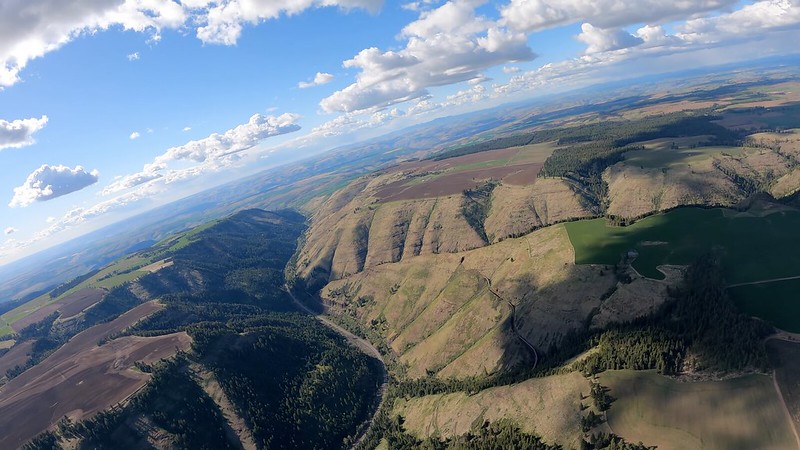
Note that south slope faces - ridges or ravines - tend to be baked while the north ones will be forested and green. Launch and Kamiak Buttes are reasonably classic examples.
It can often be a bit tricky differentiating ridges and ravines when looking straight down (satellite view).
The resolution on this one is is the same humongous 3840x2160 as we have from the Andrea Ghidini video from which I've included a still - 31-04310 - way below. Pays off on a big screen and extremely valuable when working on matching distant geographical features on the video to what's on Google Earth. (And 60 fps... Could live with something south of that for an XC video.) This is the first stills project I've done that wasn't max rez and I've started to regret the compromise but to get shots minus the noise Final Cut introduces I'd have had to have jumped through all the hoops detailed at: http://www.kitestrings.org/post12146.html#p12146
So what we have at present is a quarter that size - 1920x1080. (And only displaying 800x450.) So if ya really want or need see fine detail from these frames then Final Cut at 150 or 200 percent is probably pretty hard to beat.
There's a new 10.6.5 version of Final Cut that was unleashed 2022/10/17 and I'd so hoped that its bozo developers had dealt with their bullshit noise issue (http://www.kitestrings.org/post11927.html#p11927) but no such luck.
And Adobe (Photoshop) has fucked me over yet again. They wouldn't allow me to activate my last legal copy - as they "no longer support" it - on my current MacBook Pro and I'd have had to either buy a monthly subscription for 21 bucks apiece, an annual for for a ten buck reduction, or - as best as I can figure - 31.50 for a month as desired. That's what I was shooting for. Save up a bunch of projects over several months, knock myself out for one.
But after my seven day free trial period expired I found myself locked into the monthly subscription and out of the plan I'd wanted. Good news... My credit card had been compromised subsequent to registering so the couldn't collect anything. And I'll see if I can contact customer service one of these days and get the plan they'd advertised and I wanted. Also the new and improved version crashes and I so do long for the environment in which I'd started doing this stuff around seventeen years ago.
Googled "Photoshop alternatives" and I got Affinity Photo which I can (and did) buy outright for 55 bucks. Worked well enough for this project with the lower resolution stills but seems to have some serious issues and limitations and I've blown a lot of time and effort trying to get it to do shit that I could accomplish in Photoshop in my sleep.
AKA Latah Creek. The other name celebrates several atrocities committed by the US against the original inhabitants of the land - the winners going on to destroy it as a natural resource. We can see how it's been neatly channelized at this point in its flow from the Rockies to the Spokane River.
And just a bit downstream - 47°23'53.22" N 117°15'54.61" W...
IN 1858 WITH 700 SOLDIERS COL. WRIGHT WAS SENT FROM WALLA WALLA TO SUPPRESS AN INDIAN OUTBREAK. AFTER DEFEATING THE INDIANS IN TWO BATTLES HE CAPTURED 800 HORSES. TO PREVENT THE INDIANS FROM WAGING FURTHER WARFARE HE KILLED THE HORSES ON THE BANK OF THE RIVER DIRECTLY NORTH OF THIS MONUMENT.
--- ERECTED AD 1946
THE SPOKANE COUNTY PIONEER SOCIETY
ASSISTED BY
SONS AND DAUGHTERS OF PIONEERS
OF WASHINGTON AND LOYAL CITIZENS
MONUMENT MOVED ONE MILE EAST OF ORIGINAL LOCATION - 1964
REPICATED BY WASHINGTON MONUMENT CO. SPOKANE
In case it's not obvious... When the cloudbases are aligned like this he's around as high as it's normally possible to get at present ('specially legally). Compare/Contrast 055-054006.
Sure knows his route. (Unless his gadget is tuning him in.)
154-123129 http://live.staticflickr.com/65535/52470687724_ca905c620d_o.png
There's a mountain - unnamed as far as I can tell - topping out at:
45°51'47.29" N 116°07'27.33" W - 6128 feet
about four and a half miles south of / behind Grangeville. On 2021/05/02 it's still conspicuously snow covered and really stands out on the horizon from forever away. I think this frame - pulled from a hard pan - represents our (but certainly not Mike's) first visual contact of the neighborhood at which this flight will end. I'll call it Mount Snow for the purpose of this exercise.
155-123230 http://live.staticflickr.com/65535/52456301860_a39279a6ef_o.png
46°15'06.75" N 116°37'09.42" W - 46°14'43.56" N 116°31'03.16" W - 46°14'43.15" N 116°35'12.27" W - 46°14'19.16" N 116°33'51.40" W
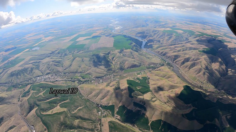
46°14'05.73" N 116°37'12.87" W - Winchester Lake
Winchester - AKA Lapwai - Lake (the gleam at the center of this frame) is a man-made remnant of the logging industry impeding the flow of Lapwai Creek - which starts trickling from several miles to the SSE (and dumps into the Clearwater north of Lapwai). Craigmont and the land to its south drain into Lawyer Creek which flows west and dumps into the Clearwater way the hell upstream at Kamiah.
156-123440 http://live.staticflickr.com/65535/52456382488_525b7406e0_o.png
46°15'40.42" N 116°25'54.04" W - 46°15'09.72" N 116°24'25.90" W - 46°14'44.06" N 116°25'53.47" W - 46°14'17.85" N 116°23'23.47" W -
46°13'42.87" N 116°24'38.65" W
157-123904 http://live.staticflickr.com/65535/52456121849_a228031895_o.png
46°20'20.89" N 116°35'15.09" W - 46°18'39.82" N 116°25'53.60" W - 46°17'47.97" N 116°29'39.22" W - 46°17'27.27" N 116°32'57.43" W -
46°16'45.14" N 116°32'38.18" W - 46°15'40.42" N 116°25'54.04" W - 46°14'52.20" N 116°27'22.12" W - 46°14'39.30" N 116°28'22.55" W
158-124328 http://live.staticflickr.com/65535/52455329932_d541a59795_o.png
46°11'26.97" N 116°23'59.40" W - 46°09'14.97" N 116°23'09.21" W
Lawyer Creek - US 95 - Ferdinand
159-124703 http://live.staticflickr.com/65535/52456382258_5cddb32124_o.png
46°13'55.88" N 116°27'49.09" W - 46°12'59.08" N 116°27'32.83" W - 46°12'43.71" N 116°26'55.57" W - 46°12'16.54" N 116°26'10.25" W -
46°12'06.13" N 116°26'18.43" W - 46°11'53.39" N 116°25'34.20" W - 46°11'17.47" N 116°26'11.99" W - 46°11'00.35" N 116°26'02.69" W -
46°10'44.55" N 116°26'30.03" W
160-124833 http://live.staticflickr.com/65535/52455851891_e67739167f_o.png
46°12'26.06" N 116°22'53.36" W - 46°11'58.85" N 116°22'39.76" W - 46°10'52.10" N 116°22'19.00" W - 46°10'40.09" N 116°23'32.22" W
46°10'24.92" N 116°23'23.20" W
Nezperce
161-125154 http://live.staticflickr.com/65535/52456301540_e17b730f6e_o.png
162-125446 http://live.staticflickr.com/65535/52456121549_606d0327dc_o.png
46°12'26.06" N 116°22'53.36" W - 46°11'58.85" N 116°22'39.76" W - 46°12'50.79" N 116°25'27.93" W - 46°12'44.99" N 116°25'16.58" W -
46°12'32.61" N 116°24'37.87" W
163-125946 http://live.staticflickr.com/65535/52455851751_576fe5a141_o.png
46°05'22.15" N 116°17'08.02" W - 46°04'55.85" N 116°17'58.36" W - 46°04'40.58" N 116°17'22.10" W - 46°03'56.01" N 116°17'00.16" W -
46°03'33.96" N 116°17'52.27" W - 46°02'27.42" N 116°18'18.82" W - 46°00'48.89" N 116°18'38.12" W - 46°00'18.61" N 116°18'22.03" W -
We're just getting in range of my favorite landmark in the video for helping to verify position. It's an agricultural field (big surprise) with a clean Trapezoid (that's what we'll call it) shape and a near jet black color. Colorwise I've only seen one other that's a good match - a neat square way back north at 070-064201 with 47°10'28.43" N 117°05'46.70" W as its northwest corner. I'm guessing recent stubble burns. The Trapezoid (near goal) has 45°58'37.51" N 116°17'08.87" W as its southeast corner and we'll get our best look at it at 167-132012.
Tolo Lake is a natural one. The result of depression from ice sheets? Have so far been unable to tell. And there are a whole bunch of other little ponds reflecting the low sun on the drainage from Mount Snow. I suspect at least some of them are natural.
Tolo was drained for a cleaning out in 1994/09 and they discovered it was loaded with Mammoth skeletons. There's a really cool display at 45°55'55.35" N 116°07'54.81" W at which everybody - including Yours Truly - stops on the way into town with a life size replica of the skeleton of the beast. We can even see it (glass walls) fairly well using Google Earth Street View. We can even see the park area - not quite the building itself behind the trees - just to the right of the end of the rainbow at 185-140944 four frames down.
Just beyond Tolo we have the beginning of the Rock Creek ravine which runs west about six miles then bends south to dump into the Salmon which meanders to the west to its convergence with the Snake. But if we turn upstream at the convergence with Salmon we shortly find ourselves in White Bird Canyon where on 1877/06/17 the Nez Perce (the people who'd saved the Lewis and Clark expedition from starvation a little shy of goal) majorly kicked US Calvary ass. That was their Little Bighorn (1876/06/25 - a year minus a eight days earlier). But in the long run it didn't end well for them either.
And what if you HAD been paying attention, Mike?
- Are you only gonna be landing on XC flights with retrieval vehicles flying windsocks from front supports?
- How long are we supposed to be looking backwards at the windsock after we've passed it on final?
- Is it possible for something to break off with no detectable warning three seconds before anticipated touchdown?
- A REAL pilot will always proceed to maximize survivability in any imaginable worst case scenario.
This guy reached his level of incompetence with respect to the basics decades ago. He will NEVER:
- execute:
-- an effective hook-in check just prior to launch ('cept when he's doing a platform launch in which it's impossible not to)
-- a competent approach and landing
-- understand the purpose of a weak link in tow launched flights
No one is perfect, we all have bad days.
Bullshit. Every day you approach and land like that is a bad day. And every day you fly you approach and land like that. It's just that just about all the time the conditions are such that you can get away with it and stay on your feet.
No Mike, it's not time to land yet. Ya gotta get it down to the surface first. And ya gotta keep your speed up all the way down to the surface. And you need to be on the CONTROL BAR in order to do that.
The glider is badly ROLLED. And that's entirely a consequence of being suddenly hit by a crosswind - which was an effect of the downpour but could've just as easily been one of a thermal breaking off in other circumstances - with the glider in mush mode. And there's never any acknowledgement of that by Mike or any of his admirerers.
Physical damage to anything? No. But it really tainted an otherwise totally spectacular flight.
Gil Dodgen - 1995/01
All of this reminds me of a comment Mike Meier made when he was learning to fly sailplanes. He mentioned how easy it was to land a sailplane (with spoilers for glide-path control and wheels), and then said, "If other aircraft were as difficult to land as hang gliders no one would fly them."
I can't control the glider in strong air with my hands at shoulder or ear height and I'd rather land on my belly with my hands on the basetube than get turned downwind.
So I just came back from flying in Austria (awesome place btw). Stark difference I noticed is a large chunk of pilots choose to fly with skids instead of wheels. Conversations I had with pilots they say they actually work better in certain situations as they don't get plugged up like smaller wheels. Even larger heavier Atosses were all flying with skids. I was curious why they consistently chose to land on skids on those expensive machines and they were saying that it's just not worth the risk of a mistimed flare or wing hitting the ground... And those are all carbon frames etc.
These birds CANNOT be landed competently/safely upright on foot. We need to stay prone, burn it in all the way to the deck, ground skim, wait until IT decides it's time to stop flying.


