birds

General discussion about the sport of hang gliding
User avatar
Tad Eareckson
Posts: 9149
Joined: 2010/11/25 03:48:55 UTC

Re: birds

Post by Tad Eareckson »

77
http://c2.staticflickr.com/2/1827/43072566311_0574176f13_o.png
Image
85
http://c1.staticflickr.com/1/842/43078859202_e7309b42e9_o.png
Image

2018/06/03 we do breakfast and roll back east to do most of Council Road.

Stop at Cape Nome. Greater Scaup, Black and White-Winged Scoter... I see a gull STANDING on Norton Sound a bit to the west. Greg determines it's got itself a dead Harbor Seal.

Lotsa reruns of the cool stuff we had in the Safety Sound stretch the previous afternoon. As we turn off the beach to head inland we've got a pair of very cooperative Pacific Loons with a nest just begging to get the scope aimed at them.

The rugged areas of the Seward Peninsula are a lot more rugged than the seem to be during prep study with Google Earth and we start climbing a lot higher and more steeply than I'm expecting. We pick up a Gyrfalcon parked on the skyline in an area of towering bare rock cliff faces in the vicinity of a known eyrie. Unlimited time available to nail him with the scope. And this is a bird that I've never seen before in the wild and real high on my wish list but he's not much more than a small identifiable lump and it's a bit disappointing. And that was also the last Gyr we'd have a shot at.

A couple Muskox browsing on willow shoots just beginning to leaf out just off the right side of the road. Everybody piles out with cameras. I want one of the zillions of little tufts of wool they've left on nearby branches and twigs. Don't wanna spook them but as I approach they continue to browse. Accomplish mission and retreat with no damage done and turn my attention to some of the nearby feathered stuff. But after a while I see the pair a hundred yards back down the road crossing it and heading away at a gallop. Looked like people had pushed the limits too much for too long.

Shortly afterwards and not far up the road scored a small herd with calves grazing on a slope up from the left side of the road. And a couple more such groups before the outing was finished.

Road altitude maxed out at about 1280 feet at Skookum Pass. That was a lot higher that I'd been expecting during prep. We pulled out at the Pull-Out for bag lunch. Plenty of snowfields remaining and spectacular views all around in the interior and back to the Sound.

One of the snow slopes climbing away from parking area was sporting the tracks left by a Grizzly. I'd been in Grizzly areas several times before but this was the first time I'd been in a Grizzly area complete with immediate physical proof of it being a Grizzly area. Pretty cool being in out in the open unprotected in turf in which a huge apex predator could eat you if it felt like it.

Towards the other end of the food chain picked up a Northern Wheatear flitting around on some snow patches edges.

Continued on and down out of the mountains into the Niukluk River plain in the hundred foot neighborhood and land of trees. Fascinating and beautiful habitat and landscape. Stopped just before the Bear River Bridge at a road maintenance facility and worked a patch bottomlands woods for warblers and other passerines. I found some Moose tracks alongside the utility building. Tons of Tree Swallows in beautiful light around the bridge.

And I was disappointed and slightly pissed off that that was gonna be our farthest extent. Council's just beyond the end of the road and on the far side of the Niukluk River (which drains SSW a couple dozen crowflight miles from that point into the Golovnin Lagoon then to Golovnin Bay and to Norton Sound). From there one either carefully crosses in an appropriate 4WD vehicle in appropriate river conditions or parks and crosses via boat. I'd have liked to have seen it and been able to say that we'd done the entire road and it was just a wee bit under two more miles to the end and the scenery, habitat, and day were all beautiful.

Worked the coast again on the home stretch. In one little gem mixed beach flock we scored Surfbird, Sanderling, Dunlin, and both Black and Ruddy Turnstone.

After we cleared Cape Nome and as we approached Nome in late afternoon I was blown away by the skyline. Anvil Mountain looms up over eleven hundred feet pretty quickly and massively from the back side of the town and was really impressive. Didn't recall it registering from the return trip on the previous afternoon's outing. Probably another casualty of the brain fry.

The trip brochure stated that topping out and taking in the "majestic views of the Bering Sea and King Island" was something we WOULD be doing. But maybe that would've involved a trade-off that would've cost us something on the wildlife tally. I dunno. And I was stressed a bit into my breaking point as things were anyway.
Steve Davy
Posts: 1338
Joined: 2011/07/18 10:37:38 UTC

Re: birds

Post by Steve Davy »

Did not expect that I would be reading about Muskox sightings. :o

I guess I was thinking that those guys would be a bit farther north and a lot more east. I'm delighted and envious to read that you got to see them.
Steve Davy
Posts: 1338
Joined: 2011/07/18 10:37:38 UTC

Re: birds

Post by Steve Davy »

I was having a long debate with myself trying to decide what is the coolest creature on earth. I had to go with the Cuttlefish and in second, Octopus.

Mollusks. God-dam slugs. Go figure!
User avatar
Tad Eareckson
Posts: 9149
Joined: 2010/11/25 03:48:55 UTC

Re: birds

Post by Tad Eareckson »

I was gonna expand on Muskox a bit down the road but...

They're a lot more sheep/goat than they are ox but not very closely related to anything still around today. They're a mostly arctic sorta animal but ice ages have previously adjusted their populations way south - like into Virginia.

The last natural Eurasian population evaporated from the Taymyr Peninsula in Siberia around two thousand years ago and, until reintroduction efforts began last century, the world Muskox population was restricted to a range from coastal northeastern Greenland through the Canadian Arctic Archipelago and the area of arctic continental Canada south of the Archipelago.

They're now established as far south as Nunivak Island, the Yukon-Kuskokwim Delta, and southwestern coastal Greenland to sixty degrees north latitude and a bit beyond. We've also got them back in a fair number of pockets in their former Eurasian ranges.

They handle cold real well but not deep snow. And fortunately for them a lot of these arctic and near arctic areas (like the Seward Peninsula for example) tend not to get much in the way of precipitation. And they've also gotta be able to handle the higher temperatures one sees in the summer when the sun never does much in the way of setting.

I was pleased, always, but not surprised, given the homework I'd done prior to the trip, to get them. It's a big herd animal, the terrain is such that one can easily scan zillions of square miles from the road, and there aren't a lot of good hiding places. Had had hopes for a Wolf or two from that model but that never happened.

Yeah, cephalopods. Was out to dinner a week or so ago with a party member who wouldn't eat them for that reason. Also a geek who'd wired a keyboard for Dvorak layout back in the dinosaur days of personal computers.

But we're in a society that thinks nothing of all the slaughter, devastation, cruelty involved in its dietary preferences and happily sends 75 percent of the menu into the landfill every meal.

The fucking local bird club used to meet at the Maryland Department of Natural Resources state office building in Annapolis. The room had prominent neat bins for recycling aluminum cans, plastic bottles, paper. And the garbage cans would be overflowing with same at the evening's conclusion.

And our entire species seems to have lost its capability of drinking water from any source other than a sealed twelve ounce plastic bottle - preferably freshly airlifted in from Fiji. Drink two thirds of it, screw the cap back on, discard in the garbage can or on the side of the road - whichever's more convenient.
User avatar
Tad Eareckson
Posts: 9149
Joined: 2010/11/25 03:48:55 UTC

Re: birds

Post by Tad Eareckson »

Back to the narrative...

I'm pretty addicted to GPS. If I go any farther than the mailbox at the bottom of the driveway without it I break out in a rash. I love knowing where I am, where I'm going, what's just ahead and nearby, speed, altitude, coordinates, marking key discoveries, name it. And I've got a rather crappy feel for direction, relative positions, big picture perspective when just driving or being driven around in a car without a gadget or paper map.

Morning of 2018/06/04 I'm even more worn down and despite the fact that I work hard every evening to clean all lenses that have seen any action, reorganize and stow gear, make sure I'm as prepared as possible I'm pretty vulnerable to getting seriously derailed.

I've got an assortment of Swarovski binocular field bags/cases that I use to stow, protect, organize binoculars and related gear and GPS equipment. The cases I use for the Leitz 7x42s and Garmin Nuvi 3590LMT receiver and mounting and power stuff are identical.

At the point at which it's too late to hold up the expedition I find that I've grabbed the Leitz spare case instead of the one with the GPS equipment. This majorly floors me 'cause we're doing Kougarok Road - my pick of the entire Alaska expedition litter. It takes us farthest into the Seward Peninsula interior, to and around the peninsula's highest mountain range, closest we're gonna get to the Arctic Circle - 89.15 miles short. Spent more time than I care to remember identifying, locating, loading, organizing thirty-some relevant coordinates.

And I know that Xavier at least also really appreciated the info I was relaying to our party the previous day - points of interest including and in addition to the official trip stuff, elevations, distances in front of and behind us.

Also now I've gotta spend a fair chunk of the day worrying that I somehow managed to misplace it someplace other than the room back at the Aurora Inn.

Anyway...

77
http://c2.staticflickr.com/2/1827/43072566311_0574176f13_o.png
Image

Just north of town I get our first Willow Ptarmigan - a winter/summer transitional plumage cock who's soon engaged by another with a disagreement about turf ownership. Classic cockfight ensues twenty or thirty yards to the west/uphill side. I think it was Bird B who threw in the towel and retreated back to the north.

Those were the first of zillions of Willow Ptarmigan we'd see along Kougarok and Teller Roads and in Denali National Park but the last we saw engaging in combat. Greg reported only six Rock Ptarmigan for the trip, all on the Peninsula, and I only saw one of them, on a rock at scope range.

Long-Tailed Jaegers - also very conspicuous on the tundra and with no seasonal plumage changes to blend in. Not much need - looks and behaves like a cross between a gull and a falcon. Pretty good at holding their ground come what may. Real cool bird one never tires of seeing.

Greg used his iPhone recording in some known breeding turf to get us a Bluethroat - Luscinia svecica, a stunningly beautiful Old World flycatcher which has a little bit of breeding range on this side of the Bering Straight across northern Alaska. We were on the extreme southern edge.

The recording brings the male out to defend his territory from another. Greg used it somewhat sparingly but we weren't by any means the only birding group targeting that location for that area and I don't wanna think too much about how much energy that single individual had to expend defending his patch of willow bottom against such fake intrusions.

And a little while later I got a good close-in shot of Common Redpoll in great light and was really impressed by the beautiful iridescence of his crown. And it wasn't too many minutes later when two of them tried to cross from the left in front of us. One bounced off the windshield and I said, "We killed him." Xavier stopped, I got out hoping that I was wrong and he was gone or just stunned, but we'd also run over him for good measure. Probably won't hear many reports of similar incidents from many ecotour outfits or their patrons.

Navigation to the Kigluaik range was reasonably straight north and I was able to maintain a fair feel for where we were and were going minus the gadgetry.

79
http://c2.staticflickr.com/2/1767/41454012750_333247a693_o.png
Image

Reached the range, turned ENE, soon saw a Salmon Lake sign. But looked and didn't see anything in the way of lake. Figured the sign must've been designating the edge of a much larger park or recreation area encompassing the lake. But nothing for a some considerable distance more and I started getting confused and losing bearings. Oh well...

At around what Greg later identified for me (as I'd had no clue) as around 64°55'38.18" N 164°53'06.15" W we got a Grizzly - a bleached blond speck to our right / SSE of us out maybe a half mile and moving roughly WSW / upstream on the far side of and obliquely approaching a stream bed. Got the Canon glasses on him briefly before he got too close to the draw and the brush got too thick and high.

Quickly set up and prepped the scope, continued scanning the suspect area. Got him again, got him in the scope, notified the rest of the group. He was a speck but still a definite Grizzly speck. Got to watch him stand upright to take in his surroundings in classic Grizzly fashion before letting others have their shots.

Xavier got his and I saw him zoom way in. Felt there wasn't much point to it 'cause shooting at that distance with such a shallow angle in such sunny and dry conditions the turbulence distortion is gonna totally neutralize any advantage you're gonna achieve. But I let him have his fun and assumed he was gonna zoom back out before handing off.

I took it again and the bear was gone and I didn't know what planet I was on. Took my brain a second or two to realize I was looking at full zoom / zilch field of view and take corrective action. Never got the animal again. Oh well, even if it hadn't been for that problem I'd have probably only scored another two or three seconds. Didn't say anything to him about it, just recognized that I needed to assume zoom whenever getting it back from anyone else and back out to the 25 power lower limit whether I needed to or not.

An awesome experience anyway. It was my total dream Alaskan tundra scope scenario with a spectacular target in spectacular scenery with excellent lighting and I was pretty happy with the way it and I had performed. All that practice on backyard Goldfinches had just paid off. Got set up quickly and efficiently, quickly locked onto the target, made quick adjustments so's a handful of different height folk could score quality views.

If I'd just had my stabilized ten power glasses I'd have still gotten some not bad looks but would've been kicking myself a bit for not having had something much better suited to the task.

On up the road a bit we do a stop. I'm guessing it was at or near the Kruzgamepa River Bridge about six crowflight miles north of the east end of the Kigluaik range. The north face of the range rises very abruptly and the view is spectacular but I was still really confused about we were and checked with Greg to make sure I was seeing what I thought I was seeing.

"Yep."
"But I never saw Salmon Lake! How come?"
"It's still frozen over."
" :idea: "

The surface is at an elevation of about 442 feet and the glacial valley walls climb steeply up away from it hundreds of feet. The surface was frozen white, the adjacent terrain was all snow covered, I was expecting a large obvious expanse of blue, my brain was fried, what I saw had totally failed to register.

So now that I know which way is up for the first time in an hour and half or so I identify the range to the group and tell them that its high point - also the high point of the peninsula - is Mount Osborn to our west at 4714 feet.

http://c1.staticflickr.com/1/940/29031160097_8b9caa3921_o.png
Image
Image
http://c2.staticflickr.com/2/1838/43969083621_182b1b0160_o.png

---

The Bristle-Thighed Curlew is a rare beast with a world population of under ten thousand individuals. It's a Holy Grail item for birders and Curlew Hill at about the Kougarok Road 73 mile mark is about the only partway accessible place on the planet that it's possible to actually see one. (The area of interest is just below where the road exits the above frame to the north.) We continue up the road to a high stretch at about 65°16'32.40" N 164°47'28.43" W and mass with a small parking lot's worth of other birder tour vehicles.

People start prepping and heading up the trail perpendicular to the road and running NW. I'm taking my time and more than happy to let others go ahead. When I finally start rolling I find that the turf is soggy sponge stuff and the "trail" is a muddy rut and parallel routes have been trampled in. I think it requires about a three hundred foot gain from about 650 feet and I not quite quickly enough decide no fuckin' way. Pop out the folding stool and enjoy the vista for a while recovering from the very little progress I've made.

Returned to the land of firm footing behind and herded up with a few others who'd decided not to start out at all and attempted and bailed before me and later others who'd thrown in the towel farther in than I'd gone.

Aside from the physical stress issues I was not happy about the damage being done to the tundra for this operation and expressed that sentiment at the time. One of our group tried to justify it with an argument that Muskox were wreaking the same kinda environmental damage to their own habitat. I gave him the short version of the response that Muskox and the tundra had spent zillions of years evolving together and adapting to each other, that Muskox hooves don't do the kind of damage that Vibram soled hiking boots do, and that Muskox don't form never-ending lines to pound mile long grooves into and through the tundra in order to personally list particular rare bird species at particular specific locations. They disperse over the landscape to graze and browse wherever the grazing and browsing is best at the time.

Said that the damage we were doing was something for which there'd never be a recovery. Didn't get a response afterwards.

After a long time everyone was back off the hill with some having gotten enough of a look at a particular sub adult bird to put it on the list. Then we turned at would be our northernmost push of the trip - fourteen road miles south of the Kougarok Bridge, the northernmost point accessible on the Peninsula by road vehicle from Nome. I for one would've probably enjoyed that option more and it's pretty much a no-brainer that a lot more of the group would've seen a lot more wildlife and other items of interest - but I'm not really intending this as a complaint.

When I'd been studying the routes at home prior to the trip I'd assumed we'd be reaching our highest elevations for the Seward Peninsula on the Kougarok Road navigating around the Kigluaik range. But the two high points are Nugget Divide, as the road turns from north to ENE along the range, and Golden Gate Pass, as the road rounds the east end of the range - about 890 and 900 feet respectively. And the hikers would've made it to about 969 at the top of Curlew Hill. Compare/Contrast to/with Council Road's 1280 at Skookum Pass.

81
http://c1.staticflickr.com/1/846/29393790498_d89bf2b6a9_o.png
Image

We retraced our path back towards Nome. And after we'd rounded the end of the Kigluaiks and I knew where I was and what I was looking for I took in the almost entirely ice and snow covered Salmon Lake that I'd written off as just the floor of a snow covered valley before. (We'd passed to within 75 yards of it at its northern extremity - ferchrisake.) And there were a few open patches being exploited by waterfowl here and there.

83
http://c1.staticflickr.com/1/914/42360633895_f1203427d7_o.png
Image

Also picked up a bit of Muskox action here and there. And when we were on the bypass just about back down to sea level and virtually back in town we were stunned to see two Muskox browsing in heavy green shrub growth right next to the road and just fifteen or twenty yards from the side of somebody's house. I thought they HAD to be domestic stock but could find no sign of anything that looked like a fence anywhere around. Plus there were two totally delighted little Indian girls with bicycles on the road next to them and it was obvious that they wouldn't be reacting as they were to animals they'd ridden by every day for the past couple years.

Got back to base and the first thing I did was rush to confirm that I still had my GPS stuff secure in the room. Grabbed the case - which contained the Leitz 7x42s I'd thought I'd had taken with me by mistake in the morning scramble to get on the road. I'd had the goddam GPS equipment with me the whole goddam trip. Somehow during the rush I'd gotten a false perception and/or memory of what I'd checked and stayed locked into the false assumption all freakin' day long.

And glider people will remained convinced for as long as there are any glider people still around that their preflight routines will eliminate the possibility of running off the ramp unhooked.
User avatar
Tad Eareckson
Posts: 9149
Joined: 2010/11/25 03:48:55 UTC

Re: birds

Post by Tad Eareckson »

2018/06/05 is Teller, to the northwest, the last of the roads out of Nome and up into the Peninsula.

74
http://c2.staticflickr.com/2/1827/43072566311_0574176f13_o.png
Image

One of our earlier stops is the Penny River Bridge. Greg tells us that this had always been a guaranteed Dipper but that about half a dozen winters back there'd been a brutal freeze that had totally eliminated water in its liquid form in the streams down to their bottoms along with the Dippers and Beavers that depended on it. Immediately upon the conclusion of that briefing a Dipper flew out from its nest under the bridge.

These are super cool Passerine birds that fly underwater in clear, fast moving mountain streams and rivers in pursuit of aquatic insects, crustaceans, mollusks, fish. We see this one catching little one-and-a-half inch silver items.

Harlequin Ducks have been pretty easy to come by in the streams encountered on our Peninsula excursions.

I think it was here or at another nearby stream crossing that we picked up our first and maybe last Moose of the Peninsula - a cow and calf as best as I can recall.

The stretch of Teller Road approaching the east end of the Kigluaik range tops out at about 844 feet at around 64°42'13.31" N 165°47'18.64" W and we start getting views of the Bering Sea. And the weather is superb so whenever we're seeing the Bering Sea we're also having no problem seeing King Island - the little rock almost straight south of the North American continent's westernmost projection towards Eurasia - along with the little line of cumulus clouds it's generating.

63
http://c1.staticflickr.com/1/837/43072567661_5077f91ffc_o.png
Image

We start rounding and reach a fair definition of the western end of the Kigluaiks then turn off to the WSW onto the road (Crete Creek) down to Wooley Lagoon - 7.82 driving miles long descending from about 696 feet. Pick up Black-Bellied, American Golden, Pacific Golden Plovers and more Long-Tailed Jaegers. Turn back at about the three quarters mark ('cause the road's washed out beyond), ascend back most of the way, stop for lunch. Make it back up to the main drag and turn right. Looks like Teller is another road we won't be taking to its end.

86
http://c1.staticflickr.com/1/916/28281648237_22d81dc133_o.png
Image

If we'd continued we'd have made it to 1030 feet at 65°08'44.63" N 166°16'41.32" W crossing a ridge about 8.6 crowflight miles shy of Teller and well clear of the Kigluaiks - leaving Kougarok Road in third place as far as anything that could be encountered via road and was encountered by some of the group on foot topping out at Curlew Hill.

6.1 miles back towards home though and we turn left onto a road which climbs briefly but steeply up the slope and into the range to a lookout spot at 1057 feet and leave the Kougarok foray in last place anyway.

http://c1.staticflickr.com/1/939/43624442891_0353e66445_o.png
Image
Greg Smith - 2018/06/05

We scan a snow field a bit on up from us for Snow Buntings. That effort comes up empty but I'm happy enough with just the view.

King Island tops out at 1053 feet - almost exactly our present elevation - at Cowanesque Rock close to 61 miles distant to the WNW. We can see it fine with the naked eye and the scope brings it in really nicely. And if you vector a few more degrees north the closest reach of Siberia is a mere 143 miles away. And from the beach at Wooley Lagoon you're shy of 132 miles. And remember that from near the downwind end of ANC's Runway 32 Denali - a bit over that beach figure away - looked like you could get to it in a short walk. So if that stretch of Russian coastline had had a bit of the kind of geography that's sprayed all around the Anchorage area...
---
Edit - 2018/07/17 22:00:00 UTC

Been spending a lot of additional time and effort exploring studying and Alaska and amending the Google Earth shots collection and descriptions at my 2018/06/22 21:29:57 UTC post. And I've discovered that seeing one continent from the other across the Bering Strait is a total no-brainer as long as the atmosphere permits.

Two points on opposite sides of the Bering Strait both approaching 2400 feet separated by a distance of a bit under eighty miles.

67
http://c1.staticflickr.com/1/917/43421852192_2c2a5113d1_o.png
Image

Our closest approach to Mount Tad was about 52.2 crowflight miles.

65
http://c1.staticflickr.com/1/919/43421852742_36265c73af_o.png
Image

If we'd taken full advantage of the Teller Road it would've been 32.

Also found:

http://www.slate.com/articles/news_and_politics/explainer/2008/09/can_you_really_see_russia_from_alaska.html
Can you really see Russia from Alaska?
Nina Rastogi - 2008/09/15 17:25

You can also see Russia from other points in Alaska. According to a New York Times article written in the waning years of the Cold War (when the Alaska-Siberia border was known as the "Ice Curtain"), if you stand on high ground on the tip of St. Lawrence Island--a larger Alaskan island in the Bering Sea, southwest of the Diomedes--you can see the Russian mainland, about 37 miles away. The same article claims that you can see Russia from the Tin City Air Force facility at Cape Prince of Wales, which is the westernmost point of the mainland Americas. The station chief at Tin City confirms that, for roughly half the year, you can see Siberian mountain ranges from the highest part of the facility.
Also... About two and a half minutes after I submitted the 1.0 of this post this:

http://themoth.org/stories/vixen-and-the-ussr
Vixen and the USSR
Sue Steinacher fights USSR bureaucracy with dog-diplomacy.

started up on the local NPR station. (Small world.)

http://s3.amazonaws.com/themoth-story-images/Sue-Steinacher-MRH-1809-Extra-8.jpg
Image
Diomedes with Russian mainland.

Involved this multi-fatal launch inconvenience landing at Laguna Uelen just across the Strait.

http://s3.amazonaws.com/themoth-story-images/Sue-Steinacher-MRH-1809-Extra-7.jpg
Image
Crash at Uelen

Top left estuary in Frame 67 above.
---
P.S. - 2018/07/20 15:05:00 UTC

Really need to address the Sarah Palin issue in a discussion about being able to see Siberia across the Bering Strait from a point in continental Alaska.

http://www.snopes.com/fact-check/false-i-can-see-russia-from-my-house/
FACT CHECK: Sarah Palin: 'I Can See Russia from My House'
The basis for the line was Governor Palin's 11 September 2008 appearance on ABC News, her first major interview after being tapped as the vice-presidential nominee. During that appearance, interviewer Charles Gibson asked her what insight she had gained from living so close to Russia, and she responded: "They're our next-door neighbors, and you can actually see Russia from land here in Alaska, from an island in Alaska."

Two days later, on the 2008 season premiere of Saturday Night Live, Tina Fey and Amy Poehler appeared in a sketch portraying Sarah Palin and Hillary Clinton, during which Fey spoofed Governor Palin's remark of a few days earlier with the following exchange.
FEY AS PALIN: "You know, Hillary and I don't agree on everything ..."
POEHLER AS CLINTON: (OVERLAPPING) "Anything. I believe that diplomacy should be the cornerstone of any foreign policy."
FEY AS PALIN: "And I can see Russia from my house."
---
P.P.S. - 2018/08/10 19:05:00 UTC

This morning I started playing around with Google Earth with the idea of seeing, maybe getting a shot of Mount Tad from a camera angle more interesting than straight down.

http://c2.staticflickr.com/2/1796/43245659204_931c921a37_o.png
Image

And I immediately start wondering what the hell that major bump out near end of the Peninsula is.

http://c2.staticflickr.com/2/1792/29026239537_f57f4d4172_o.png
Image

It's a goddam monster ridge right at Tin City - the "high ground" to which the station chief of the Tin City Air Force facility refers above.

http://c1.staticflickr.com/1/938/43245658864_6ba53a92d8_o.png
Image

According to Google Earth it maxes out at exactly 2300 feet at 65°29'37.66" N 167°19'33.73" W.

http://c1.staticflickr.com/1/942/29026239257_1f3697861a_o.png
Image

69 pitiful feet shy of the reading for Mount Tad with nuthin' else around it. 60.35 miles to the Siberian high point.

http://c2.staticflickr.com/2/1811/43245658574_bf815ce979_o.png
Image

And...

72
http://c2.staticflickr.com/2/1778/43246931154_153df6e682_o.png
Image

...a road going up to what appears to be an observatory facility at the top.

73
http://c2.staticflickr.com/2/1780/43917129122_ac02d5e48a_o.png
Image

The high bump is less than fifty yards from the nearest building.

74
http://c1.staticflickr.com/1/941/43246930854_402c06031d_o.png
Image

Can't imagine why you never hear about anybody summitting Mount Tad for a really awesome veiw across the Strait.

Note the power transmission towers and their shadows in the snow patches running down ESE from the facility. The line continues on to what must be a small power plant at 65°33'46.06" N 167°58'30.98" W about 530 yards shy of the shore if one were to continue the straight line. (SE area of two frames back.)
User avatar
Tad Eareckson
Posts: 9149
Joined: 2010/11/25 03:48:55 UTC

Re: birds

Post by Tad Eareckson »

2018/06/06 the flight back to Anchorage isn't till 12:26 so we've got time for another short foray into the Peninsula. Kougarok is the choice which suits me fine 'cause it's my pick of the three puppy litter and I'll be able to navigate through some of the terrain in which I was flying blind before. Through most of the miles of our incursions there've been Wilson's Snipe EVERYWHERE - after you've gotten yourself tuned into their calls anyway. And you damn near never see them but with a population density like that you can hardly help but trip over a few excellent viewing opportunities.

On the raptor front we've scored a couple Rough-Legs and a Harrier or two in addition to the Gyr. A Snowshoe Hare every now and then and lotsa Arctic Ground Squirrels.

The Peninsula was just coming out of winter during our occupation period and one had to look hard for hints of green in the vast expanses of somewhat depressing brown. But on the day before our departure things were starting to change but fast and I have little doubt that shortly after our departure there would've been a major color explosion. And as it was a lot of tundra areas were lousy with typically small but spectacularly beautiful low growing wildflowers.

An observation on spotting scope observations based on experiences on the Seward Peninsula with its massive oversupply of wide openness... It's amazing how much of an issue distortion due to turbulence is. In most circumstances zooming in beyond the 25 power minimum when significant distance is involved is nothing but a waste of time, energy, and field of view. At close range... I just yesterday afternoon zoomed in all the way on a backyard Goldfinch and not bad at all. But over distance even up in the near arctic where the sun maxes out at a relatively low angle with a pretty heavy overcast I'd look ahead down long straight stretches of unpaved roadway and see mirages.

Got airborne on schedule, weather was great, and I was in 28A with my face plastered against the window to get another spectacular view of all the territory we'd worked for the past three full plus two half days. I could see everything and I knew what everything was - and had the Garmin fired up as always to keep checking position, heading, altitude, speed.

75
http://c2.staticflickr.com/2/1822/43072567391_4e498d5169_o.png
Image

No problem whatsoever locking onto Mounts Osborn and Bendeleben towering over their ranges. Back across the Yukon and Kuskokwim drainages until Denali was again in view. Came close to snapping my neck prolonging visual contact.

Both Terry and Yours Truly were independently - and unsuccessfully - scanning the upper reaches of Cook Inlet for Belugas as we approached ANC. And both of us were STUNNED by the razor sharp and straight dividing line between the muddy brown stuff from the Knik Arm and the glacial grinding action that fed it and the clear blue ocean stuff that the tide was bringing in from the Gulf of Alaska / North Pacific. The line went on forever.

This effect comes across real well in the Google Earth shots...

15
http://c2.staticflickr.com/2/1806/43021604652_4716b4e587_o.png
Image

The water colors look like they've been painted on by the numbers. (But that suspicious looking vertical brown edge a bit upstream from Beluga Point is the border of an image coverage section. Disregard it for the purposes of this discussion.)

17
http://c1.staticflickr.com/1/855/41892719130_59b1159466_o.png
Image

Pretty sure my Garmin suction cup windshield mount stayed on the plane when I got off but I also had a Samsung equivalent with an identical ball diameter - so I stayed in business.

Checked into the historic Anchorage Copper Whale Inn. Real nice little place - ignoring the issue of their WiFi service MAYBE being on par with telegraph at best. Gave us a group orientation but at the point at which room assignments were being announced I interrupted and said that I'd REALLY appreciate something on the western/upper level 'cause of the DVT issue and apologized to whomever I might be screwing over.

OK, we can do that. Turned out to be a trade-off thing - elevation versus square footage. We got crammed, Ann got more space than she knew what to do with. Then I found out the prior to 1964/03/27 everything was on the same level. You can go to the vicinity of 61°12'56.36" N 149°54'23.06" W on Google Earth and note the patterns of the elevations and streets to get a feel for what happened. Samples:

23
http://c1.staticflickr.com/1/862/29830936508_3a3996eb47_o.png
Image
25
http://c1.staticflickr.com/1/934/43701219441_ff5ec51ce0_o.png
Image

2018/06/07 - after wading through a very nicely supplied and maintained breakfast bar - we have choices about what to do in terms of birds which include:

- Westchester Lagoon with Xavier.

24
http://c1.staticflickr.com/1/938/29830936318_653341b6db_o.png
Image

A mile WALK to the south to get started. And another mile WALK back at conclusion.

- The nonprofit Eagle River Nature Center with Greg. A 27 mile ride in the rental van NE to the Eagle River and up into its Chugach range glacial valley.

In this shot:

16
http://c1.staticflickr.com/1/934/43701220631_f43c55e52e_o.png
Image

Most prominent valley dumping mostly NW out of the Chugaches, NE corner of the frame. Heading upstream around the end of the wide straight run where it turns SSE and narrows.

My legs aren't in good shape and my priority is to give them as much horizontal time as possible. But I don't wanna squander the bird missions which are the whole purpose of the trip. I go with Eagle River on the false assumption that the group will be relatively stationary near the van in the target area. Turns out it will be the most physically demanding group option of the tour - a three mile loop trail with lotsa major elevation fluctuations.

No thanks, I'll hang around the Visitor Center, play with the scope, get what I can.

I think the best I was able to get was a Black-Capped Chickadee. (Back home here there's a pretty sharp dividing line between Black-Capped and Carolina. And we're well below it. So a Black-Cap is still mildly exotic.) And I later enjoyed talking Dippers with the volunteer staffers towards the end of the foray.

The group meanwhile was scoring stuff I regret missing - like American Three-Toed Woodpecker, Pacific Wren; other stuff I've had elsewhere but would've liked to have had for the Alaska list; a Dipper feeding fish to the recently fledged kid, a Black Bear, a moderately problematic close encounter with a bull Moose.

But staying put was definitely the right call for Yours Truly. Even if I'd managed to make it out alive without holding everybody else up inordinately I'd have paid a much bigger price with respect to upcoming expeditions.

Prior to the trip when I was checking out our lead guide I'd found:
Gregory "Slobirdr" Smith

Solar Eclipse Totality - Wind River Indian Reservation

http://www.flickr.com/photos/slobirdr/36681902002/
Image

Home after three weeks in Wyoming and Montana. Now time to play catch up after that incredible show put on by the moon and the sun. Totality was 2 minutes 25 seconds...

Solar Eclipse Post Totality + 15 Seconds

http://www.flickr.com/photos/slobirdr/36681903482/
Image

And you just keep looking and taking pictures when the moon moves on...
Oh wow! A third bird oriented contact in that neck of the woods doing that event. Zack is in the Wind River Range 154 miles downrange of me and Greg is in the Wind River Indian Reservation 64 miles downrange of Zack and 217 miles downrange of me. And Greg's four miles off of the centerline of the Path on its south side.

I'd figured out based on the duration time he cited that Greg was probably on an access to Ocean Lake.

Two shots centered on Zack's location - 43°30'11.98" N 109°45'48.02" W - in the upper Wind River range.

In this first you can see all three locations. I'm at about eight o'clock off the circular pivot irrigation complex in the upper left - 43°54'05.93" N 112°47'22.92" W, Zack's centered, Greg's at Ocean Lake in the Wind River drainage area to the east of the range.

0366.56 miles
http://c1.staticflickr.com/5/4338/36351652383_b5a6fdc6b4_o.png
Image

Here I'm off the edge but you can see Greg's (turquoise blue) lake more distinctly.

0202.72 miles
http://c1.staticflickr.com/5/4355/36994344602_79fb9a36e2_o.png
Image

So I think it was at a group dinner next door (Simon and Seafort - with nice WiFi service) that evening that I bring up the eclipse and the experience of Zack and Yours Truly and wanna know exactly where Greg was parked. I was a bit surprised that he was fuzzy but I guess when your profession is to lead trips to amazing locations all around the planet to soak in amazing wildlife species in amazing habitat pretty much nonstop one might become a bit overloaded. He's gonna need my laptop to zoom in on Google Earth and get his memory back up to speed.

I tell him OK, but it's not a standard keyboard. But that I can make it a standard keyboard with two clicks and a keyboard cover swap. He says nah, I'll be fine.

He wasn't fine so I did the clicks and pulled the emergency cover out of my backpack pocket and got him running in QWERTY hell mode. So this led to group interest and a discussion about the Dvorak layout. And people with functional brains tend to be intrigued with the issue and most people in this group have reasonably functional brains or better.

---

Anyway... I got it right about Ocean Lake but guessed an access at the eleven o'clock position. Greg was on an approach from the SE at three. See coordinates above. Off by three miles. His stats, for the helluvit:

2017/08/21
43°11'11.41" N 0108°33'56.24" W
43.18650°, -108.56562°
(~5265 foot elevation)
2:22.2 (total solar eclipse)
2:25.0 (lunar limb corrected)
Umbral depth - 88.22%
Umbral depth - 6.3km (3.9mi)
Path width - 107.4km (66.7mi)
Obscuration - 100.00%
Magnitude at maximum - 1.01281
Moon/Sun size ratio - 1.02903
Umbral velocity - 0.793km/s (1774 mph)
Event (ΔT=68.8s) - Altitude - Azimuth - P - V - LC
C1 - 16:19:23.0 - +40.5° - 115.5° - 287° - 13.0
C2 - 17:38:38.9 - +52.1° - 138.3° - 116° - 07.2 - -2.0s
MX - 17:39:49.9 - +52.3° - 138.7° - 019° - 10.4
C3 - 17:41:01.1 - +52.4° - 139.1° - 282° - 01.5 - +0.8s
C4 - 19:04:52.0 - +58.6° - 174.2° - 110° - 08.2

"Slobirdr". Greg's home is Morro Bay near San Luis Obispo.
User avatar
Tad Eareckson
Posts: 9149
Joined: 2010/11/25 03:48:55 UTC

Re: birds

Post by Tad Eareckson »

The morning of 2018/06/07 we get ferried to the William Allen Egan Civic and Convention Center to catch a Park Connection Motorcoach shuttle bus to the Denali National Park entrance 239 miles up the Parks Highway from that point. That's the Territorial Governor George Alexander Parks - not the Denali State and National as everybody's gonna think.

Route is pretty straightforward when looking at the geography - NE out of Anchorage to around the end of the Knik Arm, through the Wasilla area, curving west to north to line up along the Susitna River...

49
http://c2.staticflickr.com/2/1806/43368847901_deebf9e8a9_o.png
Image

...NE on up the valley to the N/S Nenana River cut through the Alaska Range...

51
http://c1.staticflickr.com/1/840/28203470947_45e972c5a8_o.png
Image

...and to the Park entrance (west end) complex (visitor center, train station, airport, park road).

Bus is very nice, young driver is way over qualified and educated and feeds us lotsa great info over the PA system as we progress.

At about the halfway point there's a rest stop at Talkeetna (the triple rivers convergence)...

50
http://c2.staticflickr.com/2/1807/42167437005_b0bd6aedaa_o.png
Image

...the Talkeetna Alaskan Lodge specifically. A short way in from the entrance there's an ultra elegant and towering "Great Room". And in the far right corner there's a very prominent display of what had been a two thousand pound Grizzly before a ten year old little girl blasted him into museum material from a range of 37 yards with a chunk of lead from her Second Amendment personal artillery piece. Don't worry - she was using some item of protective gear to keep her shoulder being demolished by the recoil and dad or somebody was out at about triple range to deliver the killing shot.

You could spend the better part of an hour reading all the display items detailing all the actions and logistics of the operation. And none of it noted a punctuation mark's worth of justification for the action. It was just "Look at that magnificent specimen of a magnificent apex predator species. Let's take it out of the gene pool and stuff it full of cotton to guarantee an automatic first in a future lifetime's worth of pecker measuring contests." Took the party a week or sumpin' to get the skin back to civilization, left the rest of the carcass for the Ravens and Magpies.

It was monumentally infuriating and depressing. And I'm pretty sure everyone in our group had a similar reaction - and I know for sure at least a couple did. And the Talkeetna Alaskan Lodge is obviously well aware of this flavor of reaction 'cause as prominently as the display is presented on site good freakin' luck finding a photo or the slightest reference to it on their website.

Also good freakin' luck finding a motel or restaurant that doesn't have a Grizzly or two on display at the entrance anywhere in Anchorage. Alright, that's an exaggeration - but not a big one. The Puffin Inn lobby sported a pair. Gwennie's Old Alaska Restaurant, less than a quarter mile walk up Spenard Road from the Puffin where we had dinner the evening before the tour group assembled, had another.

I don't have a big problem - aside from the lead issue - with legal sustainable hunting for food and population management but a total atrocity like that one...

The day's pretty gray so we totally strike out on a view of Denali's south/main/high peak from our vantage point a bit over sixty miles away to its SSE.

So then we gotta backtrack south a bit over thirteen miles to get back on the path to continue north.

Closing on our crossing of the Alaska Range our driver/guide tuned us into what was going on with the drainages between Summit and Edes Lakes...

53
http://c1.staticflickr.com/1/840/43072572051_d27eaa766c_o.png
Image

...as I discussed in my 2018/06/22 21:29:57 UTC orientation post (which I've been heavily amending pretty much nonstop since Version 1.0 - in case nobody's noticed). I really perked up and took note but was pretty confused/clueless about what was actually going on until after returning home and playing around with Google Earth somewhat extensively.

North through the Alaska Range while constantly traveling downhill on the Parks Highway / downstream along the Jack until it feeds into the Nenana River at the south end of the cut until the end of that particular ride at the Denali National Park entrance complex - which is something of a city.

54
http://c2.staticflickr.com/2/1807/42479211695_1f4da3636a_o.png
Image

There we and others not associated with our group are met by two or more North Face Lodge buses - one in which we're to load our luggage and another into which we're to load ourselves.

Sky, sunlight situation is improving.

The drivers are North Face Lodge staffers and guides and all majorly qualified and educated in the same vein as the driver from whom we're parting. Ours has a geology background and we're about to get a heavy dose of a lot of the continent's most spectacular geology.

And it doesn't take long before we start running into Grizzlies. And boy am I thankful that they're not my FIRST Grizzlies.

They tend to be right on the sides of the road, the tour buses are all talking to each other on radios so if anybody's anywhere around everybody and his dog knows about it within ten seconds of the first sighting. They don't want you sticking arms or lenses out of the window ('cause they don't want them swiped off by oncoming buses on the narrow windy roads (park rule)) and you're not supposed to talk 'cause they don't want the bears acclimating to human voices. Not sure if there are any actual problems associated with the latter and it looks like a lost cause anyway 'cause they're obviously getting good doses of the same stuff we're hearing from the guides over the PA systems and on the radios - along with what we stupid tourists emit when we forget the instructions.

There tend to be small tour bus jams with scores of camera's firing like machine guns, the bears are too close for binoculars, buses need to move on after a bit to make way for other buses.

Feels a lot more like a city zoo on a beautiful warm Saturday afternoon in May than a peak wilderness experience. That first bear that our little group scored all by itself fifty miles out from nowhere just off the Kigluaik Mountains through the shimmering atmosphere at the edge of scope range for a couple of thirty second periods was a thousand times more exciting and magical.

I suspect the Denali bears hung by the roads 'cause:
- in that steeper terrain the roads greatly facilitated moving around easily and efficiently
- they were browsing on new shoots of vegetation that seemed to favor the roadsides

It WAS interesting to watch them pretty much as long as we pleased going about their normal business from a few yards away while paying us no attention whatsoever but if we'd gotten the Denali bears before our Seward Peninsula hit...

Our first contact, if I recall correctly, was pretty sad - a mom and two 1.3 year old kids. Mom's not touching down with her right front AT ALL. I can only think of one thing likely to have inflicted an injury like that on a Grizzly.

The adult males of lotsa mammal species - including Grizzlies, Lions, Zebras, Gorillas, Humans - will kill the cubs fathered by someone else in order to... That's what I'm thinking has happened here - but it kinda defeats the purpose if you cripple the defending mom in the action or attempt.

Our guide also thinks that this was the result of such an attack and hazards a guess that the encounter had just happened.

Mom and the kids cross the road from left - the valley side - to right just a few yards in front of us and scramble up a virtual cliff rising straight up from the side. Some pretty major rocks are dislodged and crash down on the road just in front of us. A small adjustment of paths, trajectories and some substantial damage to the bus. And I guess if that had happened we could've all claimed to have been survivors of an assault by three Grizzlies.

We round the next bend and there's a huge boar Grizzly just taking a hundred pound dump. Yeah, bears shit in the tundra too. Looks like our guide has totally nailed it.

It's obvious that survival for an animal like this in an environment and climate like this is a real tough proposition. They’ve gotta forage and eat pretty much nonstop and most of what's keeping them going is shoots, roots, berries, grubs, the odd ground squirrel, maybe a carcass now and then if they get lucky. Tons of digging involved and a mom with an injury like that... I ask our guide if the kids would be able to survive on their own from that point. Nope.

It later occurs to me that, with all this intense professional observation going on, the network and park officials probably know most of what's going on with whom and that if this injury had occurred earlier it would've been noted, reported, widely known. I run this by our guide. Yep.

Our first Dall's Sheep is basking in the sun on the left side of the road. They weren't an option on the Seward Peninsula. More Grizzly encounters along the route - all of them fairly close in. Can't remember when we got our first Caribou and, in the Park, first Moose, but neither were very hard to come by on that leg of our tour.

I notice large crude stick nests in some of what this route is able to muster as excuses for trees - about the size and shape of half a basketball. Describe them to our guide. Magpies.

We stop at the Toklat River - the crossing at the NE corner in this shot:

60
http://c1.staticflickr.com/1/924/42693682304_b884638043_o.png
Image

at a pull-off picnic area and the staffers set up a rather elegant late afternoon meal for us - minus any hint of the single use plastic "disposable" crap I hate so much. I express my appreciation. They tell me I'm far from the first to do so.

And we're cautioned to be extremely careful with the food. If stuff gets dropped and left and bears start getting attracted the area needs to get closed off until the association is thoroughly snuffed. Couple years was the figure I was told.

I overhear some staffers discussing sighting of a Smew on a kettle pond near the Lodge maybe the previous day and express interest. One starts explaining to me what a Smew is. Another interrupts him and says "Look at his binoculars. He knows what a Smew is." (It's a very distinctive Old World oddball merganser that's WAY off its beaten path in this neck of the tundra.)

We get a beautiful overhead look at a pair of Golden Eagles hanging out in the area.

A few more miles in and we're twenty feet shy of four thousand the high point of the road in on the slope NW of Highway Pass - 63°28'48.67" N 150°08'26.25" W. Then a short stop at the Eielson Visitor Center - at 63°25'53.63" N 150°18'38.42" W, 1.6 road miles shy of the Park Road's southernmost point at 63°25'33.26" N 150°21'17.61" W.

Then we're paralleling the McKinley River which in times past had been more of the Muldrow Glacier. The glacier's origin is Denali from which it flows NE down and then along the edge of the Alaska Range. Switches to water mode, makes a hard left to exit the range, then goes west and NW on the way to the Yukon River. The valley that it carved out back in glacier mode eras defies description.

After about thirteen and a half crowflight miles of running parallel the road turns NW to run up the near/east/high side of Wonder Lake.

62
http://c1.staticflickr.com/1/923/42693681854_8d3b5f6cc4_o.png
Image

From the north end of the lake another one and three quarters miles of road - along the Lake Creek drainage - and drive and we're just this side of Moose Creek in the parking area being greeted by the North Face Lodge staff Downton Abbey style. Orientation in the dining hall then grab our luggage and move into our rooms - they don't bother with locks or keys in that neck of the woods.

Denali's South (main, high) Peak is a hair under 31 miles away on a bearing 5.8 degrees west of straight south. This shot:

60
http://c1.staticflickr.com/1/924/42693682304_b884638043_o.png
Image

repeated from above, is centered on the midpoint of the line between the Lodge and the Peak. Denali's at 63°04'10.30" N 151°00'21.05" W at the origin of that jumble of glaciers.

The cloud situation isn't bad and we can see the lower half of the mountain OK but there's - not surprisingly - a lot of cumulus-type junk obscuring the half we'd prefer to have clear. But as the "evening" wears on the situation keeps improving. And it eventually improves to the point at which an alert is called. The summit is CLEAR. There's still a somewhat annoying long narrow horizontal formation at maybe 14K but what the hell.

I set up the two tripods for the scope and binocular, line things up, and welcome interested parties. There's also a decent scope in the commons area behind a large picture window. And it's not too long before the blemish cloud dissipates - as everything else had before it. I fully appreciate how lucky I am / we are and give the mountain what I can of the time and attention it deserves.

I'm a little uneasy 'cause although it seems obvious that I'm looking at the highest mountain in North America I know from my prep studies that there should be a 19470 foot North Peak between us and the 20310 foot Real Deal - pretty much precisely two miles closer - and what I'm seeing doesn't really match with what I know. Fortunately there's a staffer nearby I can snag to get me straightened out. The APPARENT highest point is, in fact, the lower North Peak. But the ACTUAL highest point/peak can be seen poking out a little from behind the left hand / eastern slope rising to the South Peak and gleaming in the late and low northwestern sunlight.

I issue a recall and make sure that everyone's bucket list gets tallied accurately and appropriately.

This:

http://commons.wikimedia.org/wiki/File:MG_4070_(7205909856).jpg
Image
Albert Herring - 2010/10/29 00:32

is a reasonable approximation of what we were seeing. It's from the north end of the lake, 1.4 miles SSE of our observation point. Early day lighting angle and color, lake foreground and reflection we didn't have, about 150 feet higher, near the end of the season instead of almost the beginning. But fairly close to the same skyline.

The scope got you in closer but the binocular got you close enough and gave you a better field of view. If you'd had to pick one it would've been the latter.

I kept checking and soaking in the view until the clouds started getting back into normal operating mode. First and last shot we got of the mountain from North Face Lodge, best view we'd get for the trip.

I can't download or embed this video:

http://www.alaska.org/guide/denali-park-road
How to Travel the Denali Park Road (McKinley Park to Kantishna)

but do give it a spin.

63°15'02.61" N 150°57'56.68" W - 04810 feet
http://c2.staticflickr.com/2/1791/43249680024_ce597579da_o.png
Image
Image
User avatar
Tad Eareckson
Posts: 9149
Joined: 2010/11/25 03:48:55 UTC

Re: birds

Post by Tad Eareckson »

Camp Denali / North Face Lodge runs full day guided expeditions out of the base of operations and categorizes them Strenuous, Moderate, Foray (Wimp).

Strenuous is four to six miles of foot movement over rough terrain with elevation gains of up to 1800 feet. Fuck that of course.

I go for Wimp which is leaving the bus for a few short walks along the road and I don't even hafta do those if I don't feel like it. And I don't most of the time. I'm happy enough staying with the bus and scanning the terrain. My legs are swollen and I can use all the non upright/walking time I can get. Plus my feeling is that if you're going for wildlife in most circumstances you're likely to score a lot higher mechanized.

2018/06/09 at breakfast I'm taking a look through the Lodge scope out at the base of Denali at the precise moment a Short-Eared Owl chooses to cross its field of view. It happens fast and that's all I get but that's the only thing it could've been. I run the sighting by a staffer and he concurs. And I'm figuring nice, but we should be getting a few more of these easily enough in a place like this.

But the trip report Greg posted for this species now reads: "Our moderate hikers had the only one of the trip on their hike in Denali"

I think it was on this day's outing that CM calls attention to something suspicious parked on the tundra off her left side of the vehicle that might not be the rock that it looks like. Binoculars aren't quite doing it, this is a job for Scope Man.

I set up behind our ride and lock on pretty quick, eliminate rock from the possibilities, and am working on a more specific ID when Greg from ahead proclaims it to be a Short-Ear. Nah, it's gray and doesn't have enough of a head to be an owl. Upon further reflection it transforms into an adult male Harrier.

Harriers have facial disks the use to detect, focus on, target prey; fly with noticeable positive dihedral; hunt over marshes, grasslands, tundra - all this, along with similar size, in common with Short-Ears. But this wasn't a good call - certainly a very distant second to what I'd made back at the lodge on minus the benefit of a target behaving like a rock for as long as anyone cared to hang around.

Greg certainly does know his shit but one doesn't make definitive calls like that before one's really sure of the ID. And that wasn't even the slightest bit close to a close call.

And we never once sat down in the evening as a group to tally up the day's and different member's sightings. I think that would've been a real worthwhile expenditure of everyone's limited time and energy and could've been run through quickly and efficiently. The official final species count for all the areas and habitats we covered was 154 and we needn't have bothered much with puffins, guillemots, woodpeckers for much of the Denali area coverage.

At the beginning of the first day outing I stick with the group when we go down a bit off the road towards the edge of Wonder Lake for an intro to tundra vegetation. Real short growing season, permafrost, everything is low, stunted, slow growing. Our guide pulls up a fair bit more lichen than I thought was necessary to give us all a good look. When he and most of the group 180 one stays behind and makes an effort to replant it. Yeah, also my inclination.

I'd already encountered early season mosquitos on the Seward Peninsula and noted them working on the Muskox. The species here - and everywhere else I encountered them - was the same or very similar. Big but not evolved to evade swatting. Goddam invasive southeast Asian Tiger Mosquitos we have here are close to impossible to kill. As soon as you notice their presence they know and are back airborne. These tundra jobs are so easy I feel a little guilty about the first few I flatten.

On this stop though I get a very small taste of what it's gonna be like in another couple weeks. They're a major problem for the Caribou and global warming is doing nothing to improve the lives of the latter.

There's a nice road access off the main drag down to the south end of Wonder Lake. We take it and get ourselves the regular nesting pair of Common Loons - the only ones of the trip.

Kettle ponds liberally sprinkled all over the Muldrow Glacier area of our route:

62
http://c1.staticflickr.com/1/923/42693681854_8d3b5f6cc4_o.png
Image

They were a total delight - Trumpeter Swans, Wigeon, Pintail, Green-Winged Teal, Ring-Necked Duck, Greater and Lesser Scaup, Bufflehead, Barrow's Goldeneye, Horned Grebe... Lotsa Beaver dams and lodges. Even managed to get the actual animal in the scope on one occasion. Was headed back towards the lodge with a load of leafy branches for lunch or the cache. Fairly uncooperative - kept diving along his route.

---

After dinner a staffer does a presentation on the Arctic National Wildlife Refuge and the atrocity the Trump aligned assholes in our federal government are gearing up to perpetrate upon this fragile world treasure. While airborne between Seattle and Milwaukee on 2018/06/19 I was composing my comment to the Bureau of Land Management to beat the midnight deadline.

2018/06/10 we foray again back east on the Park Road. Sporadic rain but not much of a problem. One of our spots is being heavily defended by a male Harrier. A Golden Eagle catches hell overhead going one way and a while later going the other. An adult Bald Eagle in between gets his share as well.

Alaska's notorious for being lousy with Bald Eagles and there's no great shortage of them back home in the Chesapeake Bay area but in the Denali National Park area it's a pretty good score - relative to the Goldens for which I'm always pretty starved.

Gotta admire the Harrier a bit. I'd mentioned earlier having watched one dive on a Jabiru Stork at Spanish Lookout in Belize. And Greg reported that he'd seen one snatch a hummingbird. Astonishing agility for something that size that's primarily geared for small rodents.

I'm pissed off 'cause I'm on the right/wrong side of the bus to get a shot at a really good airborne Merlin. And I don't think Greg was all that great about directing fire when we came upon great targets - 'specially when we were in separate vehicles and using a radio connection.

You wanna hear stuff like "Ten o'clock, thirty degrees up, heading west." or "Four o'clock, just this side of the near edge of the first snowfield." On this particular instance I believe all we heard was "Merlin. On the left."

And it's astounding how clueless lotsa birders are on this issue. On the Seward Peninsula a backseater had a lock on something interesting.
"Where?
"Over there."
"What o'clock?"
"Twelve."
"No. Twelve is the road straight ahead of us. And there's nothing on the road."
"Well it's twelve o'clock to where I'm looking."
(How convenient. Everything you see is at twelve o'clock then and we can throw out those bothersome one through eleven numbers. Simplest is always best. (Wish I'd thought of that.) "Grizzly on your six, a hundred yards out and closing fast." "I'm not looking at it so obviously it doesn't exist and thus can't possible be a problem.")

Six o'clock is another good one. "Yes, I have my head twisted around 180 degrees like on "The Exorcist" for the bird in the middle of the road straight behind us."

Our day's ride extended out to where we picked up the injured mom and two kids. And they're foraging at about the same location. And nobody looks any worse for wear - or better for healing. And we find out that the injury HAD been reported several days before our 2018/06/07 afternoon sighting. So this is kinda good news. Mom's at least stable and the kids are still growing and honing foraging skills normally.

---

One of the staffers is doing an after dinner presentation on what the park would've looked like wildlife-wise in the late Pleistocene - before humans first crossed the Land Bridge and started eating everything into extinction. I caught the first ten minutes, slumped into a deep coma, recovered consciousness with five minutes to go. Not happy 'cause that was stuff I REALLY wanted to see and learn about.

The sky's all over the place for our last evening / daylit night at the Lodge - clouds, rain, big areas of blue - and it looks like we'll have a fair chance of getting another shot at Denali and I keep checking.

At one point we get a tremendous rather sustained hail storm - pea sized stuff that manages to drift into an accumulation of something around an inch against the southern exposure lodge wall under the covered deck walkway.

The blue stuff does its best but Denali doesn't happen.
User avatar
Tad Eareckson
Posts: 9149
Joined: 2010/11/25 03:48:55 UTC

Re: birds

Post by Tad Eareckson »

2018/06/11 we dislodge from the Lodge and my luggage goes back into airport mode - save for keeping the primary scope/head/tripod configuration readily accessible - 'cause our next transportation link is the Denali Star ride back to Anchorage on the Alaska Railroad. Baggage works in a manner similar to what happens at an airport - minus all the pain-in-the-ass security and limits issues. Bulky stuff gets tagged and checked below, carry-on gets carried on. But there's no overhead compartment 'cause that area is the glass you'll be looking through and zilch space to spare elsewhere.

58
http://c2.staticflickr.com/2/1764/29546644658_4413d208d5_o.png
Image

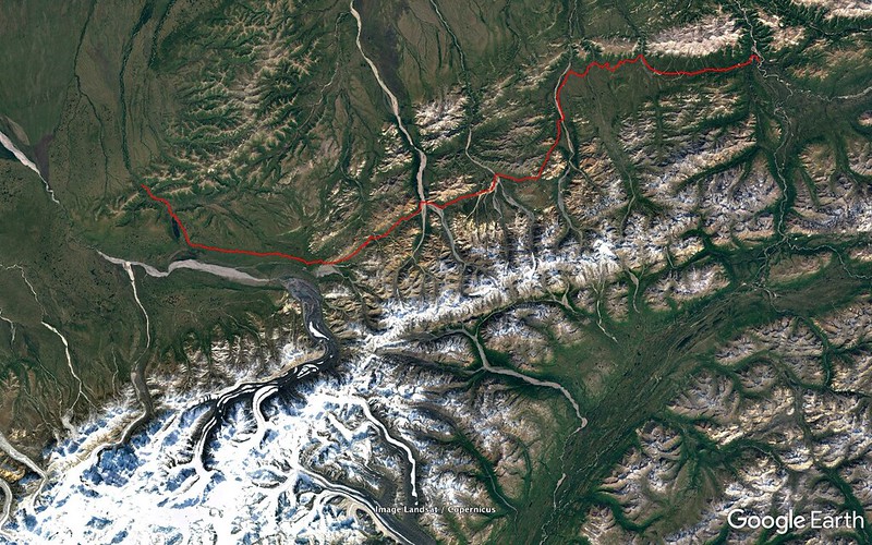
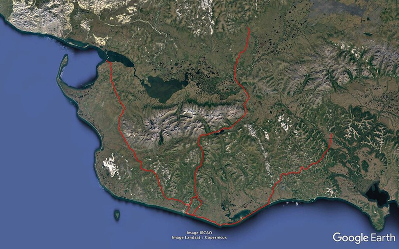
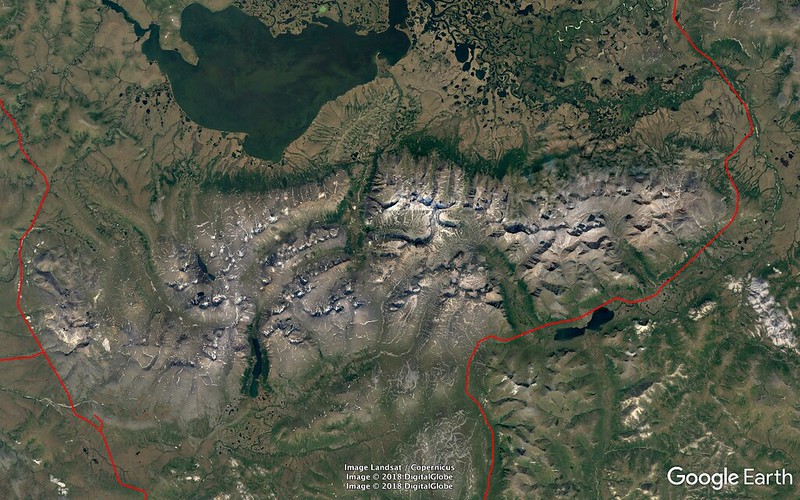
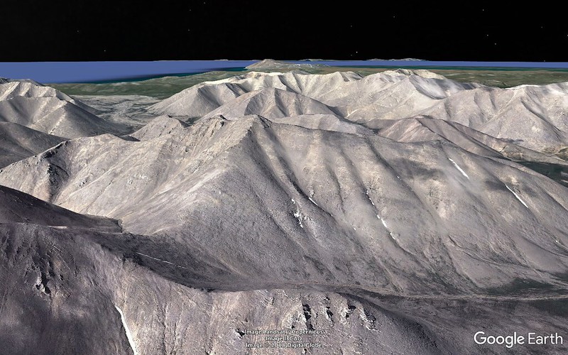
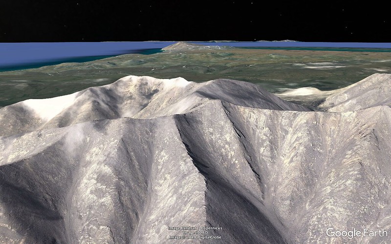
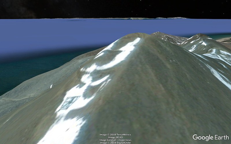
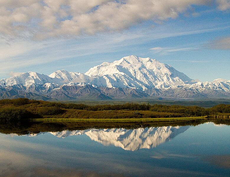
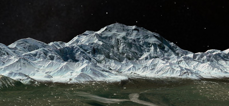
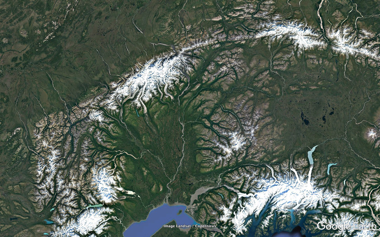
The sky around that end of the road is a bit crappy and there's not much in Denali's direction to attract a lot of attention but the situation improves with distance east and time. I hafta discipline myself to keep adhering to the if-it's-not-twice-as-high-as-everything-else-around-it-then-it's-not-Denali rule.

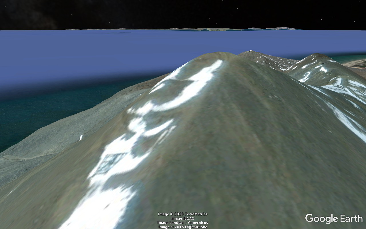
Eventually things start improving fast and we get a spectacular view of the top half of the real deal from a new and probably better angle. There's a reasonably shallow layer between the tops of the regular mortal peaks of the Alaska Range and Denali's business end and the effect is totally unworldly. It looks like Denali has arrived courtesy of some vastly superior extraterrestrial civilization and is just hovering above the distinctly inferior homegrown stuff.

I'm sitting on the aisle on the right/south half of the bus about halfway back and we get a Merlin. Just a small powerful black falcon silhouette for about one and three quarters seconds but I'll take it.

Do the Eielson Visitor Center. We've stopped at it on the way in plus once or twice on a day trip or two but I've previously been too trashed to half properly check it out.

It's got a totally awesome model of Denali in the center of the center with labeled buttons around the periphery. Push them and they fire little Christmas tree lights which allow you to identify/locate peaks, glaciers, valleys, rivers, approaches.

At the counter there are some skulls and a Dall's ram horn. I'm astounded by its weight. I think it was fifteen pounds - and there would've been another one just like it for the other side. All that weight and bulk to carry around most of one's life for the primary purpose of bashing rival rams backwards and gaining or retaining control of harems.

In a similar vein... Out front there's a pair of bull Moose skulls that were recovered from the tundra with antlers locked together. A protrusion on one of the antlers projects into an eye socket of the other animal. Horrible stuff like this isn't supposed to happen. Somebody's supposed to win and the loser's supposed to withdraw just beat up a little.

They note that an antler from one of the bulls is slightly deformed and that the asymmetry it introduced into the collision contact was probably responsible for the lock.

And I recently heard or read somewhere that when the body of a deer (a Moose is a mega-deer) sustains an injury the antler on the opposite side is prone to growing with a deformity. And so far nobody has a freakin' clue why or how so far.

I've hit it off pretty well with the park guy and gal manning the center but the bus needs to continue on. And I guess I need to continue on with it.

56
http://c1.staticflickr.com/1/915/42167435665_a9ca2d8bd8_o.png
Image

A bit on and we're in fairly heavy snow - coming down ten days prior to the summer solstice and thoroughly whitening the tundra. Visibility's still pretty good though and we do OK picking up more Bear, Moose, Caribou, Sheep.

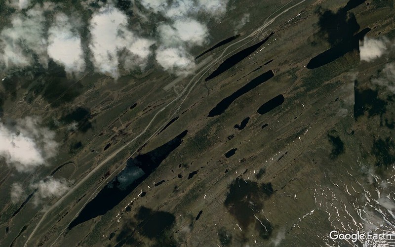
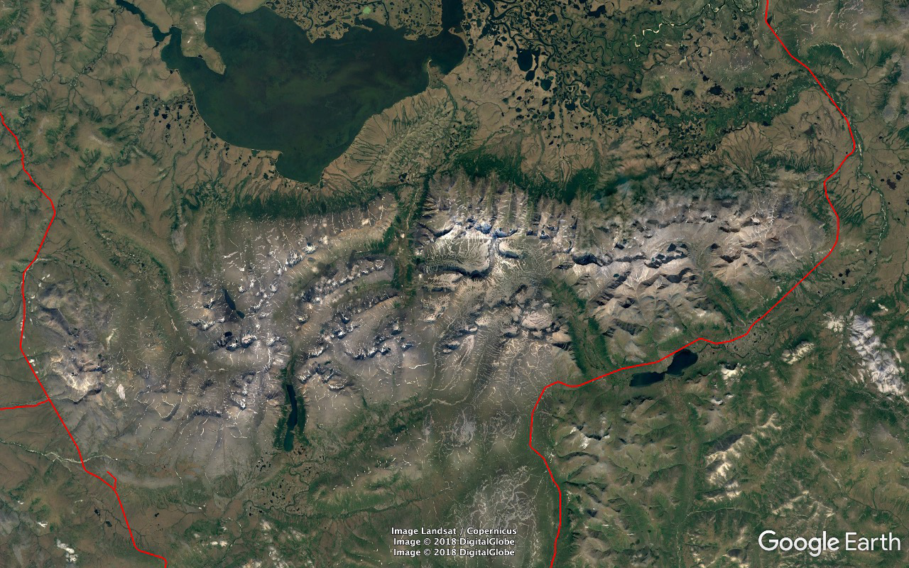
Take a substantial rest, stretch, lunch, snack stop after we get through the snow or it decides to stop at a pretty well developed facility. Can't properly recall or ID it from Google Earth but my best guess is that was at the campground area at the Savage River crossing at the end of the private vehicles range (northernmost point of the Park Road as in the frame above).

DO NOT FEED THE WILDLIFE signs all over the place but I've been handed an oatmeal cookie and now I've got a Mew Gull standing six feet in front of me giving me that look. Oops, a crumb from my cookie seems to have broken off accidentally and fallen in front of me. Better pick it up and properly dispose of it in a bear proof steel garbage container. But that gull might bite me as I'm reaching for it. Better take a step back and think this through properly. Evidence gone.

There's a small herd of Sheep up on a steep slope above us. I hit 'em with the scope and adjust the level for members of our group and other park visitors.

We continue on towards the park entrance and run through an extensive area of Black Spruce growing somewhat sparsely on the south facing slope of the Healy Range. They hadn't really registered on the way in but now after I haven't seen anything remotely resembling a tree for three days...

Ann keeps scanning to the side out of her window. She looks just like I do when cruising through Joshua Tree desert habitat scanning for Shrikes.
"What are you looking for?"
"A Hawk Owl."

Oh wow! That's a really cool bird. I can really use one of those. And that would be a lifer for at least a good chunk of our group. So I start pretending the Spruces are Joshuas and alter my profile preferences accordingly.

And as I write this it occurs to me that none of our guides - Naturalist Journeys or North Face Lodge - has advised us to be on alert for this bird in this particular habitat. Ditto for the ride in. I wonder what's going on with that. Minimize the danger of a non commercial interest scoring something really good for the group on his/her own?

Here's what it says in the Naturalist Journeys brochure for this particular expedition:
Mon., June 11 Denali National Park / Train to Anchorage

Our return trip through the park is full of anticipation ... we never know what we may see! We keep our eyes open for rare sightings of Gray Wolf and even Lynx -- not likely, but possible! We have seen Arctic Ground Squirrel, the blue morph of Red Fox, and, in some years, Northern Hawk Owl. We do have to meet the train so we can’t linger, but we always hope for unusual sightings and photo opportunities.
Nothing about keeping our eyes peeled for a Hawk Owl during the Black Spruce leg of the run. And I wonder why this iconic bird is only an item for the trip BACK OUT.

And this isn't a bird that requires any particular skill or experience to find. Just scan the Spruce tops for a rather substantial lump. The more untrained but dedicated pairs of eyes the merrier.

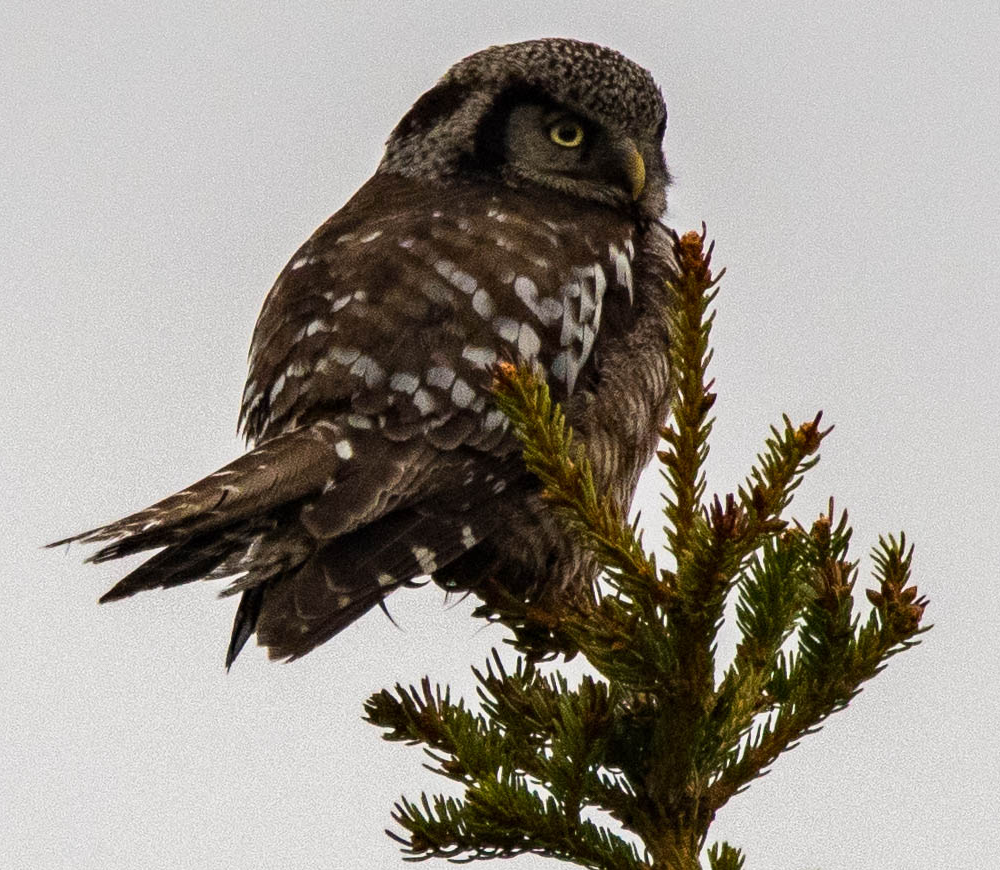
And it isn't long before Ann scores. I'm a second and a half behind getting what she got but I'm unable to get a lock with the glasses before it takes off - parallel to our direction of travel. From what I PERCEIVED I'd have guessed Merlin. I couldn't make it an owl head.

But a suspiciously short roll ahead and on again off to starboard at fairly short range we've got an indisputable Hawk Owl. I think it took a(nother ?) short hop before stabilizing into cooperative mode.

We need to adjust bus position back a bit for a good clean shot before this bird decides he'd rather be someplace else and Ann calls the request. Our North Face Lodge guide/driver - one of the many individuals on board who had no part in this score - doesn't seem much interested and voices a concern about the buses behind him. I do a quick check of our six and see the better part of a mile of straight Park Road without so much as an Arctic Ground Squirrel encroaching on our position - nothing but air.

Roodal Ramlal / Channel-Billed Toucans déjà vu. He's LYING to us and I'm not in the mood. "HEY! We've got a HAWK OWL here!" (And I'm not gonna take bullshit like this very lightly - asshole.)

http://c1.staticflickr.com/1/857/28610567577_dd212c096f_o.png
Image
Ann Constantino - 2018/06/11
Denali National Park

And then he's gone elsewhere and out of sight.

And we continue on to our rendezvous with the train with Yours Truly smoldering a bit.

There's a Red Fox den in the open and within an easy shot of the road. A parent and I think eight third grown kids. The kids are chasing each other around, totally unconcerned with our presence, cute as hell, and we stay and watch for a long time. But I'm still smoldering and not enjoying things as much as a would be otherwise.

And farther down the road we pick up group of several Caribou. And they get a stop with a generous time allotment.

OK, but I've gotten twice as many Fox species in the back yard (had a Red under the bird feeders late Monday morning) and we'd never had to go very long between good Caribou sightings throughout our Denali stay. If we can afford this much time for these last two stops then a minute and a half for the previous one shouldn't have been asking for too much.

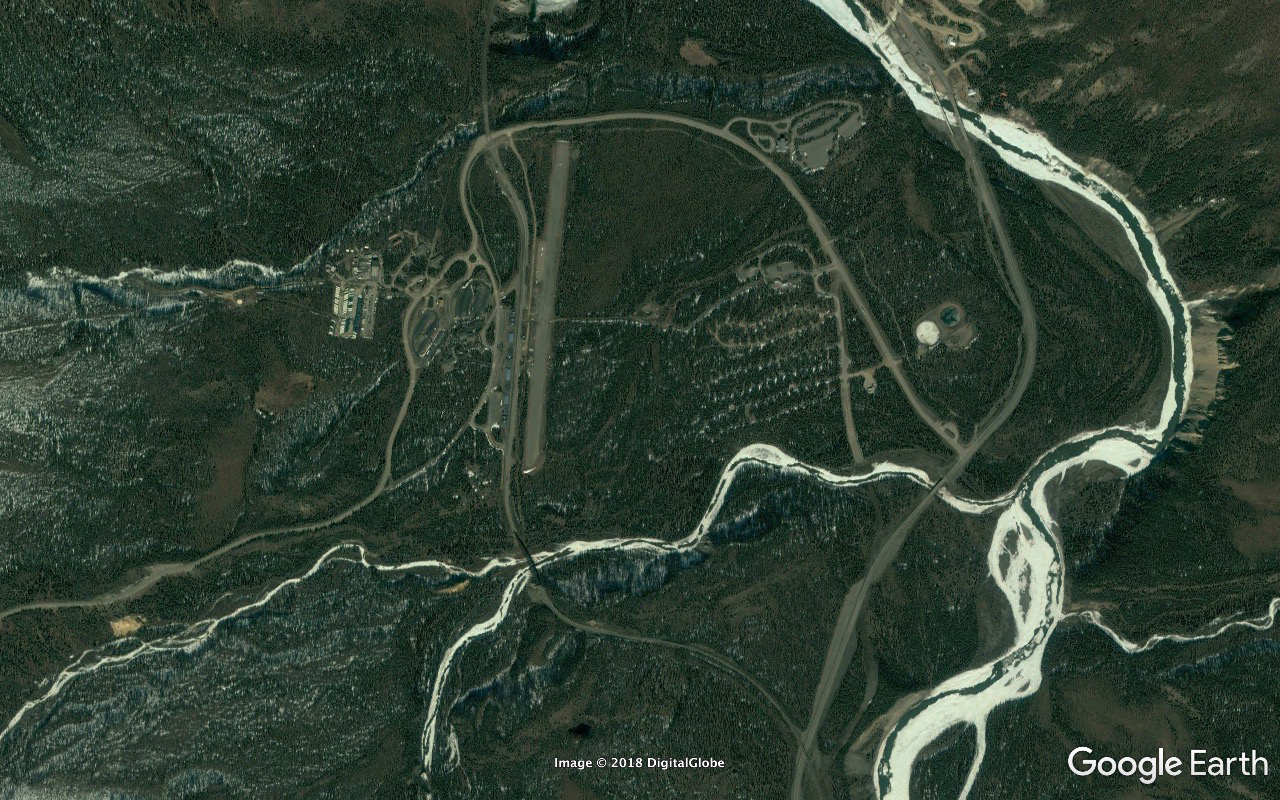
Soon we're disembarking at the Park entrance/exit...

54
http://c2.staticflickr.com/2/1807/42479211695_1f4da3636a_o.png
Image

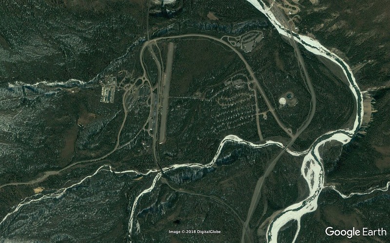
...with TONS of time to spare prior to our 12:30 AKDT scheduled departure.

We get ourselves sorted out, transitioned from bus to rail mode, figure out where we're supposed to board. I see something else interesting at the top of a Spruce and hit it with the glasses. Gray Jay - my first and last jay of any description for the duration of the trip. I'd been expecting a handful of Steller's and lotsa Grays. HM had scored a Steller's at a feeder next to the Lakefront in Anchorage on 2018/06/01 while we were waiting for the Naturalist Journeys group to start forming. But a lawnmower had queered that deal before I was able to get a shot. And the group totally struck out on them over the official duration of the tour. And no references to Grays in the report beyond one scored on the Eagle River trail on 2018/06/07.

49
http://c2.staticflickr.com/2/1806/43368847901_deebf9e8a9_o.png
Image

Hate to speak ill of public transportation and boost the profiles of private regular and SUV automobiles but... Train downsides:
- This thing is SLOW.
-- Travels on ITS schedule (not necessarily yours).
-- Doesn't:
--- depart from the point at which you last stopped
--- run all the way to your next chosen destination
-- Stops en route to:
--- discharge and pick up passengers at other stations
--- sidetrack to allow northbound trains to pass
--- swap out crews
-- Never gets up to highway speed limits even on long, straight, uninterrupted stretches.
- Gotta deal with multiple luggage issues.
- Although the upper deck is beautifully engineered with huge expanses of glass to the sides and up above the rail seems to favor the river bottom (as it should) a lot more than the highway. And just about all of the relevant leg of the route is rather densely forested so the vast majority of what you're seeing are the trees screens on both sides a few yards out.
- Trains don't and can't stop - or even slow down - for sightings of Moose, Eagles, Hawk Owls. And unless you're the one who spots the Moose you're probably not gonna see it because in the time it takes you to respond to the alert and position calls...
- Seating space is a bit more generous than what you'd get on a passenger jet aft of First Class.

Upsides:
- Smaller carbon footprint.
- It's different, kinda cool, and reasonably comfortable.
- All the glass works to your advantage every now and then.
- You can get:
-- up and walk around pretty easily
-- a civilized restaurant type meal at a table on the lower level
- They have knowledgeable guides on the PA giving you interesting background info and answering your questions.

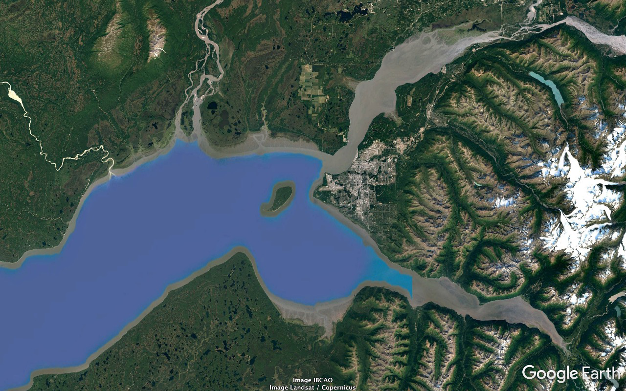
Allowing smidgens for boarding and disembarking It's an eight hour ride (much more realistically) - twice what it would take at a modest speed in a rental car on the highway - but I don't have unpleasant memories of it. The Hurricane Gulch crossing is spectacular. I keep the GPS running and targeting Denali but the sky cover isn't gonna give us the slightest break this time. Get a few Moose, miss a lot more. Dock in Anchorage at 20:00 AKDT. Checked baggage recovery works a lot like at an airport - involves a bit of walking, snaking through crowd crushes, standing around.

I'm NOT in good shape at this point in the trip. Legs just keep getting more and more swollen since I NEVER get the couple days I need to stay mostly horizontal and start making a significant dent in the problem. And even relatively comfortable travel days such as this one tend to wear one down a fair bit.

Greg is managing the herd and organizing for the shuttle back to the Copper Whale Inn via taxi. I'm heavily loaded with all my trip gear bringing up the rear and obviously hurting to a substantial degree. Greg's at the target point, I'm fifty yards out and closing. Both of us are tall and I'm making eye contact with Greg over all the heads in the relevant area of the crowd. Greg calls loudly and clearly "Over here, Tad!"

Thanks for broadcasting that extremely useful information, Greg. Otherwise I'd have had absolutely no idea that you were over there and/or that I should be proceeding to that point. And please don't trouble yourself to relieve me of any of the gear that's benefitting the group you're getting paid to lead - or ask another group member to give me a hand.

Back to the Copper Whale - same upper level but somewhat cramped room (Susitna) as before, dinner on our own next door.

Both the days from/to the Copper Whale and to/from the North Face Lodge seem like weeks. Such distances and changes in habitats and scenery. Earlier in this day we're in the tundra at close to four thousand feet in a heavy steady snowstorm weaving through Grizzlies and Caribou. Near its end - according to the clock - we're in a nice corner of a substantial city with the summer sun high and blazing. Not all that different from what things would've been like in the afternoon of the same day in Baltimore back homeways. Psychologically overwhelming.

A little amendment regarding the Hawk Owl...

This is actually the NORTHERN Hawk Owl. It's found across the northern latitudes of both the Old and New Worlds and is in its own single species genus, Surnia (ulula), and is not closely related to about thirty species of Old World owls in genus Ninox, many of which bear a "Hawk-Owl" name. (Since they're all Old World we can skip the Northern part of this one's name over here without causing any confusion.)

It's a heavily biased diurnal hunter and, as previously noted, there's not a lot of daylight around in the winter solstice ballpark in the northern reaches of their range. But although they're essentially nonmigratory:
- there are periods of the days in the winter in the higher latitudes when the sun's making a long shallow skim not far below the horizon
- they can fly and can and do move into southern areas of their breeding range (and sometimes well beyond it) with little effort

P.S. That photo of Ann's, which I've substantially cropped, is amazingly high quality - 'specially considering it was shot hand-held with a long telephoto from inside of a tour bus (window open) in dreary light. And use the URL to go to full res for an even better appreciation.

P.P.S. I've amended my 2017/01/21 14:11:57 UTC post with respect to Asa Wright guides Roodal and son Dave.
http://www.kitestrings.org/post9899.html#p9899

P.P.P.S. And now that I think about it... There's a pretty substantial commercial link between my Channel-Billed Toucans on Trinidad and this Northern Hawk Owl in Denali.

Roodal Ramlal is the Asa Wright Nature Centre senior guide. Ya wanna stay at Asa Wright ya gotta book through Naturalist Journeys / Caligo Ventures. This Alaska tour with its North Face Lodge subpackage was Naturalist Journeys / Caligo Ventures. And the guide at the bus wheel when we were trying to do that Hawk Owl...

About 5500 miles and over 53 degrees of latitude apart. From well into the tropics to less than two hundred miles shy of the Arctic Circle. Small freakin' world.

P.P.P.P.S. - 2018/07/20 06:00:00 UTC

HM believes there WAS a call to peel eyes for Hawk Owls prior to hitting the Spruce on the way BACK OUT. But if so it doesn't appear that much of an effort was made to make sure Yours Truly was tuned in. Every other comment I had on this on stands.

And along this line... One of the other group members had told me that during a return in Greg's van back to Nome during the Seward Peninsula stage on one of the three roads he thought he had a Shrike. And if one THINKS one has a Shrike in that kind of turf one HAS a SHRIKE - 'cause there's nothing else for which it can possibly be mistaken. But he didn't say anything 'cause Greg was hauling ass and he thought Greg just wanted to get back to the hotel and wouldn't have appreciated the interruption/distraction. That was an EXTREMELY valuable bird and had been REAL high on my priorities list - like in the Top Two along with Gyrfalcon.

Checked out the Hawk Owl's range a bit more carefully. Its northern extent tends to stop right around the Arctic Circle around a solid most of the Northern Hemisphere.

Meant to note that the number of Wolves we scored in Denali National Park was zero - identical to what we had in downtown Anchorage. The reason for that was probably that - with the blessings of Alaska state laws - Denali Wolves tend to get annihilated within ten of fifteen seconds of setting a toe outside of Park boundaries. Molten hot political issue.

P.P.P.P.P.S. - 2018/07/25 11:45:00 UTC

From Greg's trip report:
Caribou were closer to the road this year and last with low predation pressure, given the continued onslaught of those in Alaska that feel it is a rite of passage to take a wolf simply to hang on the wall.
Post Reply