birds

General discussion about the sport of hang gliding
User avatar
Tad Eareckson
Posts: 9149
Joined: 2010/11/25 03:48:55 UTC

Re: birds

Post by Tad Eareckson »

Thanks much but there definitely won't be better news. The other two times I was seriously worried it didn't make any sense that anything really bad had happened because of what WASN'T going on with other birds. This time everything makes absolute total sense.

It's a fairly easy answer for me now. NOTHING makes up for something like this. I did love watching her flying through the woods, learning, having a blast but let her do it in the house where she's protected by walls and windows and soak up rays on the deck where she's protected by bars.

I thought THIS:

http://www.youtube.com/watch?v=IQa-wiW5Lms


was indescribably cool.

http://www.kitestrings.org/post951.html#p951
http://www.kitestrings.org/post952.html#p952
http://www.kitestrings.org/post955.html#p955
http://www.kitestrings.org/post2619.html#p2619

But...

http://www.kitestrings.org/post2674.html#p2674
Steve Davy - 2012/08/11 00:03:53 UTC

I've not seen the Macaws in a long time. I always hope to see them when I'm there. They are spectacular and the only ones that will get on a tip and turn with a glider.
Did somebody get grabbed by a Golden Eagle? The bird's history and the person's damaged for life.

I couldn't follow your Sea Eagles.

http://www.kitestrings.org/post10090.html#p10090

Some years back I jumped on the wagon and got hooked on these guys:

http://www.ustream.tv/decoraheagles
Decorah Eagles, Ustream.TV

Watched them hatch - three kids. And in the early stages there was a runt who wasn't getting fed and I was sure he'd starve / get killed by his siblings - which is pretty SOP for lotsa eagles. It was tough to watch but that's how these birds work.

But to my astonishment he survived and the kids got their plumage and it was wonderful watching their gentleness and affection.

They started branching and finally dispersed to the point that they cut the camera for the season. Then almost immediately one of the kids got fried on some nearby powerlines and I was furious and totally devastated. And that, I found sometime thereafter, was a pretty routine occurrence.

And I felt I couldn't afford to let an emotional attachment like that form again. So right after you put up the link I took this live screenshot:

2017/04/22 19:02:50 UTC
http://c1.staticflickr.com/3/2811/34073538491_8e49dd10a8_o.png
Image

checked out the parents a couple times, wished them the very best, and split while I could.

I see the empty nest now blowing around in the wind. Hope things turned out well for everybody. (But, of course, they're eagles. And whenever things turn out well for eagles it's a dead certainty that they turned out really badly for somebody else.)
User avatar
Tad Eareckson
Posts: 9149
Joined: 2010/11/25 03:48:55 UTC

Re: birds

Post by Tad Eareckson »

http://www.idahostatesman.com/news/local/article156825609.html
Solar eclipse, Aug. 21, 2017: Idaho readies for visitors | Idaho Statesman
Expect traffic jams and big crowds for the Aug. 21 eclipse

Bill Roberts - 2017/06/17 11:49 MDT

No roadside viewing: Use the shoulder only for roadside emergencies, not to gawk at the eclipse, transportation officials say. "We don't want people stopping in the middle of the road when the eclipse (happens)," said Bill Kotowski, Idaho Department of Transportation spokesman.
Totally moronic paragraph.

- What the fuck does people stopping in the middle of the road when the eclipse happens have to do with pulling off of some back road out in the middle of the desert hours before the partial starts and setting up camp?

- Furthermore, does anybody with a double or better digit IQ think that anybody in the Path Of Totality will be just rolling along at 65 during the two and a quarter minute span of this once-in-a-lifetime most-spectacular-of-all-natural-phenomena-on-the-planet event? Even if the relevant traffic ISN'T totally gridlocked as everyone and his dog has for years been predicting and expecting it to be?

My Plan A is the Path Of Totality and Idaho 22 on the Snake River Plain (about 27 miles a bit North of East of King Mountain). And I don't have a Plan B that involves something other than pulling off of a remote otherwise lightly traveled road.

But I can't find anything supporting and clearly defining this No roadside viewing proclamation, can't see how it would be enforceable as things start going Woodstock, and am hoping that common sense will take the day. Do they want people like me off the road hours ahead and out of the gridlock or on the road hours ahead driving around at zero miles an hour with no place to go contributing to it?

Yes officer, I DO have a roadside emergency - now that you mention it. Ran out of gas two hours ago. Can you help me out with that? Or at least put me on the waiting list?
User avatar
Tad Eareckson
Posts: 9149
Joined: 2010/11/25 03:48:55 UTC

Re: birds

Post by Tad Eareckson »

http://xjubier.free.fr/en/site_pages/solar_eclipses/TSE_1970_GoogleMapFull.html
USA - 1970 March 7 Total Solar Eclipse - Interactive Google Map - Xavier Jubier
Carly Simon - 1972/11

Well I hear you went up to Saratoga and your horse naturally won
Then you flew your Learjet up to Nova Scotia
To see the total eclipse of the sun...
That's the one my parents saw with my brother and sister and let me miss. The centerline of the Path exits the US coast at:

36°45'12.22" N 075°56'44.66" W
2374 North Sandfiddler Road
Virginia Beach, Virgina

250 road miles, two minutes over four and a half hours from the then driveway on Landfall Lane in Annapolis, and they were gonna be RIGHT FUCKIN' THERE *ANYWAY*. Didn't hafta fly the Learjet anywhere. Two minutes and fifty seconds - half a minute better than what Nova Scotia got. Almost exact ditto for what I'll be getting in a bit under nine days most of the way across the continent IF I don't get fucked over by traffic, forest fire smoke, traffic, cops, some or all of the above.

Just how fuckin' clueless/callous are a single yoke of parents capable of getting?
---
Edit - 2017/08/12 22:15:00 UTC

Apparently somebody got in almost immediately after this post was submitted. When I looked at what I'd posted I saw "1972" in the URL of the interactive eclipse map. Supposed to have been the "1970" it is now. Have no idea how that happened but I fixed it right away and things should make a lot more sense now. Sorry 'bout that if someone fell victim.
---
Edit - 2017/08/12 22:30:00 UTC

I now know how I got the wrong eclipse page. I quickly snatched it off the Wikipedia refererences for the Carly Simon song article. They have BOTH links listed together above/below. (Maybe the second one to illustrate that Nova Scotia was missed then.)
---
Edit - 2017/08/12 22:40:00 UTC

Wrong again. They list it to illustrate that Nova Scotia was HIT then - 1972/07/10 - and thus was a viable candidate as a song clue. (Wow.) Actually a MORE viable candidate. Why would anyone go a lot farther away for a shorter duration view/experience? (Lucky break. Should've done my homework better.)
---
Edit - 2017/08/12 22:45:00 UTC

Wrong again.

http://en.wikipedia.org/wiki/You%27re_So_Vain
You're So Vain - Wikipedia
Two solar eclipses were visible from Nova Scotia in the early 1970s, on March 7, 1970, and July 10, 1972. Simon said she wrote the song in 1971, so she likely referenced the one from 1970.
I'd skimmed that but it hadn't adequately registered.
User avatar
Tad Eareckson
Posts: 9149
Joined: 2010/11/25 03:48:55 UTC

Re: birds

Post by Tad Eareckson »

Email message to sister and nephew:
Tad Eareckson - 2017/04/25 01:01:13 UTC

Have GPS receiver, solar filters for binoculars, eclipse glasses. Need "Trump 2016 - Make America Great Again" bumper stickers.
http://www.bostonglobe.com/metro/2017/08/01/the-solar-eclipse-coming-trump-country/Ldd7MhDroW1cdYCwCBoxbO/story.html
The 2017 solar eclipse is coming - to Trump Country - The Boston Globe
Zack C
Site Admin
Posts: 292
Joined: 2010/11/23 01:31:08 UTC

Re: birds

Post by Zack C »

Hi Tad, I had a feeling you'd be at the eclipse so checked in here for the first time in ages. I won't be too far from you. I'll be spending the week in Yellowstone with the plan to drive to Dubois, Wyoming the morning of the eclipse. Hopefully things work out for both of us!

I'm sorry to hear about Quinn and hope this event provides some needed distraction.
User avatar
Tad Eareckson
Posts: 9149
Joined: 2010/11/25 03:48:55 UTC

Re: birds

Post by Tad Eareckson »

Hey Zack, delighted to see you back.

I'm thinking that you already have a firmish plan commitment to Dubois but was about to recommend you think instead about heading west along the Path to my target area 'cause the weather outlook had been less iffy. But then I checked for an update and:

http://www.washingtonpost.com/news/capital-weather-gang/wp/2017/08/17/total-solar-eclipse-weather-forecast-as-of-aug-17/?utm_term=.993bec5d4f66
Total solar eclipse weather forecast as of Aug. 17 - The Washington Post
Got into Helena Tuesday about 21:30 local in pretty crappy physical condition and have since been recovering and gearing up at my nephew's across the street from the old Governor's Mansion - and on the turf of a family of Magpies. Don't get to see them back east and they're not shy about strutting the sidewalks within Pigeon range of pedestrians such as Yours Truly. Had to drop the binoculars 'cause the guy was too close and almost stepped on him.

But I'm guessing you'll be doing a lot better with wildlife in Yellowstone. I was only there once in 1977/06. Struck out on Grizzlies and they didn't have Wolves back then but there was no shortage of other cool stuff to keep me entertained.

Smoke has been a bit thick here most of the time but wouldn't be enough to really trash the eclipse - what with the sun being up nearly 49 degrees - and so far hasn't been an issue in the target area.

Traffic... No one really knows what will happen beyond the fact that it will be some degree of horrendous. But it looks like if you get stuck in yours you'll at least be stuck well within the Path.

Quinn... Thanks. Yeah, the eclipse is now a distraction - instead of something I can really enjoy. Dull pain, emptiness that doesn't go away. All my fault, hard to live with.
---
Just went out - a bit before 05:00 MDT - to get a look the moon, through the stabilized ten powers, in this one of its last three appearances before the critical day. Thin waning crescent, prominent shadows from the surface features, Venus out a bit from its lit side.
---
P.S. - 2017/08/18 14:45:00 UTC

Dubois, Next State to the Left is where we pull off of the Interstate onto Idaho 22 - our desert road of choice for pulling off and setting up the folding chairs at the center of the Path of Totality (another 37 miles). Great minds...
Zack C
Site Admin
Posts: 292
Joined: 2010/11/23 01:31:08 UTC

Re: birds

Post by Zack C »

Before I saw you were going I looked into heading west but decided against it as the designated viewing area to anticipated crowd ratio seemed a lot lower in that direction. Not that I necessarily care about being in a 'designated viewing area'...I'm just worried about getting harassed for parking on the side of the road.

The area you're hitting seems like it would remote enough you wouldn't get bothered, but it's a bit far for me. More distance means either less sleep or a later arrival with the greater traffic risk that entails.

All that said, the only thing set in stone for me is leaving Yellowstone Lake Monday morning. I'll be keeping an eye on the weather and prepared to shift my plans if necessary.
User avatar
Tad Eareckson
Posts: 9149
Joined: 2010/11/25 03:48:55 UTC

Re: birds

Post by Tad Eareckson »

Been tied up a couple days, sorry for the slow response.

Your first paragraph... Ditto to everything.

The area for which I'm aiming... My thoughts, hopes. Idaho has been mowing roadsides to reduce the fire hazard / fuel load so it looks like they know that they can't/won't be enforcing any no-roadside-viewing stated policy in the almost certain Woodstock conditions. Downside... I wonder how many miles of cars will be parked on the shoulders out from the center of the Path.

Friday evening my nephew dragged me a couple hours north to his father's cabin just in the Rockies west of Augusta. Wasn't entirely happy about it 'cause it stresses me out and diverts from prep time but it's a spectacular place and en route we picked up lotsa Mule Deer, Pronghorn; one Whitetail, Harrier; several Redtails, Kestrels.

Heavy smoke for most of the route, lots of it plenty thick enough to obliterate an eclipse, but we broke out into some decent air, skies when we got close to goal.

Cormorants in the Nilan Reservoir. Straddled a rather hefty close to two foot Garter Snake with the four wheels of the Astro van and two of the U-Haul trailer on the way up. Totally unharmed. I grabbed him and got crapped all over but not bit.

Spectacular night sky at about 5870 feet - Milky Way is something I don't get to see much of back home. Yesterday morning at just before 06:00 local I saw the moon for the last time before it does its thing - a thin crescent facing north and a dazzling Venus with the rest of its face lit with earthshine just over the ridge to the east. Two bats of two flavors I think - little and bigger - buzzing around at close range.

Nephew spent the day on his root cellar project - I accompanied him up to the Gibson Reservoir area where he collected large stones of his preferred specs and loaded them into the trailer. Indescribably spectacular scenery - but that's true for just about anywhere you go in that neck of the woods. Got a great female Common Merganser tearing down the rapids of the Sun River.

We reluctantly, wisely, fortunately decided/agreed to bail around five rather than spend another night. Got six Kestrels - obviously a family - in sight at once where we'd had two on the way up. Lotsa Pronghorn, Mule Deer. Great birds in the prairie potholes - Coots, Horned Grebes, Ring-Necked Ducks, Lesser Scaup, Bufflehead, Mallard, Gadwall, other stuff I didn't have the time (or expertise) to properly ID.

Got the van stopped just short of another smaller Garter Snake, again got crapped all over but not bit, dumped him out of range of tires.

Decent dinner at Mel's Diner in Augusta, then south for some more Redtails and lotsa Mule Deer but no more Pronghorns. Smoke zone wasn't as bad, home about 21:00 with a little daylight to spare. Picked up the rental car at the airport today at noon.

Been closely monitoring relevant weather and traffic. Weather outlook is excellent for primary target and southbound traffic issues have been astonishingly nonexistent. We'd geared to roll at the first indication of congestion but instead have set our alarms for 03:00. Three and a half hours driving time if we're lucky.

Dubois, Wyoming appears to be JUST to the NW of a somewhat problematic high thin cloud zone. Hope all goes well there or at Plan B.

Signing off now to continue getting prepped and hopefully get a few hours sleep.
Steve Davy
Posts: 1338
Joined: 2011/07/18 10:37:38 UTC

Shadow of the Moon

Post by Steve Davy »

Well, how was the eclipse experience?

PS - Remember this classic?

http://ozreport.com/forum/viewtopic.php?t=13132
Unhooked Death Again - Change our Methods Now?
George Stebbins - 2009/01/23 18:55:15 UTC

Stupidity: Years ago I was in an astronomy class. On the first day of class, the instructor said "I'm now going to tell you one question that will be on the final. I'm also going to give you the answer. The question is: "Can you see the moon in the daytime?" The answer is: "Yes, you can see the moon in the daytime." The professor then took the whole class outside. He said, "Look up. What is that?" Quiet answer: "The Moon." He said, "Is it daytime?" Quiet answer: "Yes." He said: "Can you see the moon in the daytime?" Quiet answer: "Yes." Close to half of the students missed that question on the final exam. (Not me.) Some people are just too stupid to be believed. And this was a college class
User avatar
Tad Eareckson
Posts: 9149
Joined: 2010/11/25 03:48:55 UTC

Re: birds

Post by Tad Eareckson »

You got in a bit ahead of me. Back home as of late Thursday afternoon and resuming the narrative. The full report is gonna take a book.

Yeah, I remember that one. And measurably stupider by the year. Oh well, the crowd with whom I spent the critical hours of the critical day were at least intelligent enough to know that even if it's not possible to actually see the moon during a given day it can be possible to see where it is and its effects.

Relevant traffic stayed virtually nonexistent, weather outlook steady optimal, rolled from Helena at about 03:30, stars shining, onto I-15. About half / two thirds of the way down started noticing that we were becoming a component of a low density parade of eclipsees - zilch northbound, significant southbound.

Stopped off in Dillon to top off and increase the 2017 Corolla's range enough to get us back out of any conceivable nightmare scenario (and they gave it to us at least a couple gallons low).

Sky to the east started lightening, crossed the Continental Divide at least three times - the last being at Monida (Mon(tana)ida(ho)) Pass at 6820 feet. Shortly before then, I think, we started seeing a high cloud layer in dark grey light over the Snake River Plain but it looked thin enough to get burned off quickly and as range and lighting improved it appeared to taper off to the east short of target. A bit thereafter we got our first shot at the unobstructed sun just above the horizon after clearing the end of a ridge.

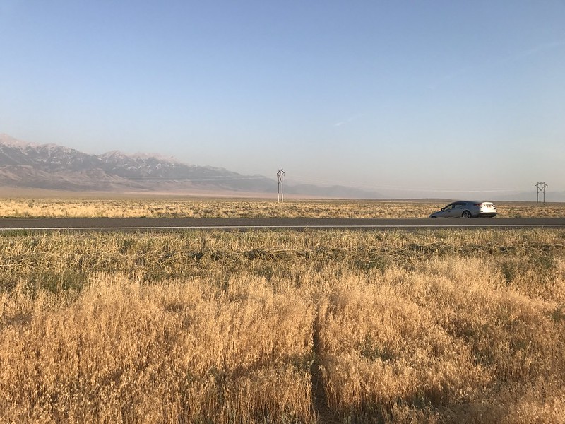
Got off I-15 at Dubois, we went west on Idaho 22, everybody else went east. Picked up a Golden Eagle and the highest concentration of Redtails I've ever seen, all parked on whatever was available - utility poles, fences, pivot irrigation equipment, ground... Had to keep priorities straight though and get in position and prepped.

Target I'd designated as E(clipse)09. I'd identified road accessible Center of Path points between just before Idaho at Lime, Oregon and just after at Jackson Hole Airport, coded them E27 to E01, and punched them into the GPS receiver so's we could plan and be prepared as best as possible for last gasp cloud dodging.

Specs for same from:

http://xjubier.free.fr/en/site_pages/solar_eclipses/TSE_2017_GoogleMapFull.html
USA - 2017 August 21 Total Solar Eclipse - Interactive Google Map - Xavier Jubier

E09
2017/08/21
43°54'05.93" N 112°47'22.92" W
43.90165°, -112.78970°
(~4940 foot elevation)
2:16.7 (total solar eclipse)
2:17.3 (lunar limb corrected)
Umbral depth - 100.00%
Umbral depth - 0 m (0 ft)
Path width - 105.3 km (65.5 mi)
Obscuration - 100.00%
Magnitude at maximum - 1.01419
Moon/Sun size ratio - 1.02838
Umbral velocity - 0.853 km/s (1908 mph)
Event (ΔT=68.8s) - Altitude - Azimuth - P - V - LC
C1 - 16:14:33.8 - 36.7° - 111.1° - 286° - 13.0
C2 - 17:31:37.0 - 48.5° - 131.1° - 108° - 07.3 - -0.8 s
MX - 17:32:45.3 - 48.7° - 131.5° - 198° - 04.3
C3 - 17:33:53.7 - 48.8° - 131.8° - 288° - 01.3 - -0.2 s
C4 - 18:56:26.0 - 56.9° - 162.9° - 109° - 07.9

Click on a point in the Path on the Jubier site and then click on the Help in the upper right corner of the resulting box (or just near the upper left corner (Help) I've subsequently found) for explanations of the terms if interested. Or:
Eclipse type & Duration - The type and duration of the eclipse as seen at your location (taking into account that the Sun may not be above the horizon until the eclipse is in progress, etc.). The corrected duration taking into account the lunar limb profile is displayed only inside the path of totality. Displays "???" if the eclipse is underway at sunrise or sunset.
Umbral/Antumbral depth - The percentage of the way from the edge of the eclipse to the centre line that this location is at.
Path Width - The width of the total or annular path in kilometers.
Obscuration - The percentage of the Sun's disk surface covered at maximum eclipse (this box will display "???" if the Sun is below the horizon at maximum eclipse).
Magnitude at maximum - The fraction of the Sun's diameter covered by the Moon at the local maximum eclipse.
Moon/Sun size ratio - The ratio of the apparent size of the Moon to that of the Sun at the local maximum eclipse.
Umbral/Antumbral velocity - The speed of the umbra/antumbra.
Eclipse diagram - The eclipse diagram displays the relatives positions of the Sun, Moon and ground in horizontal coordinates (the refraction and terrain declivity are not taken into account). The solar north is indicated by the red tick mark and the diagram is updated when hovering the cursor over the various contact events.

Eclipse Event or sunrise/sunset.
The Universal Time (UT) Date and Time of the event (if the event occurs while the Sun is below the horizon, an asterisk (*) will appear after the hour).
Alt - Altitude of the sun. in degrees, above the horizon. To have the value with the atmospheric refraction, hover the cursor over the value for a few seconds to get a tooltip.
Azi - Azimuth of the sun, in degrees (0° = due north, 90° = due east, etc.).
P - Angle, in degrees, between the north point on the Sun's disk and the contact point with the Moon. When the current event is sunrise or sunset, the obscuration of that event is displayed over the two columns when the eclipse is in progress (the time is then rounded to the nearest minute and the atmopsheric refraction not taken into account).
V - The "o'clock" position on the Sun's face of the contact point with the Moon (eg V=12.0 means that the contact point is in the "12 o'clock" position - ie the top of the Sun's disk).
LC - The calculator is able to determine a correction factor to the time of the start and end of the eclipse due to the fact that the Moon's limb is not smooth. When it is, then the correction (in seconds) it has applied is given. A click on the LC column header will display the lunar limb profile and Baily's beads in a new window.

Image
Local / Mountain Daylight Times - UTC-6:
- 10:14:33.8 - start of partial
- 11:31:37.0 - start of total
- 11:32:45.3 - maximum
- 11:33:53.7 - end of total
- 12:56:26.0 - end of partial

Duration of E09 event:
- 02:41:52.2

Bear with me for a dozen Google Earth shots all dead centered on E09 and zooming in progressively with altitudes noted.

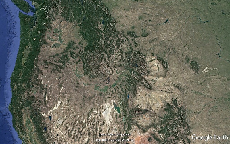
Pacific NorthWest plus:
E09 - 01 - 1085.30 miles
http://c1.staticflickr.com/5/4385/36403875850_95d754a2b6_o.png
Image
E09 - 02 - 0825.00 miles
Note the U-shaped Snake River Plain bending around the dodging-road unfriendly central Idaho mountains:
http://c1.staticflickr.com/5/4415/36801050975_1b138ae22c_o.png
Image
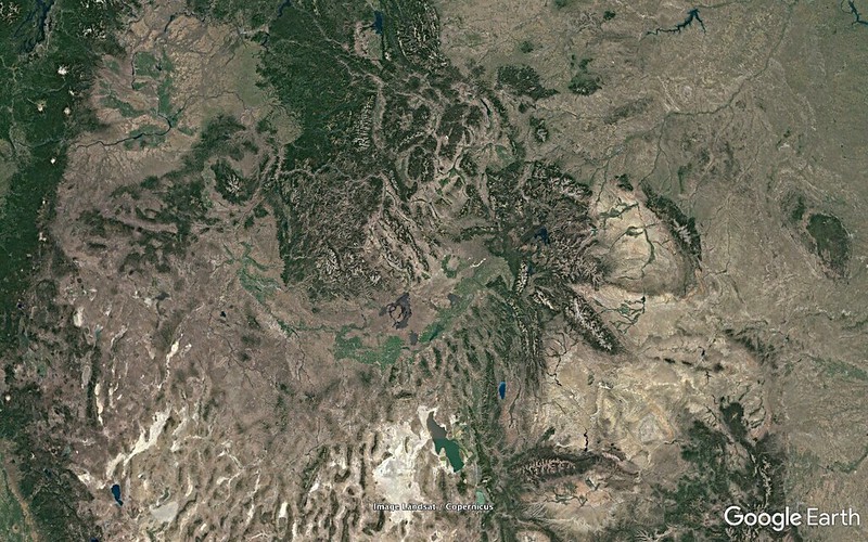
Yellowstone, Continental Divide is just beyond the NE end of the U.
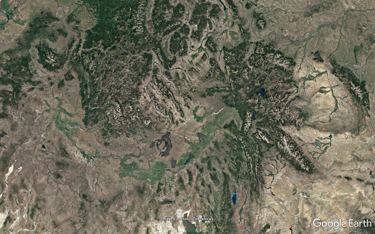
E09 - 03 - 0519.77 miles
http://c1.staticflickr.com/5/4340/36403875630_aa1f3dec28_o.png
Image
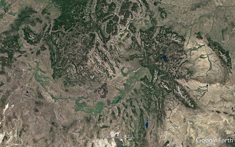
Tetons. Mostly North/South snow covered range south of Yellowstone. Grand Teton is 13770 feet, 8.4 miles from the path on the north, 100.0 miles a bit south of east of E09, on a line with Rexburg (50.1 miles).
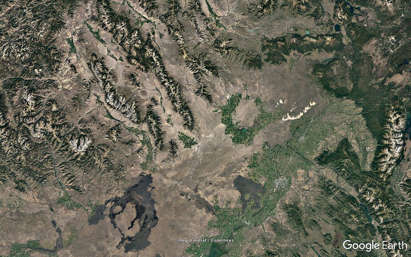
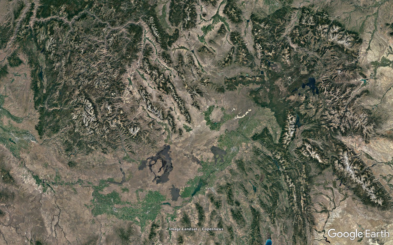
E09 - 04 - 0354.17 miles
http://c1.staticflickr.com/5/4370/36801050775_0665b3d301_o.png
Image
Note the BLM's Saint Anthony Sand Dunes and the Craters of the Moon National Monument - thin white strip north of Rexburg and sprawling dark lava flow SW of Arco, respectively. Borah Peak, high point of Idaho and within the Path 7.36 miles off Centerline on the north side, is just above the point of bulge of the southwesternmost of three rather distinct parallel ranges extending SSW into the northeastern Snake River Plain.
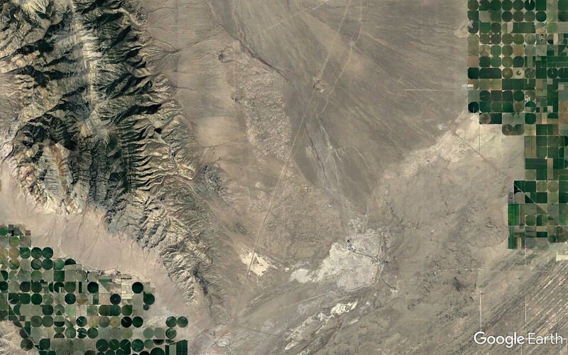
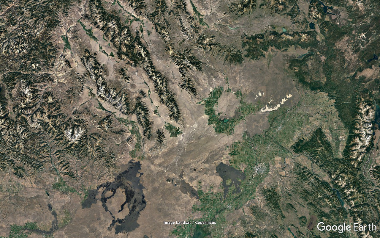
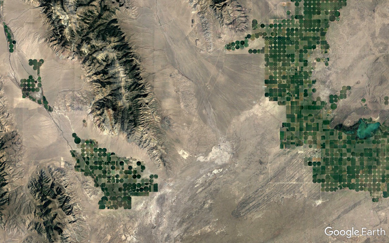
E09 - 05 - 0184.24 miles
http://c1.staticflickr.com/5/4342/36403875450_c6dc2d0426_o.png
Image
E09 is between a huge circular pivot irrigation area associated with Mud Lake to the east and Saddle Mountain to the west. King Mountain overlooks an extensive pivot irrigation area to its west from a somewhat disjointed south end section of Borah Peak's range.
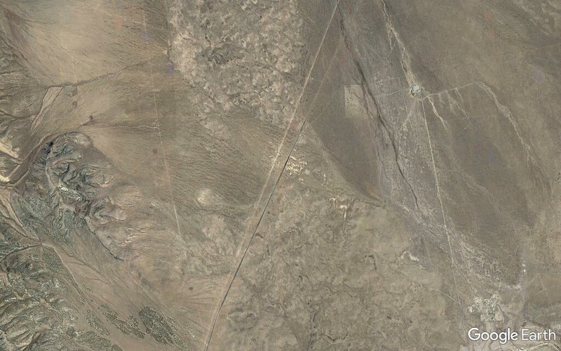
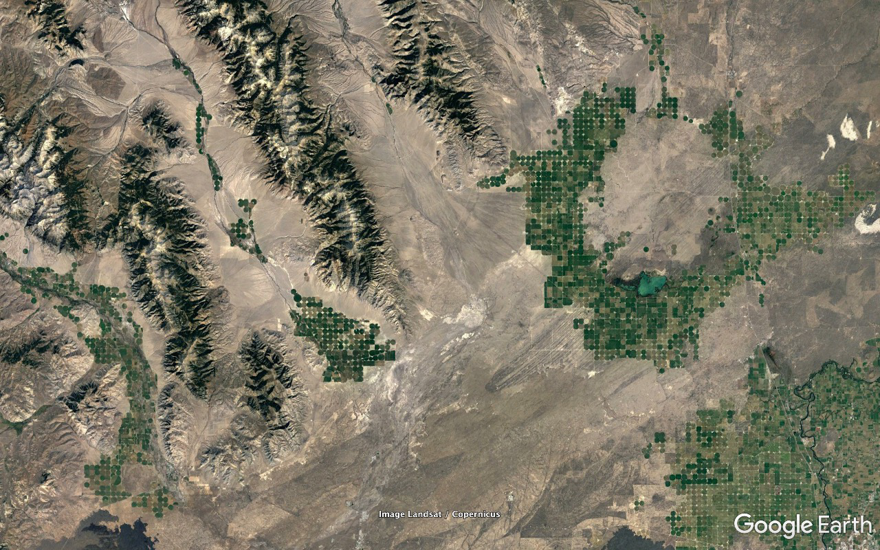
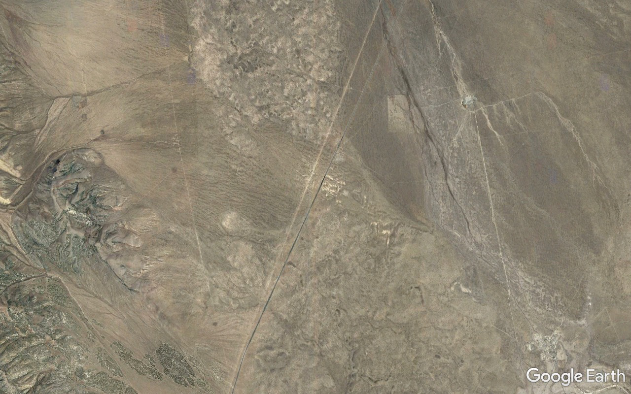
E09 - 06 - 0073.39 miles
http://c1.staticflickr.com/5/4347/36801050505_a40e84261e_o.png
Image
Saddle Mountain, 10810 feet, 8.58 miles from E09.
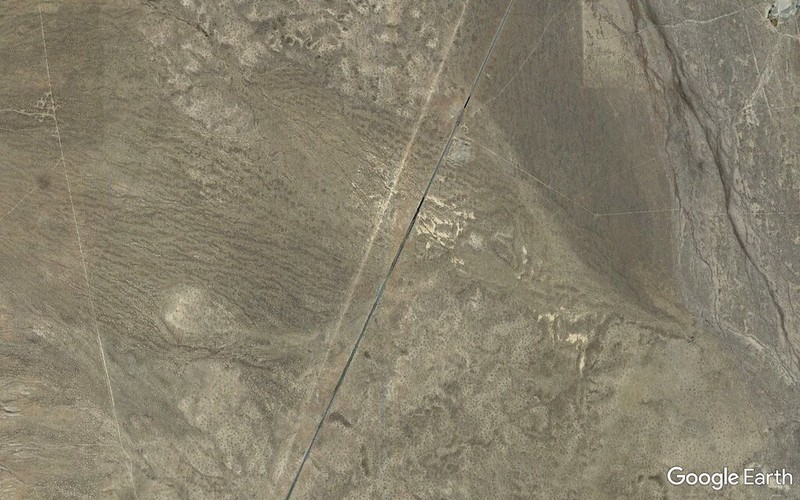
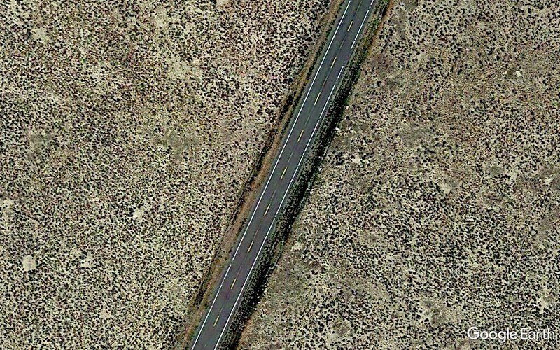
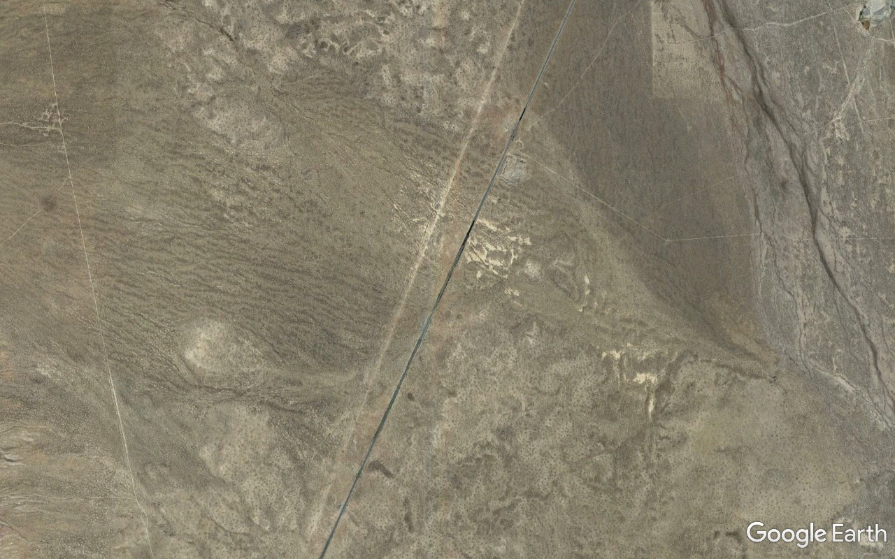
E09 - 07 - 0039.95 miles
http://c1.staticflickr.com/5/4415/36403875230_1fd54250e9_o.png
Image
Idaho 22 - NNE/SSW - visible.
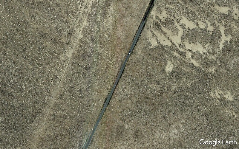
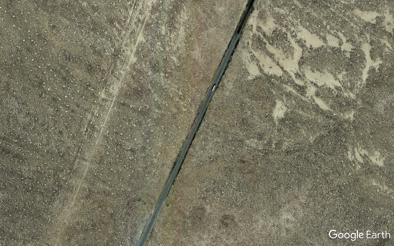
E09 - 08 - 0022.64 miles
http://c1.staticflickr.com/5/4431/36801050345_39984c825d_o.png
Image
Powerlines running mostly parallel and to the west of Idaho 22.
E09 - 09 - 43782 feet
http://c1.staticflickr.com/5/4370/36403875070_3bf91ee436_o.png
Image
E09 - 10 - 24560 feet
http://c1.staticflickr.com/5/4391/36801050145_b49c58726a_o.png
Image
E09 - 11 - 08223 feet
http://c1.staticflickr.com/5/4361/36801049095_7508c15093_o.png
Image
E09 - 12 - 05526 feet
http://c1.staticflickr.com/5/4345/36403873190_2f5c769749_o.png
Image

Shoulders had been nicely mowed as a precaution against catalytic converter fires and we started seeing people parked and camped on shoulders and farther off the road as we progressed SW so fears of being booted dissipated fast.

At the junction of Idahos 22 and 28 there's a couple of end-to-end football fields worth of asphalt and we found it only light moderately populated with geeks, cars, Winnebagos, gear, kids, dogs, four porta-potties. Plenty of available space.

Wow! This could be an option! Stopped and talked to a geek unit to get a better feel for the lay of the land. It was tempting but it was still about 6.7 miles and three seconds worth of totality off center and we continued to see if there would be a good reason not to do E09 and turn back.

There wasn't.

Nightmare scenario was bumper to bumper parking both sides radiating miles in both directions out from E09. Reality was maybe a couple hundred loosely scattered individuals along the stretch. Nothing particularly close or tight around what I was able to pinpoint with the GPS.

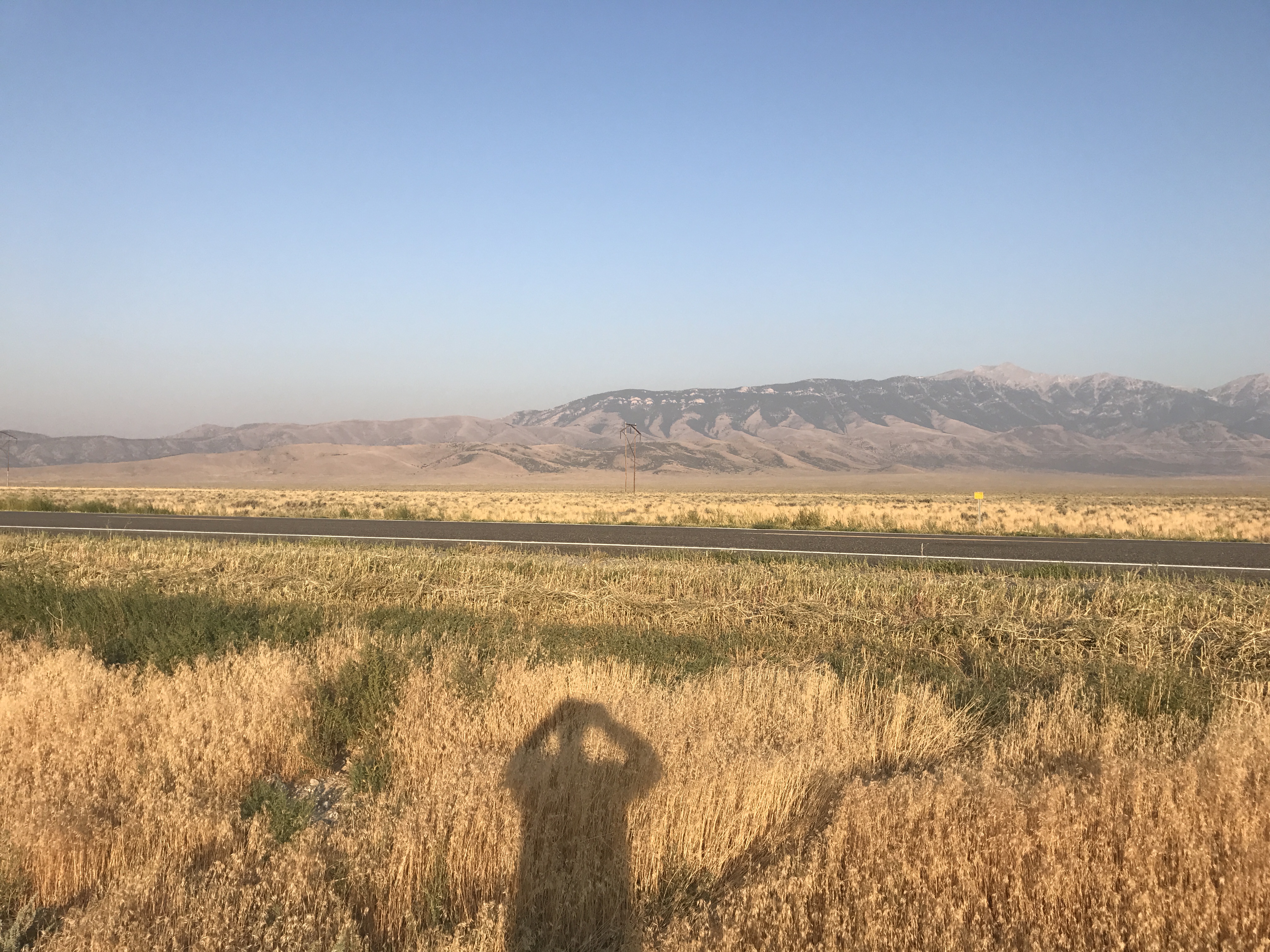
Shadow of nephew with iPhone at 07:50 with low morning sun lighting ENE face of Saddle Mountain.
01-7108
http://c1.staticflickr.com/5/4424/36652721921_5384bbe6a8_o.jpg
Image
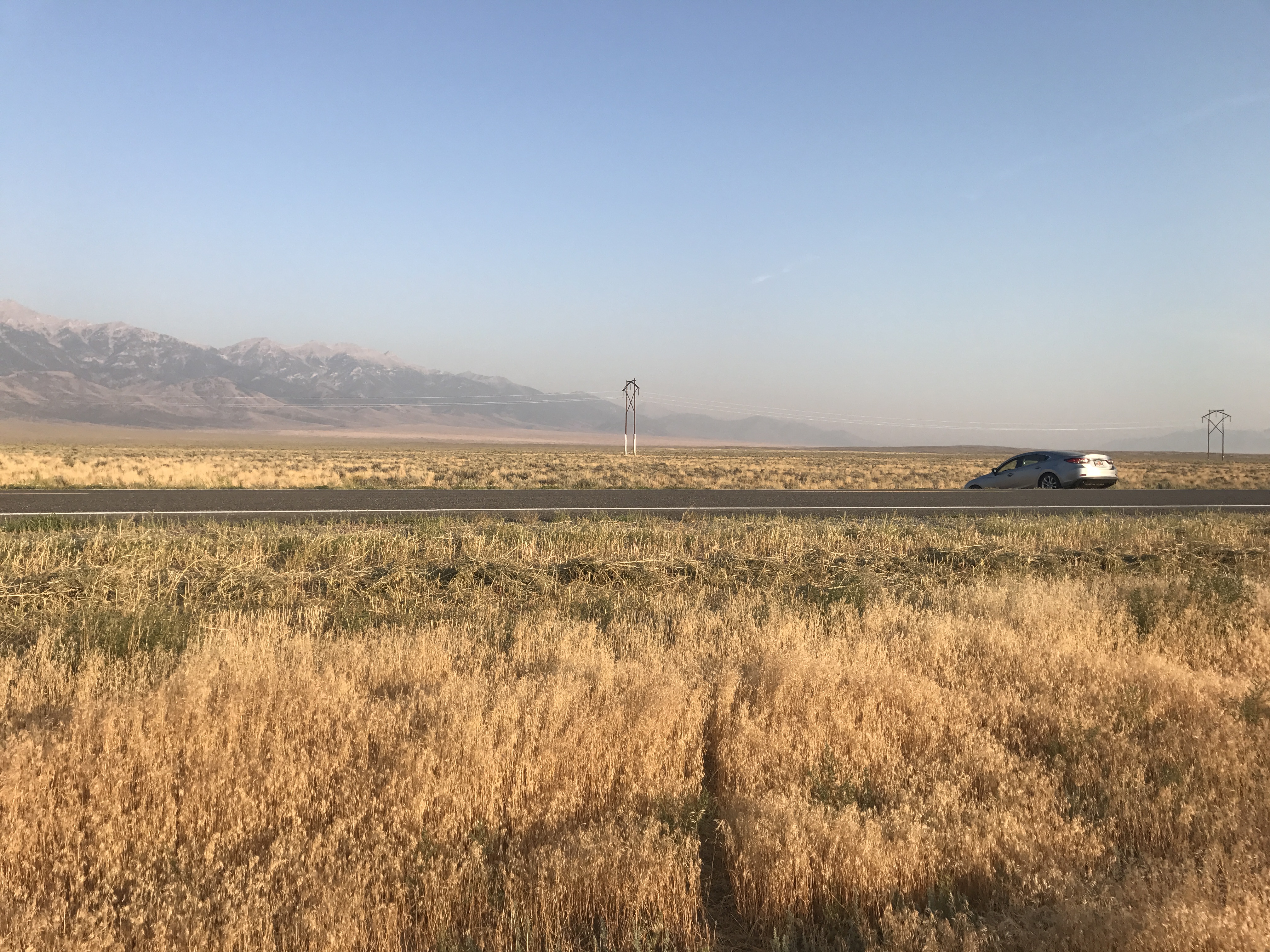
Aforementioned powerline. Clouds, smoke as nonexistent everywhere as in these two photos.
02-7109
http://c1.staticflickr.com/5/4357/36395021500_e941124509_o.jpg
Image

Under two and a half hours to go before things start happening. To be continued...

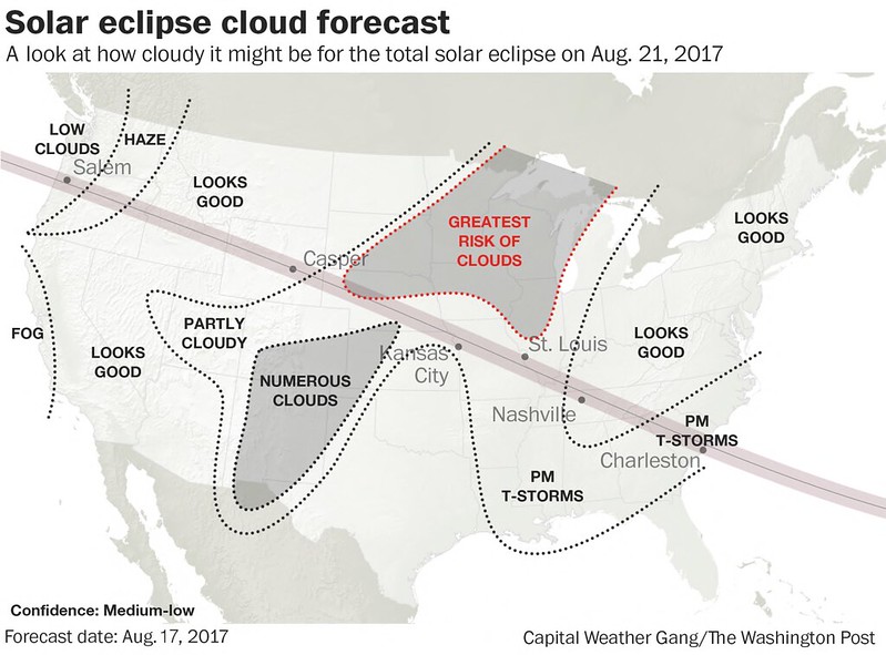
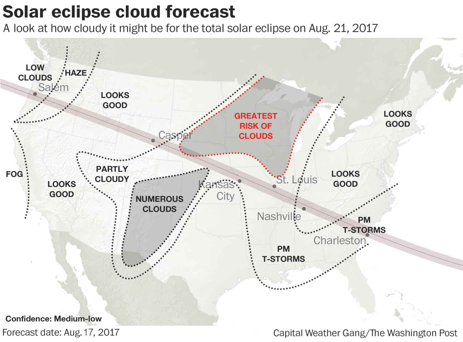
http://en.wikipedia.org/wiki/Solar_eclipse_of_August_21,_2017
Solar eclipse of August 21, 2017 - Wikipedia
Image
---
Edit - 2017/08/29 16:00:00 UTC

Jubier graphic amended.
Post Reply